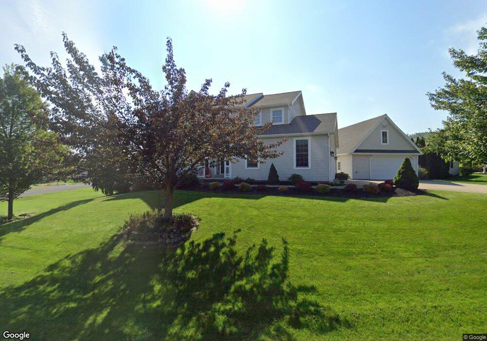
5 Swope Dr Selinsgrove, PA 17870
Estimated Value: $144,936 - $523,000
--
Bed
--
Bath
--
Sq Ft
0.41
Acres
About This Home
This home is located at 5 Swope Dr, Selinsgrove, PA 17870 and is currently estimated at $394,484. 5 Swope Dr is a home located in Snyder County with nearby schools including Selinsgrove Area Elementary School, Selinsgrove Intermediate School, and Selinsgrove Area Middle School.
Ownership History
Date
Name
Owned For
Owner Type
Purchase Details
Closed on
Feb 24, 2022
Sold by
Livi Aucker A and Livi Tana
Bought by
Shaffer Aucker A and Shaffer Tana M
Current Estimated Value
Purchase Details
Closed on
Oct 13, 2006
Sold by
Shaffer Aucker A and Shaffer Tana M
Bought by
Shaffer Aucker A and Shaffer Tana K
Home Financials for this Owner
Home Financials are based on the most recent Mortgage that was taken out on this home.
Original Mortgage
$174,132
Interest Rate
6.48%
Mortgage Type
Purchase Money Mortgage
Purchase Details
Closed on
Oct 12, 2006
Sold by
Westbranch Real Estate Development
Bought by
Aucker A Daniel and Shaffer Tana M
Home Financials for this Owner
Home Financials are based on the most recent Mortgage that was taken out on this home.
Original Mortgage
$174,132
Interest Rate
6.48%
Mortgage Type
Purchase Money Mortgage
Create a Home Valuation Report for This Property
The Home Valuation Report is an in-depth analysis detailing your home's value as well as a comparison with similar homes in the area
Home Values in the Area
Average Home Value in this Area
Purchase History
| Date | Buyer | Sale Price | Title Company |
|---|---|---|---|
| Shaffer Aucker A | -- | Michetti Antonio D | |
| Shaffer Aucker A | -- | -- | |
| Aucker A Daniel | $38,900 | -- |
Source: Public Records
Mortgage History
| Date | Status | Borrower | Loan Amount |
|---|---|---|---|
| Previous Owner | Shaffer Aucker A | $174,132 | |
| Previous Owner | Aucker A Daniel | $174,132 |
Source: Public Records
Tax History Compared to Growth
Tax History
| Year | Tax Paid | Tax Assessment Tax Assessment Total Assessment is a certain percentage of the fair market value that is determined by local assessors to be the total taxable value of land and additions on the property. | Land | Improvement |
|---|---|---|---|---|
| 2025 | $4,306 | $45,270 | $10,000 | $35,270 |
| 2024 | $3,915 | $42,410 | $10,000 | $32,410 |
| 2023 | $989 | $42,410 | $10,000 | $32,410 |
| 2022 | $3,724 | $42,410 | $10,000 | $32,410 |
| 2021 | $3,724 | $42,410 | $10,000 | $32,410 |
| 2020 | $3,724 | $42,410 | $10,000 | $32,410 |
| 2019 | $243 | $42,410 | $10,000 | $32,410 |
| 2018 | $3,724 | $42,410 | $10,000 | $32,410 |
| 2017 | $925 | $42,410 | $10,000 | $32,410 |
| 2016 | $925 | $42,410 | $10,000 | $32,410 |
| 2015 | $84,025 | $42,410 | $10,000 | $32,410 |
| 2014 | $84,025 | $42,410 | $10,000 | $32,410 |
Source: Public Records
Map
Nearby Homes
- 85 Old Colony Rd
- 20 Quarry Rd
- 456 State School Rd
- 1667&1679 Route 204
- Lot 1 522 Route S
- 21 Calvett Place
- 732 Salem Rd
- 321 Pleasant Dr
- 107 Saint Andrews Way
- 81 Saint Andrews Way
- 79 Saint Andrews Way
- 34 Oakmont Ct
- 610 N 10th St
- 90 Limerick Ln
- 88 Limerick Ln
- 86 Limerick Ln
- 84 Limerick Ln
- 722 N 8th St
- 501 N 9th St
- 0 Mill Rd