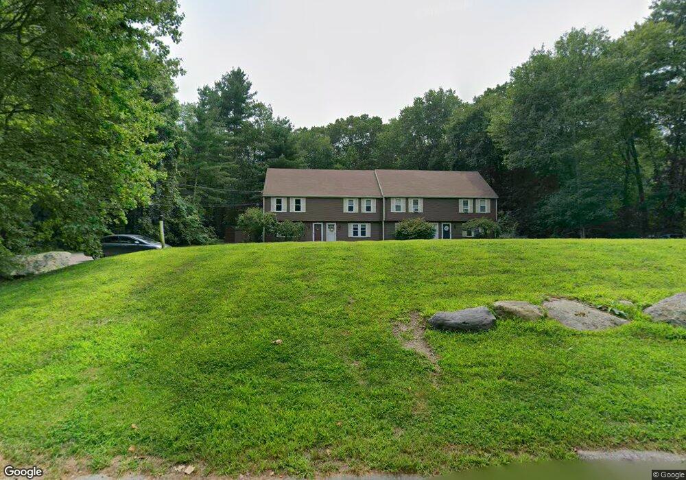
5 Taylor Ct Unit 4 Norton, MA 02766
Estimated Value: $330,000 - $360,000
2
Beds
2
Baths
1,130
Sq Ft
$307/Sq Ft
Est. Value
About This Home
This home is located at 5 Taylor Ct Unit 4, Norton, MA 02766 and is currently estimated at $346,608, approximately $306 per square foot. 5 Taylor Ct Unit 4 is a home located in Bristol County with nearby schools including J.C. Solmonese Elementary School, Henri A. Yelle Elementary School, and Norton Middle School.
Ownership History
Date
Name
Owned For
Owner Type
Purchase Details
Closed on
Jan 2, 2020
Sold by
Copeland Alice
Bought by
Hersey Michael P
Current Estimated Value
Home Financials for this Owner
Home Financials are based on the most recent Mortgage that was taken out on this home.
Original Mortgage
$199,000
Outstanding Balance
$175,069
Interest Rate
3.6%
Mortgage Type
New Conventional
Estimated Equity
$171,539
Purchase Details
Closed on
Aug 6, 2019
Sold by
Sullivan Carol A
Bought by
Copeland Alice
Purchase Details
Closed on
Sep 4, 2014
Sold by
Allen Kathy K
Bought by
Sullivan Carol A
Home Financials for this Owner
Home Financials are based on the most recent Mortgage that was taken out on this home.
Original Mortgage
$100,000
Interest Rate
4.12%
Mortgage Type
New Conventional
Purchase Details
Closed on
May 17, 2004
Sold by
Russell Gary and Foster Laura
Bought by
Allen Kathy K
Home Financials for this Owner
Home Financials are based on the most recent Mortgage that was taken out on this home.
Original Mortgage
$176,000
Interest Rate
5.47%
Mortgage Type
Purchase Money Mortgage
Purchase Details
Closed on
Sep 24, 1999
Sold by
Darsco Rt and Brown Darleen
Bought by
Bramwell Michelle J
Home Financials for this Owner
Home Financials are based on the most recent Mortgage that was taken out on this home.
Original Mortgage
$104,100
Interest Rate
8.1%
Mortgage Type
Purchase Money Mortgage
Purchase Details
Closed on
May 3, 1999
Sold by
Foster Laura J and Russell Gary M
Bought by
Russell Gary and Foster Laura
Home Financials for this Owner
Home Financials are based on the most recent Mortgage that was taken out on this home.
Original Mortgage
$76,000
Interest Rate
6.95%
Mortgage Type
Purchase Money Mortgage
Purchase Details
Closed on
Jan 26, 1999
Sold by
Carey Michael J
Bought by
Federal National Mortgage Association
Purchase Details
Closed on
May 27, 1987
Sold by
Mullen Gerald F
Bought by
Darsco Rt
Purchase Details
Closed on
Apr 15, 1987
Sold by
Leblanc Joseph
Bought by
Banyard Leslie F
Create a Home Valuation Report for This Property
The Home Valuation Report is an in-depth analysis detailing your home's value as well as a comparison with similar homes in the area
Home Values in the Area
Average Home Value in this Area
Purchase History
| Date | Buyer | Sale Price | Title Company |
|---|---|---|---|
| Hersey Michael P | $199,000 | None Available | |
| Copeland Alice | $195,000 | -- | |
| Sullivan Carol A | $165,000 | -- | |
| Allen Kathy K | $220,000 | -- | |
| Bramwell Michelle J | $106,500 | -- | |
| Russell Gary | $80,000 | -- | |
| Federal National Mortgage Association | $89,500 | -- | |
| Darsco Rt | $110,000 | -- | |
| Banyard Leslie F | $116,000 | -- |
Source: Public Records
Mortgage History
| Date | Status | Borrower | Loan Amount |
|---|---|---|---|
| Open | Hersey Michael P | $199,000 | |
| Previous Owner | Sullivan Carol A | $100,000 | |
| Previous Owner | Allen Kathy K | $176,000 | |
| Previous Owner | Banyard Leslie F | $104,100 | |
| Previous Owner | Banyard Leslie F | $101,660 | |
| Previous Owner | Banyard Leslie F | $76,000 |
Source: Public Records
Tax History Compared to Growth
Tax History
| Year | Tax Paid | Tax Assessment Tax Assessment Total Assessment is a certain percentage of the fair market value that is determined by local assessors to be the total taxable value of land and additions on the property. | Land | Improvement |
|---|---|---|---|---|
| 2025 | $35 | $266,600 | $0 | $266,600 |
| 2024 | $3,392 | $261,900 | $0 | $261,900 |
| 2023 | $3,042 | $234,200 | $0 | $234,200 |
| 2022 | $2,962 | $207,700 | $0 | $207,700 |
| 2021 | $2,908 | $194,800 | $0 | $194,800 |
| 2020 | $2,828 | $191,100 | $0 | $191,100 |
| 2019 | $2,727 | $183,000 | $0 | $183,000 |
| 2018 | $2,712 | $178,900 | $0 | $178,900 |
| 2017 | $2,598 | $169,000 | $0 | $169,000 |
| 2016 | $2,587 | $165,700 | $0 | $165,700 |
| 2015 | $2,836 | $184,300 | $0 | $184,300 |
| 2014 | $2,784 | $181,100 | $0 | $181,100 |
Source: Public Records
Map
Nearby Homes
- 14 Country Club Way
- 4 Village Way Unit F
- 9 Larson Farm Dr
- 19 Precourt Ln
- 16 Park Ln
- 37 Oakleaf Dr
- 73 Godfrey Dr
- 2 Oak St Unit 2D
- 2 Oak St Unit 2A
- 2 Oak St Unit 2C
- 2 Oak St Unit 2B
- 451R Gilbert St
- 53 Sturdy St
- 55 Sturdy St
- 933 Pleasant St
- 180 Pike Ave
- 176 Elm St
- 157 Mansfield Ave Unit 14
- 108 S Worcester St
- 250 Mansfield Ave Unit 66