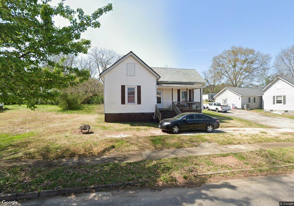
5 Thornton St Lagrange, GA 30241
Estimated Value: $118,454 - $142,000
3
Beds
1
Bath
1,312
Sq Ft
$97/Sq Ft
Est. Value
About This Home
This home is located at 5 Thornton St, Lagrange, GA 30241 and is currently estimated at $127,864, approximately $97 per square foot. 5 Thornton St is a home located in Troup County with nearby schools including Franklin Forest Elementary School, Hollis Hand Elementary School, and Ethel W. Kight Elementary School.
Ownership History
Date
Name
Owned For
Owner Type
Purchase Details
Closed on
Nov 30, 2021
Sold by
T Squared 1 Llc
Bought by
Brbrshy Investments Inc
Current Estimated Value
Purchase Details
Closed on
Jun 1, 2021
Sold by
Stribling Ty
Bought by
T Squared 1 Llc
Purchase Details
Closed on
Apr 25, 2006
Sold by
Matthews James Ralph
Bought by
Matthews James Ralph and Jackson Janice Faye Co
Purchase Details
Closed on
Mar 19, 1968
Sold by
Charles Charles W and Charles Lorene M
Bought by
Matthews James and Matthews Janice
Create a Home Valuation Report for This Property
The Home Valuation Report is an in-depth analysis detailing your home's value as well as a comparison with similar homes in the area
Home Values in the Area
Average Home Value in this Area
Purchase History
| Date | Buyer | Sale Price | Title Company |
|---|---|---|---|
| Brbrshy Investments Inc | $12,484,500 | -- | |
| T Squared 1 Llc | -- | -- | |
| Matthews James Ralph | -- | -- | |
| Matthews James | -- | -- |
Source: Public Records
Tax History Compared to Growth
Tax History
| Year | Tax Paid | Tax Assessment Tax Assessment Total Assessment is a certain percentage of the fair market value that is determined by local assessors to be the total taxable value of land and additions on the property. | Land | Improvement |
|---|---|---|---|---|
| 2024 | $1,035 | $40,520 | $5,240 | $35,280 |
| 2023 | $639 | $23,440 | $5,240 | $18,200 |
| 2022 | $622 | $22,280 | $5,240 | $17,040 |
| 2021 | $233 | $7,720 | $1,600 | $6,120 |
| 2020 | $233 | $7,720 | $1,600 | $6,120 |
| 2019 | $197 | $6,520 | $1,280 | $5,240 |
| 2018 | $197 | $6,520 | $1,280 | $5,240 |
| 2017 | $197 | $6,520 | $1,280 | $5,240 |
| 2016 | $213 | $7,060 | $1,200 | $5,860 |
| 2015 | $213 | $7,060 | $1,200 | $5,860 |
| 2014 | $214 | $7,060 | $1,200 | $5,860 |
| 2013 | -- | $11,833 | $1,600 | $10,233 |
Source: Public Records
Map
Nearby Homes
- 15 Fulton St
- 5 Curran Ave
- 906 Georgia Ave
- 0 E Render St
- 902 Georgia Ave
- 130 Clara Jean Ct
- 0 N Barnard Ave
- Coleman Plan at Crossvine Village
- 0 Mill Creek Pkwy Unit PHASE 5 10313564
- Beckman Plan at Crossvine Village
- 0 Mill Creek Pkwy Unit PHASE 4 10313585
- Fairfield Plan at Crossvine Village
- Broadmoor Plan at Crossvine Village
- Dover Plan at Crossvine Village
- 113 Lenox Cir
- 121 de Groat St
- 621 Arthur St
- 128 Shenandoah Ln Unit A67
- 124 Shenandoah Ln
- 618 S Harlem Cir
- 7 Thornton St
- 3 Thornton St
- 9 Thornton St
- 10 Barnard Ave
- 8 Barnard Ave
- 1 Thornton St
- 6 Barnard Ave
- 12 Barnard Ave
- 11 Thornton St
- 14 Barnard Ave
- 4 N Barnard Ave
- 13 Thornton St
- 11 Barnard Ave
- 14 Thornton St
- 16 Barnard Ave
- 5 Barnard Ave
- 15 Thornton St
- 16 Thornton St
- 0 Barnard Ave Unit 8315987
- 0 Barnard Ave Unit 8246626