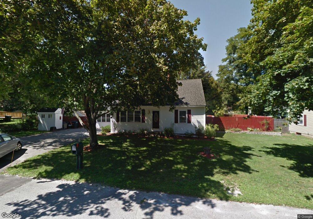
5 Trinity Dr Nashua, NH 03063
Northwest Nashua NeighborhoodEstimated Value: $471,000 - $592,000
About This Home
This home is located at 5 Trinity Dr, Nashua, NH 03063 and is currently estimated at $515,306, approximately $333 per square foot. 5 Trinity Dr is a home located in Hillsborough County with nearby schools including Broad Street Elementary School, Elm Street Middle School, and Nashua High School North.
Ownership History
We collect this data history from publicly available records. To have your information removed, we recommend requesting removal directly through your county’s website.
Purchase Details
Home Financials for this Owner
Home Financials are based on the most recent Mortgage that was taken out on this home.Home Values in the Area
Average Home Value in this Area
Purchase History
We collect this data history from publicly available records. To have your information removed, we recommend requesting removal directly through your county’s website.
| Date | Buyer | Sale Price | Title Company |
|---|---|---|---|
| $218,000 | -- |
Mortgage History
We collect this data history from publicly available records. To have your information removed, we recommend requesting removal directly through your county’s website.
| Date | Status | Borrower | Loan Amount |
|---|---|---|---|
| Open | $250,000 | ||
| Closed | $113,400 | ||
| Closed | $203,000 | ||
| Closed | $50,000 | ||
| Closed | $174,400 |
Tax History
We collect this data history from publicly available records. To have your information removed, we recommend requesting removal directly through your county’s website.
| Year | Tax Paid | Tax Assessment Tax Assessment Total Assessment is a certain percentage of the fair market value that is determined by local assessors to be the total taxable value of land and additions on the property. | Land | Improvement |
|---|---|---|---|---|
| 2025 | $7,530 | $447,400 | $159,100 | $288,300 |
| 2024 | $7,114 | $447,400 | $159,100 | $288,300 |
| 2023 | $6,736 | $369,500 | $127,300 | $242,200 |
| 2022 | $6,677 | $369,500 | $127,300 | $242,200 |
| 2021 | $6,197 | $266,900 | $84,900 | $182,000 |
| 2020 | $6,035 | $266,900 | $84,900 | $182,000 |
| 2019 | $5,808 | $266,900 | $84,900 | $182,000 |
| 2018 | $5,661 | $266,900 | $84,900 | $182,000 |
| 2017 | $5,522 | $214,100 | $69,300 | $144,800 |
| 2016 | $5,367 | $214,100 | $69,300 | $144,800 |
| 2015 | $5,252 | $214,100 | $69,300 | $144,800 |
| 2014 | $5,149 | $214,100 | $69,300 | $144,800 |
Map
- 3 Sioux Ave
- 14 Upstone Dr
- 377 Broad St
- 19 Carroll St
- 2 Iroquois Rd
- 6 Aztec Rd
- 2 Birch Hill Dr
- 7 Hopi Dr
- 33 Coburn Woods Dr
- 40 Coburn Ave
- 44 Coburn Woods
- 45 Northwood Dr
- 14 Juniper Ln
- 2 Myopia Ln Unit U31
- 96 Dublin Ave
- 12 Wheaton Dr
- 6 Westchester Dr
- 5 Ivy Ln Unit U131
- 27 Hollow Ridge Dr Unit 12
- 44 Broad St
Ask me questions while you tour the home.