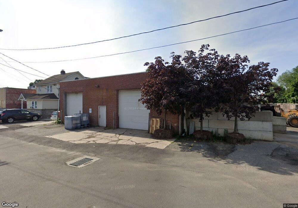
5 van Tassell Ct Norwalk, CT 06851
Downtown Norwalk NeighborhoodEstimated Value: $323,277
--
Bed
--
Bath
4,000
Sq Ft
$81/Sq Ft
Est. Value
About This Home
This home is located at 5 van Tassell Ct, Norwalk, CT 06851 and is currently priced at $323,277, approximately $80 per square foot. 5 van Tassell Ct is a home located in Fairfield County with nearby schools including Silvermine Elementary School, West Rocks Middle School, and Norwalk High School.
Ownership History
Date
Name
Owned For
Owner Type
Purchase Details
Closed on
Nov 9, 2015
Sold by
5 Vantassel Ct Llc
Bought by
Romanos 5 Vantassell C
Current Estimated Value
Purchase Details
Closed on
Nov 25, 2014
Sold by
Greene Edmund and Hall Diane
Bought by
5 Van Tassell Court Ll
Purchase Details
Closed on
Nov 7, 2013
Sold by
Green Edmund
Bought by
Greene Edmund
Purchase Details
Closed on
Mar 8, 2010
Sold by
Greene Edmund B
Bought by
Greene Edmund A
Create a Home Valuation Report for This Property
The Home Valuation Report is an in-depth analysis detailing your home's value as well as a comparison with similar homes in the area
Home Values in the Area
Average Home Value in this Area
Purchase History
| Date | Buyer | Sale Price | Title Company |
|---|---|---|---|
| Romanos 5 Vantassell C | $175,000 | -- | |
| Romanos 5 Vantassell C | $175,000 | -- | |
| 5 Van Tassell Court Ll | -- | -- | |
| 5 Van Tassell Court Ll | -- | -- | |
| Greene Edmund | -- | -- | |
| Greene Edmund | -- | -- | |
| Greene Edmund A | $50,400 | -- | |
| Greene Edmund A | $50,400 | -- |
Source: Public Records
Mortgage History
| Date | Status | Borrower | Loan Amount |
|---|---|---|---|
| Previous Owner | Greene Edmund A | $120,000 |
Source: Public Records
Tax History Compared to Growth
Tax History
| Year | Tax Paid | Tax Assessment Tax Assessment Total Assessment is a certain percentage of the fair market value that is determined by local assessors to be the total taxable value of land and additions on the property. | Land | Improvement |
|---|---|---|---|---|
| 2025 | $11,501 | $481,200 | $365,210 | $115,990 |
| 2024 | $11,330 | $481,200 | $365,210 | $115,990 |
| 2023 | $11,100 | $442,470 | $333,260 | $109,210 |
| 2022 | $10,860 | $442,470 | $333,260 | $109,210 |
| 2021 | $10,606 | $442,470 | $333,260 | $109,210 |
| 2020 | $10,600 | $442,470 | $333,260 | $109,210 |
| 2019 | $10,316 | $442,470 | $333,260 | $109,210 |
| 2018 | $8,312 | $312,410 | $229,070 | $83,340 |
| 2017 | $8,023 | $312,410 | $229,070 | $83,340 |
| 2016 | $7,948 | $312,410 | $229,070 | $83,340 |
| 2015 | $7,926 | $312,410 | $229,070 | $83,340 |
| 2014 | $7,823 | $312,410 | $229,070 | $83,340 |
Source: Public Records
Map
Nearby Homes
- 10 Delaware Ave
- 15 Delaware Ave
- 14 Ohio Ave
- 28 Aiken St
- 42 Ohio Ave
- 57 Plattsville Ave Unit J
- 38 Plymouth Ave
- 13 Slocum St
- 5 Mathias Ct
- 14 Sniffen St
- 25 Grand St Unit 245
- 25 Grand St Unit 107
- 25 Grand St Unit 204
- 25 Grand St Unit 116
- 25 Grand St Unit 203
- 20 Pulaski St
- 34 Sunrise Hill Rd
- 27 W Main St Unit 11
- 50 Aiken St Unit 225
- 194 Sunrise Hill Rd