Estimated Value: $291,514 - $310,000
4
Beds
2
Baths
1,644
Sq Ft
$183/Sq Ft
Est. Value
About This Home
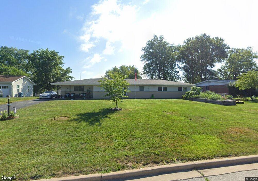
This home is located at 5 Wayne Ln, Saint Charles, MO 63301 and is currently estimated at $301,629, approximately $183 per square foot. 5 Wayne Ln is a home located in St. Charles County with nearby schools including George M. Null Elementary School, Hardin Middle School, and Jefferson Intermediate School.
Ownership History
Date
Name
Owned For
Owner Type
Purchase Details
Closed on
Oct 29, 2025
Sold by
Williams Victor S and Williams Catherine
Bought by
Guignard Randel
Current Estimated Value
Home Financials for this Owner
Home Financials are based on the most recent Mortgage that was taken out on this home.
Original Mortgage
$244,000
Outstanding Balance
$244,000
Interest Rate
6.3%
Mortgage Type
New Conventional
Estimated Equity
$57,629
Purchase Details
Closed on
Feb 15, 2007
Sold by
Welko Kathleen E
Bought by
Williams Victor S
Home Financials for this Owner
Home Financials are based on the most recent Mortgage that was taken out on this home.
Original Mortgage
$100,000
Interest Rate
6.17%
Mortgage Type
Purchase Money Mortgage
Create a Home Valuation Report for This Property
The Home Valuation Report is an in-depth analysis detailing your home's value as well as a comparison with similar homes in the area
Home Values in the Area
Average Home Value in this Area
Purchase History
| Date | Buyer | Sale Price | Title Company |
|---|---|---|---|
| Guignard Randel | -- | Investors Title | |
| Williams Victor S | $125,000 | Ust |
Source: Public Records
Mortgage History
| Date | Status | Borrower | Loan Amount |
|---|---|---|---|
| Open | Guignard Randel | $244,000 | |
| Previous Owner | Williams Victor S | $100,000 |
Source: Public Records
Tax History
| Year | Tax Paid | Tax Assessment Tax Assessment Total Assessment is a certain percentage of the fair market value that is determined by local assessors to be the total taxable value of land and additions on the property. | Land | Improvement |
|---|---|---|---|---|
| 2025 | $2,806 | $46,609 | -- | -- |
| 2023 | $2,801 | $43,640 | $0 | $0 |
| 2022 | $2,353 | $34,124 | $0 | $0 |
| 2021 | $2,355 | $34,124 | $0 | $0 |
| 2020 | $2,473 | $34,458 | $0 | $0 |
| 2019 | $2,451 | $34,458 | $0 | $0 |
| 2018 | $1,826 | $24,309 | $0 | $0 |
| 2017 | $1,802 | $24,309 | $0 | $0 |
| 2016 | $1,540 | $19,967 | $0 | $0 |
| 2015 | $1,538 | $19,967 | $0 | $0 |
| 2014 | $1,672 | $21,457 | $0 | $0 |
Source: Public Records
Map
Nearby Homes
- 7 Wayne St
- 56 Judy Dr
- 2809 Mayer Dr
- 2713 Treadway Ave
- 2520 Fair Oaks Dr
- 729 Norwich Dr
- 2512 Chesstal St
- 904 Kingston Terrace Ct
- 2520 Chartom Mar Dr
- 1116 Chargene St
- 1200 Chargene St
- 28 Eau Claire Dr
- 2916 Mockingbird Dr
- 2714 Linden Place
- 1464 Hawks Nest Ct Unit H
- 1464 Hawks Nest Ct Unit F
- 1456 Hawks Nest Ct Unit F
- 2652 Falcons Way Unit 59
- 944 Saint Charles Ave
- 2661 Falcons Way Unit 82
Your Personal Tour Guide
Ask me questions while you tour the home.