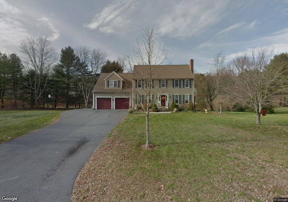
5 Whip Poor Will Cir Wrentham, MA 02093
Sheldonville NeighborhoodEstimated Value: $741,000 - $793,000
4
Beds
2
Baths
1,728
Sq Ft
$439/Sq Ft
Est. Value
About This Home
This home is located at 5 Whip Poor Will Cir, Wrentham, MA 02093 and is currently estimated at $758,624, approximately $439 per square foot. 5 Whip Poor Will Cir is a home located in Norfolk County with nearby schools including Delaney Elementary School and Charles E Roderick.
Ownership History
Date
Name
Owned For
Owner Type
Purchase Details
Closed on
Jan 11, 2000
Sold by
Ofena Corp
Bought by
Bennett Ruth B
Current Estimated Value
Create a Home Valuation Report for This Property
The Home Valuation Report is an in-depth analysis detailing your home's value as well as a comparison with similar homes in the area
Home Values in the Area
Average Home Value in this Area
Purchase History
| Date | Buyer | Sale Price | Title Company |
|---|---|---|---|
| Bennett Ruth B | $170,250 | -- |
Source: Public Records
Tax History Compared to Growth
Tax History
| Year | Tax Paid | Tax Assessment Tax Assessment Total Assessment is a certain percentage of the fair market value that is determined by local assessors to be the total taxable value of land and additions on the property. | Land | Improvement |
|---|---|---|---|---|
| 2025 | $7,690 | $663,500 | $287,000 | $376,500 |
| 2024 | $7,484 | $623,700 | $287,000 | $336,700 |
| 2023 | $7,128 | $564,800 | $261,000 | $303,800 |
| 2022 | $7,002 | $512,200 | $243,500 | $268,700 |
| 2021 | $6,481 | $460,600 | $212,600 | $248,000 |
| 2020 | $6,283 | $440,900 | $189,000 | $251,900 |
| 2019 | $6,070 | $429,900 | $189,000 | $240,900 |
| 2018 | $5,521 | $387,700 | $189,300 | $198,400 |
| 2017 | $5,176 | $363,200 | $185,600 | $177,600 |
| 2016 | $5,091 | $356,500 | $180,300 | $176,200 |
| 2015 | $4,942 | $329,900 | $173,300 | $156,600 |
| 2014 | $4,887 | $319,200 | $166,700 | $152,500 |
Source: Public Records
Map
Nearby Homes
- 440 Chestnut St
- 80 Carriage House Ln
- 955 Summer St
- 50 Green St
- 6 Woodchester Rd
- 0 Fall Ln
- 55 Lawrence Dr Unit 55
- 791 South St Unit 5
- 29 Lawrence Dr
- 1204 South St
- 1222 South St
- Lot 1 - Blueberry 2 Car Plan at King Philip Estates
- Lot 8 - Blueberry 2 Car Plan at King Philip Estates
- Lot 5 - Hughes 2 car Plan at King Philip Estates
- Lot 6 - Blueberry 3 Car Plan at King Philip Estates
- Lot 2 - Camden 2 Car Plan at King Philip Estates
- Lot 7 - Cedar Plan at King Philip Estates
- Lot 4 - Hemingway 2 Car Plan at King Philip Estates
- Lot 3 - Blueberry 2 Car Plan at King Philip Estates
- Lot 3 - 14 Earle Stewart Ln
- 15 Whip Poor Will Cir
- 308 Chestnut St
- 10 Whip Poor Will Cir
- 2 Ingrid Dr
- 25 Whip Poor Will Cir
- 20 Whip Poor Will Cir
- 267 Chestnut St
- 277 Chestnut St
- 5 Ingrid Dr
- 30 Whip Poor Will Cir
- 240 Chestnut St
- 260 Chestnut St
- 287 Chestnut St
- 346 Chestnut St
- 257 Chestnut St
- 348 Chestnut St
- 220 Chestnut St
- 221 Chestnut St
- 349 Chestnut St
- 20 Ingrid Dr