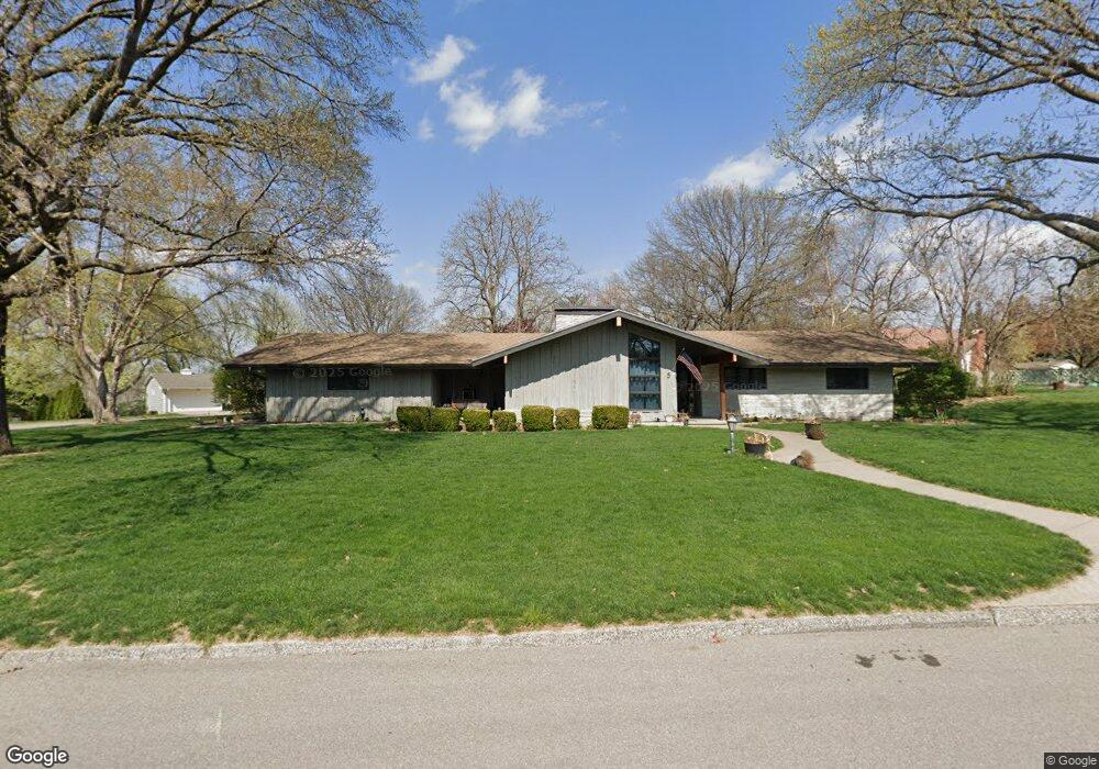
5 Wishbone Rd Saint Joseph, MO 64506
Lovers Lane NeighborhoodEstimated Value: $347,885 - $436,000
Studio
--
Bath
2,205
Sq Ft
$182/Sq Ft
Est. Value
About This Home
This home is located at 5 Wishbone Rd, Saint Joseph, MO 64506 and is currently estimated at $401,721, approximately $182 per square foot. 5 Wishbone Rd is a home located in Buchanan County with nearby schools including Field Elementary School, Bode Middle School, and Central High School.
Ownership History
Date
Name
Owned For
Owner Type
Purchase Details
Closed on
Feb 13, 2020
Sold by
Mccoppin Amanda
Bought by
Wealth Cap Holdings Llc
Current Estimated Value
Purchase Details
Closed on
Apr 20, 2010
Sold by
Carr Gaylen T
Bought by
Be Federal National Mortgage Assn
Purchase Details
Closed on
Aug 30, 2007
Sold by
Deayon Harrion B and Deayon Terri L
Bought by
Lowrance Gregg A and Lowrance Kelly N
Home Financials for this Owner
Home Financials are based on the most recent Mortgage that was taken out on this home.
Original Mortgage
$80,000
Interest Rate
6.7%
Mortgage Type
Purchase Money Mortgage
Create a Home Valuation Report for This Property
The Home Valuation Report is an in-depth analysis detailing your home's value as well as a comparison with similar homes in the area
Home Values in the Area
Average Home Value in this Area
Purchase History
| Date | Buyer | Sale Price | Title Company |
|---|---|---|---|
| Wealth Cap Holdings Llc | -- | Advantage Title | |
| Be Federal National Mortgage Assn | $103,358 | None Available | |
| Lowrance Gregg A | -- | St Joseph Title & Abstract C |
Source: Public Records
Mortgage History
| Date | Status | Borrower | Loan Amount |
|---|---|---|---|
| Previous Owner | Lowrance Gregg A | $80,000 |
Source: Public Records
Tax History
| Year | Tax Paid | Tax Assessment Tax Assessment Total Assessment is a certain percentage of the fair market value that is determined by local assessors to be the total taxable value of land and additions on the property. | Land | Improvement |
|---|---|---|---|---|
| 2025 | $3,714 | $51,760 | $9,220 | $42,540 |
| 2024 | $2,983 | $41,480 | $9,220 | $32,260 |
| 2023 | $2,983 | $41,480 | $9,220 | $32,260 |
| 2022 | $2,754 | $41,480 | $9,220 | $32,260 |
| 2021 | $2,766 | $41,480 | $9,220 | $32,260 |
| 2020 | $2,749 | $41,480 | $9,220 | $32,260 |
| 2019 | $2,656 | $41,480 | $9,220 | $32,260 |
| 2018 | $2,399 | $41,480 | $9,220 | $32,260 |
| 2017 | $2,377 | $41,480 | $0 | $0 |
| 2015 | $1 | $38,770 | $0 | $0 |
| 2014 | $2,437 | $38,770 | $0 | $0 |
Source: Public Records
Map
Nearby Homes
- 2511 Kent St
- 3309 Westwood Dr
- 3413 W Colony Square
- 2324 Goff Ave
- 1805 6th Ave
- 2011 Lovers Ln
- 2502 Flintstone Dr
- 1717 6th Ave
- 2610 Parallel Ave
- 1511 6th Ave
- 2611 Parallel Ave
- 1525 4th Ave
- 1302 Randolph St
- 0 Moss and Eugene Field Ave
- 2204 Ashland Ave
- 28 Court Ln
- 2634 Lucille Ave
- 2110 Ashland Ave
- 3133 Saint Joseph Ave
- 3131 Saint Joseph Ave
Your Personal Tour Guide
Ask me questions while you tour the home.