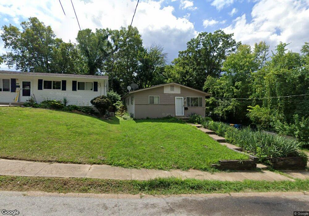
50 Albert Ave Saint Louis, MO 63135
Estimated Value: $98,908 - $143,000
3
Beds
3
Baths
1,080
Sq Ft
$111/Sq Ft
Est. Value
About This Home
This home is located at 50 Albert Ave, Saint Louis, MO 63135 and is currently estimated at $119,727, approximately $110 per square foot. 50 Albert Ave is a home located in St. Louis County with nearby schools including Ferguson Middle School, Johnson Wabash Elementary School, and McCluer High School.
Ownership History
Date
Name
Owned For
Owner Type
Purchase Details
Closed on
Feb 2, 2015
Sold by
Majeed Ali Sarhank
Bought by
Synt Properties Llc
Current Estimated Value
Purchase Details
Closed on
Jan 27, 2015
Sold by
Qadin Shadya
Bought by
Majeed Ali Sarhank
Purchase Details
Closed on
Jan 3, 2014
Sold by
Buckner Aaron and Buckner Gean
Bought by
Qadir Shadya
Purchase Details
Closed on
Nov 8, 2013
Sold by
Nationstar Mortgage Llc
Bought by
Buckner Aaron and Buckner Gean
Purchase Details
Closed on
Sep 3, 2013
Sold by
Wood Oscar A
Bought by
Nationstar Mortgage Llc and Champion Mortgage Company
Purchase Details
Closed on
Jun 11, 1975
Sold by
Deraps Larry J and Deraps Peggy A
Bought by
Wood Oscar A
Create a Home Valuation Report for This Property
The Home Valuation Report is an in-depth analysis detailing your home's value as well as a comparison with similar homes in the area
Home Values in the Area
Average Home Value in this Area
Purchase History
| Date | Buyer | Sale Price | Title Company |
|---|---|---|---|
| Synt Properties Llc | -- | None Available | |
| Majeed Ali Sarhank | -- | None Available | |
| Qadir Shadya | -- | None Available | |
| Buckner Aaron | $16,000 | Continental Title Company | |
| Nationstar Mortgage Llc | $21,000 | None Available | |
| Wood Oscar A | -- | None Available |
Source: Public Records
Tax History Compared to Growth
Tax History
| Year | Tax Paid | Tax Assessment Tax Assessment Total Assessment is a certain percentage of the fair market value that is determined by local assessors to be the total taxable value of land and additions on the property. | Land | Improvement |
|---|---|---|---|---|
| 2025 | $1,374 | $21,450 | $3,000 | $18,450 |
| 2024 | $1,374 | $19,480 | $2,680 | $16,800 |
| 2023 | $1,408 | $19,480 | $2,680 | $16,800 |
| 2022 | $1,243 | $14,950 | $3,440 | $11,510 |
| 2021 | $1,204 | $14,950 | $3,440 | $11,510 |
| 2020 | $1,017 | $11,310 | $2,760 | $8,550 |
| 2019 | $998 | $11,310 | $2,760 | $8,550 |
| 2018 | $899 | $9,060 | $2,390 | $6,670 |
| 2017 | $882 | $9,060 | $2,390 | $6,670 |
| 2016 | $1,029 | $10,450 | $2,390 | $8,060 |
| 2015 | $1,035 | $10,450 | $2,390 | $8,060 |
| 2014 | $1,106 | $11,060 | $2,090 | $8,970 |
Source: Public Records
Map
Nearby Homes
- 222 Wooster Dr
- 231 Wooster Dr
- 601 Chanslor Ave
- 614 January Ave
- 15 Lake Pembroke Dr
- 716 Nancy Place
- 439 Warford Ave
- 901 Frost Ave
- 415 Warford Ave
- 16 White Dr
- 18 White Dr
- 127 Thoroughman Ave
- 6640 Thurston Ave
- 111 Royal Ave
- 6 Sandringham Ln
- 218 N Marguerite Ave
- 6612 Torlina Dr
- 6717 Thurston Ave
- 324 Newell Dr
- 429 N Clay Ave
- 40 Albert Ave
- 30 Albert Ave
- 20 Albert Ave
- 223 Eddy 225
- 805 Mary Ave
- 51 Albert Ave
- 41 Albert Ave
- 221 Eddy Ave
- 31 Albert Ave
- 10 Albert Ave
- 17 Albert Ave
- 11 Albert Ave
- 5 Marcel Ct
- 815 N Florissant Rd
- 4 Marcel Ct
- 829 N Florissant Rd
- 809 N Florissant Rd
- 805 N Florissant Rd
- 835 N Florissant Rd
- 801 N Florissant Rd