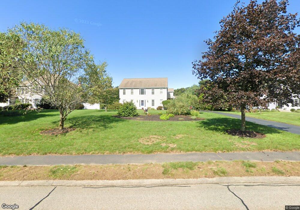
50 Annawon Ave Wrentham, MA 02093
Estimated Value: $944,710 - $1,148,000
4
Beds
3
Baths
2,726
Sq Ft
$384/Sq Ft
Est. Value
About This Home
This home is located at 50 Annawon Ave, Wrentham, MA 02093 and is currently estimated at $1,046,678, approximately $383 per square foot. 50 Annawon Ave is a home located in Norfolk County with nearby schools including Delaney Elementary School and Charles E Roderick.
Ownership History
Date
Name
Owned For
Owner Type
Purchase Details
Closed on
Jul 17, 2000
Sold by
Diplacido Dev Corp
Bought by
Kelly Robert F and Kelly Catherine A
Current Estimated Value
Home Financials for this Owner
Home Financials are based on the most recent Mortgage that was taken out on this home.
Original Mortgage
$170,000
Interest Rate
8.5%
Mortgage Type
Purchase Money Mortgage
Create a Home Valuation Report for This Property
The Home Valuation Report is an in-depth analysis detailing your home's value as well as a comparison with similar homes in the area
Home Values in the Area
Average Home Value in this Area
Purchase History
| Date | Buyer | Sale Price | Title Company |
|---|---|---|---|
| Kelly Robert F | $341,630 | -- |
Source: Public Records
Mortgage History
| Date | Status | Borrower | Loan Amount |
|---|---|---|---|
| Open | Kelly Robert F | $160,000 | |
| Closed | Kelly Robert F | $170,000 | |
| Previous Owner | Kelly Robert F | $146,900 |
Source: Public Records
Tax History Compared to Growth
Tax History
| Year | Tax Paid | Tax Assessment Tax Assessment Total Assessment is a certain percentage of the fair market value that is determined by local assessors to be the total taxable value of land and additions on the property. | Land | Improvement |
|---|---|---|---|---|
| 2025 | $9,920 | $855,900 | $318,800 | $537,100 |
| 2024 | $9,468 | $789,000 | $318,800 | $470,200 |
| 2023 | $9,214 | $730,100 | $289,800 | $440,300 |
| 2022 | $9,039 | $661,200 | $263,500 | $397,700 |
| 2021 | $8,853 | $629,200 | $263,500 | $365,700 |
| 2020 | $8,745 | $613,700 | $216,600 | $397,100 |
| 2019 | $8,410 | $595,600 | $216,600 | $379,000 |
| 2018 | $7,974 | $560,000 | $216,900 | $343,100 |
| 2017 | $7,759 | $544,500 | $212,800 | $331,700 |
| 2016 | $7,648 | $535,600 | $206,600 | $329,000 |
| 2015 | $7,622 | $508,800 | $198,600 | $310,200 |
| 2014 | $7,548 | $493,000 | $191,000 | $302,000 |
Source: Public Records
Map
Nearby Homes
- Lot 1 - Blueberry 2 Car Plan at King Philip Estates
- Lot 8 - Blueberry 2 Car Plan at King Philip Estates
- Lot 6 - Blueberry 3 Car Plan at King Philip Estates
- Lot 2 - Camden 2 Car Plan at King Philip Estates
- Lot 7 - Cedar Plan at King Philip Estates
- Lot 4 - Hemingway 2 Car Plan at King Philip Estates
- Lot 3 - Blueberry 2 Car Plan at King Philip Estates
- Lot 3 - 14 Earle Stewart Ln
- 11 Earle Stewart Ln
- 131 Creek St Unit 7
- 791 South St Unit 5
- 319 Taunton St
- 570 Franklin St
- 10 Nature View Dr
- 15 Nature View Dr
- 440 Chestnut St
- 50 Green St
- 270 Dedham St
- 1 Lorraine Metcalf Dr
- 362 East St
- 60 Annawon Ave
- 40 Annawon Ave
- 70 Annawon Ave
- 30 Annawon Ave
- 140 Pokanoket Path
- 130 Pokanoket Path
- 45 Annawon Ave
- 35 Annawon Ave
- 120 Pokanoket Path
- 15 Annawon Ave
- 55 Annawon Ave
- 20 Annawon Ave
- 150 Pokanoket Path
- 90 Annawon Ave
- 110 Pokanoket Path
- 65 Annawon Ave
- 160 Pokanoket Path
- 25 Annawon Ave
- 75 Annawon Ave
- 80 Annawon Ave