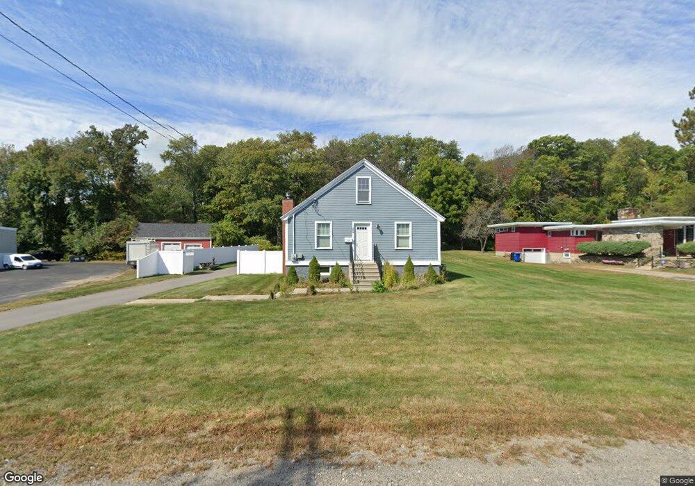
50 Arnold Rd Worcester, MA 01607
Pakachoag NeighborhoodEstimated Value: $403,000 - $558,000
2
Beds
3
Baths
2,012
Sq Ft
$235/Sq Ft
Est. Value
About This Home
This home is located at 50 Arnold Rd, Worcester, MA 01607 and is currently estimated at $472,535, approximately $234 per square foot. 50 Arnold Rd is a home with nearby schools including Auburn Senior High School.
Ownership History
Date
Name
Owned For
Owner Type
Purchase Details
Closed on
Mar 14, 2024
Sold by
Staruk James E
Bought by
James E Staruk T - 2013 and Staruk
Current Estimated Value
Purchase Details
Closed on
Jan 29, 2009
Sold by
Countrywide Home Loans and Usa Va Affairs
Bought by
Staruk James E
Purchase Details
Closed on
Feb 20, 2007
Sold by
Hazard Eugene E and Citimortgage Inc
Bought by
Usa Va
Purchase Details
Closed on
Apr 1, 2004
Sold by
W W T T
Bought by
Hazard Eugene E
Create a Home Valuation Report for This Property
The Home Valuation Report is an in-depth analysis detailing your home's value as well as a comparison with similar homes in the area
Home Values in the Area
Average Home Value in this Area
Purchase History
| Date | Buyer | Sale Price | Title Company |
|---|---|---|---|
| James E Staruk T - 2013 | -- | None Available | |
| Staruk James E | $103,000 | -- | |
| Usa Va | $171,854 | -- | |
| Hazard Eugene E | $183,000 | -- |
Source: Public Records
Tax History
| Year | Tax Paid | Tax Assessment Tax Assessment Total Assessment is a certain percentage of the fair market value that is determined by local assessors to be the total taxable value of land and additions on the property. | Land | Improvement |
|---|---|---|---|---|
| 2025 | $71 | $496,500 | $106,700 | $389,800 |
| 2024 | $6,928 | $464,000 | $102,700 | $361,300 |
| 2023 | $6,909 | $435,100 | $93,400 | $341,700 |
| 2022 | $6,114 | $363,500 | $88,200 | $275,300 |
| 2021 | $5,883 | $324,300 | $77,900 | $246,400 |
| 2020 | $5,786 | $321,800 | $77,900 | $243,900 |
| 2019 | $5,368 | $291,400 | $72,700 | $218,700 |
| 2018 | $5,250 | $284,700 | $67,900 | $216,800 |
| 2017 | $5,040 | $274,800 | $61,600 | $213,200 |
| 2016 | $4,510 | $249,300 | $63,500 | $185,800 |
| 2015 | $4,186 | $242,500 | $63,500 | $179,000 |
| 2014 | $4,250 | $245,800 | $60,300 | $185,500 |
Source: Public Records
Map
Nearby Homes
- 557 SW Cutoff Unit 17
- 557 SW Cutoff Unit 55
- 557 SW Cutoff Unit 60
- 557 SW Cutoff Unit 130B
- 557 SW Cutoff Unit 130C
- 557 SW Cutoff Unit 130A
- 49 Strasburg Rd
- 29 Steele St
- 154 Pakachoag St
- 22 Bittersweet Blvd
- 457 Granite St
- 50 Sophia Dr
- 204-212 Hampton St
- 4 Stockholm St
- 73 Sophia Dr
- 30 Ekman St
- 6 Beckman St
- 405 Granite St
- 50 Whipple St
- 38 Garnet St
- 50 Arnold Rd
- 30 Arnold Rd
- 20 Washington St
- 26 Arnold Rd
- 26 Arnold Rd
- 4 Washington St
- 24 Arnold Rd
- 22 Arnold Rd
- 17 Washington St Unit 25
- 17 Washington St Unit 17
- 17 Washington St Unit Lot 6
- 17 Washington St Unit 23
- 17 Washington St Unit 12
- 17 Washington St Unit 26
- 17 Washington St Unit 1
- 17 Washington St Unit 24
- 17 Washington St Unit 13
- 17 Washington St Unit 19
- 17 Washington St Unit 6
- 17 Washington St Unit 18
Your Personal Tour Guide
Ask me questions while you tour the home.