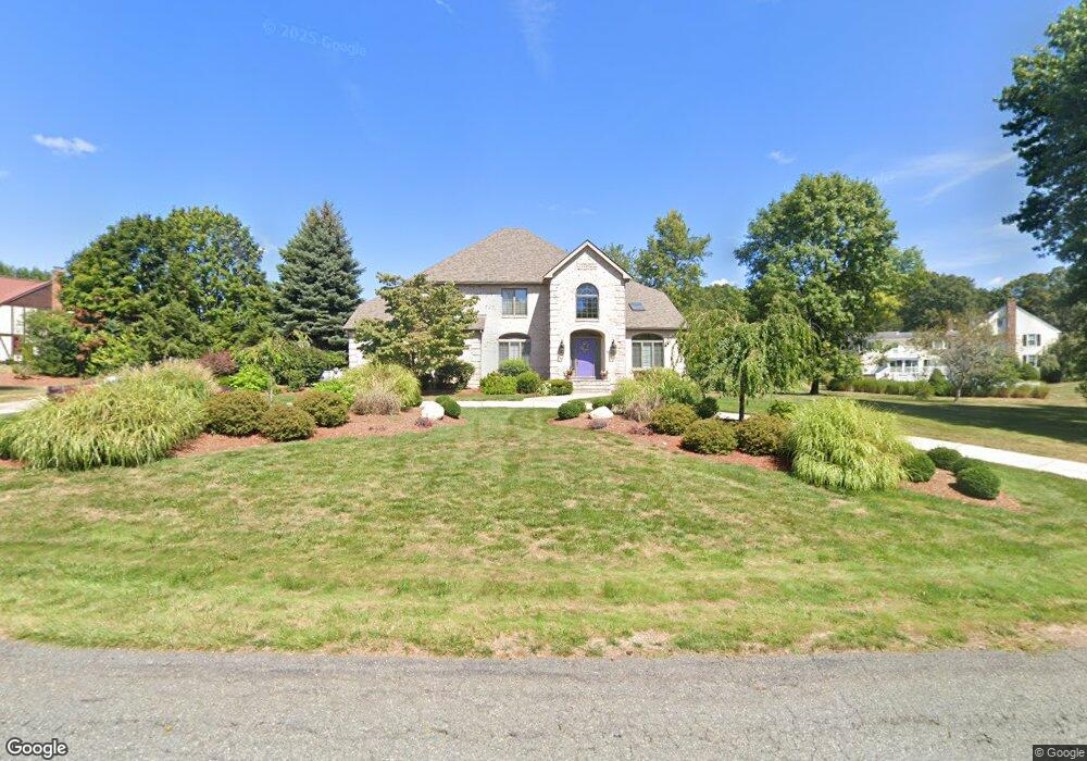
50 Bayberry Rd Canton, MA 02021
Estimated Value: $1,213,000 - $1,454,000
4
Beds
3
Baths
3,327
Sq Ft
$404/Sq Ft
Est. Value
About This Home
This home is located at 50 Bayberry Rd, Canton, MA 02021 and is currently estimated at $1,342,949, approximately $403 per square foot. 50 Bayberry Rd is a home located in Norfolk County with nearby schools including Canton High School and St. John the Evangelist School.
Ownership History
Date
Name
Owned For
Owner Type
Purchase Details
Closed on
Apr 6, 2023
Sold by
Demartino Michael and Demartino Lidia
Bought by
Demartino Ft
Current Estimated Value
Purchase Details
Closed on
Dec 4, 1989
Sold by
Scopa Constr Corp
Bought by
Demartino Michael
Home Financials for this Owner
Home Financials are based on the most recent Mortgage that was taken out on this home.
Original Mortgage
$50,000
Interest Rate
9.82%
Mortgage Type
Purchase Money Mortgage
Purchase Details
Closed on
Dec 24, 1987
Sold by
Feinberg Paul I
Bought by
Scopa Const Corp
Home Financials for this Owner
Home Financials are based on the most recent Mortgage that was taken out on this home.
Original Mortgage
$365,000
Interest Rate
10.67%
Mortgage Type
Purchase Money Mortgage
Create a Home Valuation Report for This Property
The Home Valuation Report is an in-depth analysis detailing your home's value as well as a comparison with similar homes in the area
Home Values in the Area
Average Home Value in this Area
Purchase History
| Date | Buyer | Sale Price | Title Company |
|---|---|---|---|
| Demartino Ft | -- | None Available | |
| Demartino Michael | $125,000 | -- | |
| Scopa Const Corp | $151,250 | -- |
Source: Public Records
Mortgage History
| Date | Status | Borrower | Loan Amount |
|---|---|---|---|
| Previous Owner | Scopa Const Corp | $50,000 | |
| Previous Owner | Scopa Const Corp | $365,000 |
Source: Public Records
Tax History Compared to Growth
Tax History
| Year | Tax Paid | Tax Assessment Tax Assessment Total Assessment is a certain percentage of the fair market value that is determined by local assessors to be the total taxable value of land and additions on the property. | Land | Improvement |
|---|---|---|---|---|
| 2025 | $11,828 | $1,196,000 | $360,500 | $835,500 |
| 2024 | $11,344 | $1,137,800 | $346,700 | $791,100 |
| 2023 | $10,767 | $1,018,600 | $346,700 | $671,900 |
| 2022 | $10,649 | $938,200 | $330,200 | $608,000 |
| 2021 | $10,443 | $856,000 | $300,100 | $555,900 |
| 2020 | $9,976 | $815,700 | $285,900 | $529,800 |
| 2019 | $9,870 | $796,000 | $259,800 | $536,200 |
| 2018 | $9,875 | $795,100 | $272,500 | $522,600 |
| 2017 | $9,976 | $780,000 | $267,200 | $512,800 |
| 2016 | $9,738 | $761,400 | $260,700 | $500,700 |
| 2015 | $9,503 | $741,300 | $253,100 | $488,200 |
Source: Public Records
Map
Nearby Homes
- 240 York St
- 55 Old County Way
- 214 Turnpike St
- 19 Cynthia Rd
- 7 Edward St
- 3 Spotted Turtle Path Unit 24-2
- 40 Randolph St
- Lot 0 York St
- 35 Turnpike St
- 11 Redman Rd
- 25 Kelly Way Unit 25
- 8 Talbot Rd
- 1 Ridgehill Rd
- 1603 Irving Rd
- 1307 Irving Rd
- 232 Canton St Unit 104
- 232 Canton St Unit 205
- 232 Canton St Unit 112
- 30 Green Lodge St
- 14 Anderson Dr