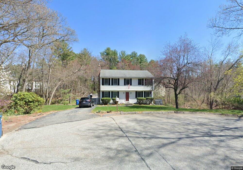
50 Blease Dr Tewksbury, MA 01876
Estimated Value: $706,143 - $864,000
4
Beds
3
Baths
1,836
Sq Ft
$427/Sq Ft
Est. Value
About This Home
This home is located at 50 Blease Dr, Tewksbury, MA 01876 and is currently estimated at $784,286, approximately $427 per square foot. 50 Blease Dr is a home located in Middlesex County with nearby schools including Heath-Brook Elementary School, John W. Wynn Middle School, and John F. Ryan Elementary School.
Ownership History
Date
Name
Owned For
Owner Type
Purchase Details
Closed on
Dec 20, 2024
Sold by
Obrien Catherine J
Bought by
Obrien Ft and Obrien
Current Estimated Value
Purchase Details
Closed on
Dec 2, 2003
Sold by
Martin Amy A and Martin John J
Bought by
Obrien Catherine J
Purchase Details
Closed on
Jun 25, 1999
Sold by
Stavropoulos Ames and Stavropoulos Cynthia
Bought by
Martin John J and Martin Any A
Purchase Details
Closed on
May 20, 1992
Sold by
Maher William and Maher Janice
Bought by
Stavropoulos James and Stavropoulo Cynthia
Purchase Details
Closed on
Jun 12, 1987
Sold by
Stella Charles J
Bought by
Maher William
Create a Home Valuation Report for This Property
The Home Valuation Report is an in-depth analysis detailing your home's value as well as a comparison with similar homes in the area
Home Values in the Area
Average Home Value in this Area
Purchase History
| Date | Buyer | Sale Price | Title Company |
|---|---|---|---|
| Obrien Ft | -- | None Available | |
| Obrien Ft | -- | None Available | |
| Obrien Catherine J | $397,650 | -- | |
| Obrien Catherine J | $397,650 | -- | |
| Martin John J | $260,000 | -- | |
| Martin John J | $260,000 | -- | |
| Stavropoulos James | $163,000 | -- | |
| Stavropoulos James | $163,000 | -- | |
| Maher William | $219,900 | -- |
Source: Public Records
Mortgage History
| Date | Status | Borrower | Loan Amount |
|---|---|---|---|
| Previous Owner | Maher William | $214,000 | |
| Previous Owner | Maher William | $222,000 |
Source: Public Records
Tax History Compared to Growth
Tax History
| Year | Tax Paid | Tax Assessment Tax Assessment Total Assessment is a certain percentage of the fair market value that is determined by local assessors to be the total taxable value of land and additions on the property. | Land | Improvement |
|---|---|---|---|---|
| 2025 | $8,663 | $655,300 | $332,600 | $322,700 |
| 2024 | $8,458 | $631,700 | $316,800 | $314,900 |
| 2023 | $8,196 | $581,300 | $288,000 | $293,300 |
| 2022 | $7,375 | $485,200 | $250,400 | $234,800 |
| 2021 | $7,135 | $453,900 | $227,700 | $226,200 |
| 2020 | $7,019 | $439,500 | $216,700 | $222,800 |
| 2019 | $7,950 | $406,100 | $206,200 | $199,900 |
| 2018 | $3,058 | $379,700 | $206,200 | $173,500 |
| 2017 | $6,092 | $373,500 | $206,200 | $167,300 |
| 2016 | $5,884 | $359,900 | $206,200 | $153,700 |
| 2015 | $5,641 | $344,600 | $196,900 | $147,700 |
| 2014 | $5,593 | $347,200 | $206,200 | $141,000 |
Source: Public Records
Map
Nearby Homes
- 1455 Main St Unit 4
- 1455 Main St Unit 10
- 1455 Main St Unit 8
- 1418 Main St Unit 201
- 142 Patrick Rd
- 6 Stonebury Way Unit 6
- 111 Patrick Rd Unit 111
- 61 Patrick Rd
- 1334 Main St
- 1325 Main
- 14 Hinckley Rd
- 8 Boisvert Rd
- 11 Orchard St
- 70 Ronald Dr
- 27 Marie St
- 16 Eagle Dr
- 31 Marie St
- 100 Pine St
- 107 Eagle Dr Unit 107
- 93 Fairway Dr
- 55 Blease Dr
- 44 Blease Dr
- 34 Blease Dr
- 45 Blease Dr
- 35 Blease Dr
- 41 Virginia Rd
- 20 Blease Dr
- 1501 Main St Unit 54
- 1501 Main St Unit 55
- 1501 Main St Unit 33
- 1501 Main St Unit 9
- 1501 Main St Unit 38
- 1501 Main St Unit 12
- 1501 Main St Unit 21
- 1501 Main St Unit 24
- 1501 Main St Unit 19
- 1501 Main St Unit 43
- 1501 Main St Unit 20
- 1501 Main St Unit 7
- 1501 Main St Unit 13