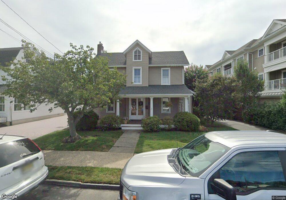
50 Broad St Manasquan, NJ 08736
Estimated Value: $1,079,000 - $1,287,000
4
Beds
3
Baths
2,063
Sq Ft
$576/Sq Ft
Est. Value
About This Home
This home is located at 50 Broad St, Manasquan, NJ 08736 and is currently estimated at $1,188,468, approximately $576 per square foot. 50 Broad St is a home located in Monmouth County with nearby schools including Manasquan Elementary School, Manasquan High School, and The Brookside School.
Ownership History
Date
Name
Owned For
Owner Type
Purchase Details
Closed on
May 17, 2019
Sold by
Robinson David Brooke and Estate Of Christopher D Robins
Bought by
Robinson Tara A
Current Estimated Value
Home Financials for this Owner
Home Financials are based on the most recent Mortgage that was taken out on this home.
Original Mortgage
$248,000
Outstanding Balance
$217,599
Interest Rate
4.1%
Mortgage Type
New Conventional
Estimated Equity
$970,869
Purchase Details
Closed on
Feb 1, 1996
Sold by
Trafford Christopher
Bought by
Robinson Christopher and Robinson Tara
Home Financials for this Owner
Home Financials are based on the most recent Mortgage that was taken out on this home.
Original Mortgage
$176,000
Interest Rate
6.99%
Create a Home Valuation Report for This Property
The Home Valuation Report is an in-depth analysis detailing your home's value as well as a comparison with similar homes in the area
Home Values in the Area
Average Home Value in this Area
Purchase History
| Date | Buyer | Sale Price | Title Company |
|---|---|---|---|
| Robinson Tara A | $50,000 | Anchor Title Agency Llc | |
| Robinson Christopher | $220,000 | -- |
Source: Public Records
Mortgage History
| Date | Status | Borrower | Loan Amount |
|---|---|---|---|
| Open | Robinson Tara A | $248,000 | |
| Previous Owner | Robinson Christopher | $176,000 |
Source: Public Records
Tax History Compared to Growth
Tax History
| Year | Tax Paid | Tax Assessment Tax Assessment Total Assessment is a certain percentage of the fair market value that is determined by local assessors to be the total taxable value of land and additions on the property. | Land | Improvement |
|---|---|---|---|---|
| 2025 | $10,231 | $575,400 | $231,500 | $343,900 |
| 2024 | $9,845 | $575,400 | $231,500 | $343,900 |
| 2023 | $9,845 | $575,400 | $231,500 | $343,900 |
| 2022 | $9,477 | $575,400 | $231,500 | $343,900 |
| 2021 | $9,477 | $575,400 | $231,500 | $343,900 |
| 2020 | $9,345 | $575,400 | $231,500 | $343,900 |
| 2019 | $8,994 | $575,400 | $231,500 | $343,900 |
| 2018 | $8,792 | $575,400 | $231,500 | $343,900 |
| 2017 | $8,458 | $575,400 | $231,500 | $343,900 |
| 2016 | $8,234 | $575,400 | $231,500 | $343,900 |
| 2015 | $9,940 | $581,600 | $219,200 | $362,400 |
| 2014 | $9,928 | $581,600 | $219,200 | $362,400 |
Source: Public Records
Map
Nearby Homes
- 34 Broad St Unit 306
- 22 Woodland Ave
- 3 Central Ave
- 116 Curtis Ave
- 80 Stockton Lake Blvd
- 34 Gertrude Place
- 15 Spruce Ave
- 20 Old Squan Rd
- 130 Union Ave
- 534 Washington Blvd Unit 6
- 721 Crescent Place
- 722 Boston Blvd
- 610 Agnes Ave
- 409 Sea Girt Ave
- 2253 Wagner Ln
- 355 Cedar Ave
- 2311 Camden Ave
- 504 Crescent Pkwy
- 619 Park Ave
- 507 Crescent Pkwy
- 821 Squan Brook Way
- 54 Broad St
- 58 Broad St
- 39 Pearce Ave
- 43 Pearce Ave
- 37 Pearce Ave
- 49 Pearce Ave
- 49 Broad St Unit 51
- 33 Pearce Ave
- A34 Broad St Unit 206
- 34 Broad St
- 34 Broad St Unit 301
- 34 Broad St Unit 311
- 34 Broad St Unit 308
- 34 Broad St Unit 307
- 34 Broad St Unit 305
- 34 Broad St Unit 304
- 34 Broad St Unit 303
- 34 Broad St Unit 302
- 34 Broad St Unit 208