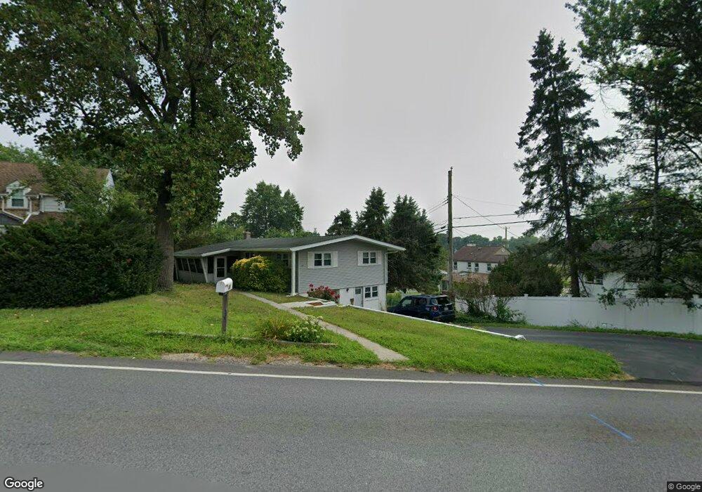
50 Burnside Ave Norristown, PA 19403
West Norriton Township NeighborhoodEstimated Value: $341,000 - $372,000
2
Beds
1
Bath
1,118
Sq Ft
$323/Sq Ft
Est. Value
About This Home
This home is located at 50 Burnside Ave, Norristown, PA 19403 and is currently estimated at $360,966, approximately $322 per square foot. 50 Burnside Ave is a home located in Montgomery County with nearby schools including Charles Blockson Middle School, Paul V Fly Elementary School, and East Norriton Middle School.
Ownership History
Date
Name
Owned For
Owner Type
Purchase Details
Closed on
Oct 15, 2002
Sold by
Smith Mark A
Bought by
Hogencamp John W and Mccartney Donna M
Current Estimated Value
Purchase Details
Closed on
Apr 13, 2001
Sold by
Smith Mark A and Smith Jennifer J
Bought by
Smith Mark A
Purchase Details
Closed on
Jul 26, 1995
Sold by
Sweeney Edward P and Sweeney Kathleen L
Bought by
Smith Mark A and Smith Jennifer J
Create a Home Valuation Report for This Property
The Home Valuation Report is an in-depth analysis detailing your home's value as well as a comparison with similar homes in the area
Home Values in the Area
Average Home Value in this Area
Purchase History
| Date | Buyer | Sale Price | Title Company |
|---|---|---|---|
| Hogencamp John W | $155,000 | -- | |
| Smith Mark A | -- | -- | |
| Smith Mark A | $119,000 | -- |
Source: Public Records
Tax History Compared to Growth
Tax History
| Year | Tax Paid | Tax Assessment Tax Assessment Total Assessment is a certain percentage of the fair market value that is determined by local assessors to be the total taxable value of land and additions on the property. | Land | Improvement |
|---|---|---|---|---|
| 2025 | $5,766 | $118,030 | $42,190 | $75,840 |
| 2024 | $5,766 | $118,030 | $42,190 | $75,840 |
| 2023 | $5,701 | $118,030 | $42,190 | $75,840 |
| 2022 | $5,664 | $118,030 | $42,190 | $75,840 |
| 2021 | $5,630 | $118,030 | $42,190 | $75,840 |
| 2020 | $5,462 | $118,030 | $42,190 | $75,840 |
| 2019 | $5,340 | $118,030 | $42,190 | $75,840 |
| 2018 | $4,358 | $118,030 | $42,190 | $75,840 |
| 2017 | $5,041 | $118,030 | $42,190 | $75,840 |
| 2016 | $4,995 | $118,030 | $42,190 | $75,840 |
| 2015 | $4,628 | $118,030 | $42,190 | $75,840 |
| 2014 | $4,628 | $118,030 | $42,190 | $75,840 |
Source: Public Records
Map
Nearby Homes
- 2055 W Marshall St
- 37 Burnside Ave
- 32 Miami Rd
- 68 Jefferson Ave
- 136 Markley Farm Cir
- 2020 Davis Dr
- 709 Middleton Place
- 1107 Middleton Place
- 2020 Sterigere St
- 1749 W Marshall St
- 2008 Hemlock Rd
- 1104 Arden Dr Unit METHACTON SCHOOL
- 00 Arden Dr Unit METHACTON SCHOOL
- 108 N Prospect Ave
- 137 Avondale Rd
- 166 Hoover Ave
- 155 Avondale Rd
- 1635 W Marshall W Marshall St
- 443 Brandon Rd
- 391 Rittenhouse Blvd
- 54 Burnside Ave
- 2075 W Marshall St
- 2077 W Marshall St
- 56 Burnside Ave
- 2073 W Marshall St
- 105 Kramer Dr
- 2071 W Marshall St
- 51 Burnside Ave
- 53 Burnside Ave
- 111 Kramer Dr
- 49 Burnside Ave
- 55 Burnside Ave
- 58 Burnside Ave
- 2067 W Marshall St
- 47 Burnside Ave
- 117 Kramer Dr
- 57 Burnside Ave
- 45 Burnside Ave
- 54 Crawford Dr
- 52 Crawford Dr