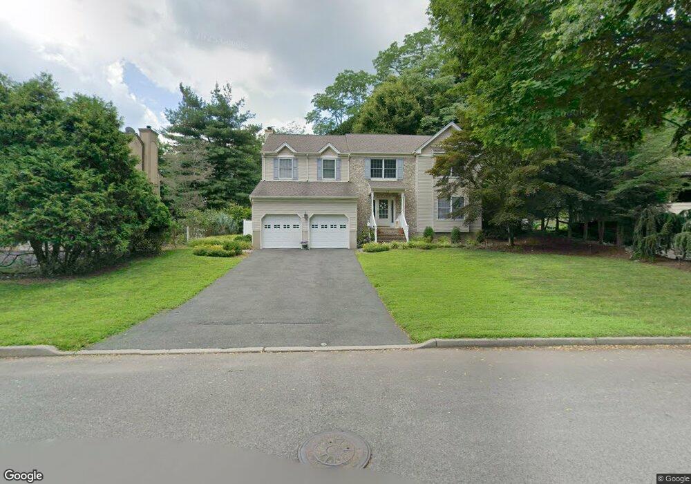
50 Devine Dr Mahwah, NJ 07430
Estimated Value: $767,000 - $1,071,000
Studio
--
Bath
2,684
Sq Ft
$338/Sq Ft
Est. Value
About This Home
This home is located at 50 Devine Dr, Mahwah, NJ 07430 and is currently estimated at $907,616, approximately $338 per square foot. 50 Devine Dr is a home located in Bergen County with nearby schools including Mahwah High School and ONESCHOOL GLOBAL-NEW YORK.
Ownership History
Date
Name
Owned For
Owner Type
Purchase Details
Closed on
Sep 22, 2023
Sold by
Brown Steven and Brown Shana
Bought by
Brown Living Trust and Brown
Current Estimated Value
Purchase Details
Closed on
May 25, 2000
Sold by
Lapidus Rov A and Lapidus Maria A
Bought by
Brown Steven L and Brown Shana
Home Financials for this Owner
Home Financials are based on the most recent Mortgage that was taken out on this home.
Original Mortgage
$378,000
Interest Rate
7.5%
Purchase Details
Closed on
Jul 28, 1995
Sold by
Cord Developers Inc
Bought by
Lapidus Roy and Lapidus Marie
Home Financials for this Owner
Home Financials are based on the most recent Mortgage that was taken out on this home.
Original Mortgage
$210,000
Interest Rate
7.48%
Create a Home Valuation Report for This Property
The Home Valuation Report is an in-depth analysis detailing your home's value as well as a comparison with similar homes in the area
Home Values in the Area
Average Home Value in this Area
Purchase History
| Date | Buyer | Sale Price | Title Company |
|---|---|---|---|
| Brown Living Trust | -- | None Listed On Document | |
| Brown Living Trust | -- | None Listed On Document | |
| Brown Steven L | $480,000 | -- | |
| Lapidus Roy | $329,900 | -- |
Source: Public Records
Mortgage History
| Date | Status | Borrower | Loan Amount |
|---|---|---|---|
| Previous Owner | Brown Steven L | $378,000 | |
| Previous Owner | Lapidus Roy | $210,000 |
Source: Public Records
Tax History
| Year | Tax Paid | Tax Assessment Tax Assessment Total Assessment is a certain percentage of the fair market value that is determined by local assessors to be the total taxable value of land and additions on the property. | Land | Improvement |
|---|---|---|---|---|
| 2025 | $11,800 | $571,700 | $270,700 | $301,000 |
| 2024 | $11,646 | $571,700 | $270,700 | $301,000 |
| 2023 | $11,274 | $571,700 | $270,700 | $301,000 |
| 2022 | $11,274 | $571,700 | $270,700 | $301,000 |
| 2021 | $10,437 | $571,700 | $270,700 | $301,000 |
| 2020 | $10,794 | $566,900 | $270,700 | $296,200 |
| 2019 | $10,437 | $566,900 | $270,700 | $296,200 |
| 2018 | $10,289 | $566,900 | $270,700 | $296,200 |
| 2017 | $10,125 | $566,900 | $270,700 | $296,200 |
| 2016 | $9,904 | $566,900 | $270,700 | $296,200 |
| 2015 | $9,768 | $566,900 | $270,700 | $296,200 |
| 2014 | $9,603 | $566,900 | $270,700 | $296,200 |
Source: Public Records
Map
Nearby Homes
- 142 Island Rd
- 17 Maple Ave
- 0 Avenue B
- 63 W Airmount Rd
- 134 Arthur Ct
- 23 Olney Rd
- 1194 Chedworth Cir Unit 7J
- 130 Reich Ave
- 12 Alcott Rd
- 1060 Chedworth Cir
- 16 Gardner St
- 474 Green Mountain Rd
- 5 Foxwood Ave
- 459 Lost River Ct
- 77 Parkside Dr
- 2384 Quill Ct
- 496 Shadow Mountain Rd
- 51 Black Oak Ln
- 224 Miller Rd
- 59 Prairie Ave
Your Personal Tour Guide
Ask me questions while you tour the home.