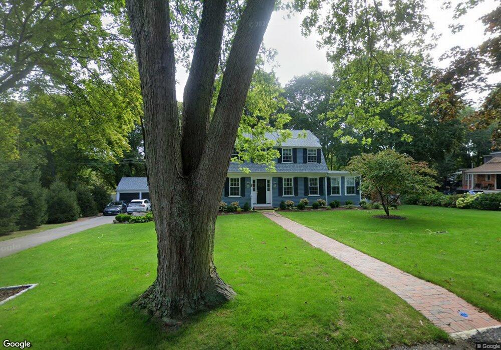
50 Dreamwold Rd Scituate, MA 02066
Estimated Value: $1,003,440 - $1,512,000
3
Beds
3
Baths
2,688
Sq Ft
$444/Sq Ft
Est. Value
About This Home
This home is located at 50 Dreamwold Rd, Scituate, MA 02066 and is currently estimated at $1,193,610, approximately $444 per square foot. 50 Dreamwold Rd is a home located in Plymouth County with nearby schools including Cushing Elementary School, Lester J. Gates Middle School, and Scituate High School.
Ownership History
Date
Name
Owned For
Owner Type
Purchase Details
Closed on
Jun 25, 2012
Sold by
Tibbetts Richard S and Tibbetts Edith C
Bought by
Tibbetts Ft
Current Estimated Value
Purchase Details
Closed on
Nov 1, 1983
Bought by
Tibbetts Richard S and Tibbetts Edith C
Create a Home Valuation Report for This Property
The Home Valuation Report is an in-depth analysis detailing your home's value as well as a comparison with similar homes in the area
Home Values in the Area
Average Home Value in this Area
Purchase History
| Date | Buyer | Sale Price | Title Company |
|---|---|---|---|
| Tibbetts Ft | -- | -- | |
| Tibbetts Richard S | $89,000 | -- |
Source: Public Records
Mortgage History
| Date | Status | Borrower | Loan Amount |
|---|---|---|---|
| Previous Owner | Tibbetts Richard S | $165,000 | |
| Previous Owner | Tibbetts Richard S | $200,000 | |
| Previous Owner | Tibbetts Richard S | $150,000 |
Source: Public Records
Tax History Compared to Growth
Tax History
| Year | Tax Paid | Tax Assessment Tax Assessment Total Assessment is a certain percentage of the fair market value that is determined by local assessors to be the total taxable value of land and additions on the property. | Land | Improvement |
|---|---|---|---|---|
| 2025 | $7,286 | $729,300 | $371,800 | $357,500 |
| 2024 | $7,305 | $705,100 | $338,000 | $367,100 |
| 2023 | $7,467 | $666,000 | $324,400 | $341,600 |
| 2022 | $7,467 | $591,700 | $292,400 | $299,300 |
| 2021 | $7,257 | $544,400 | $278,500 | $265,900 |
| 2020 | $7,173 | $531,300 | $267,800 | $263,500 |
| 2019 | $7,157 | $520,900 | $262,500 | $258,400 |
| 2018 | $7,257 | $520,200 | $274,000 | $246,200 |
| 2017 | $7,176 | $509,300 | $263,100 | $246,200 |
| 2016 | $6,763 | $478,300 | $241,100 | $237,200 |
| 2015 | $6,123 | $467,400 | $230,200 | $237,200 |
Source: Public Records
Map
Nearby Homes
- 46 Dreamwold Rd
- 20 Dreamwold Rd
- 4 Orchard Rd
- 58 Dreamwold Rd
- 51 Dreamwold Rd
- 40 Dreamwold Rd
- 32 Dreamwold Rd
- 8 Orchard Rd
- 62 Dreamwold Rd
- 35 Curtis St
- 23 Dreamwold Rd
- Lot C Dreamwold Rd
- 5 Orchard Rd
- 25 Dreamwold Rd
- 59 Dreamwold Rd
- 33 Dreamwold Rd
- 11 Orchard Rd
- 14 Orchard Rd
- 29 Dreamwold Rd
- 31 Curtis St