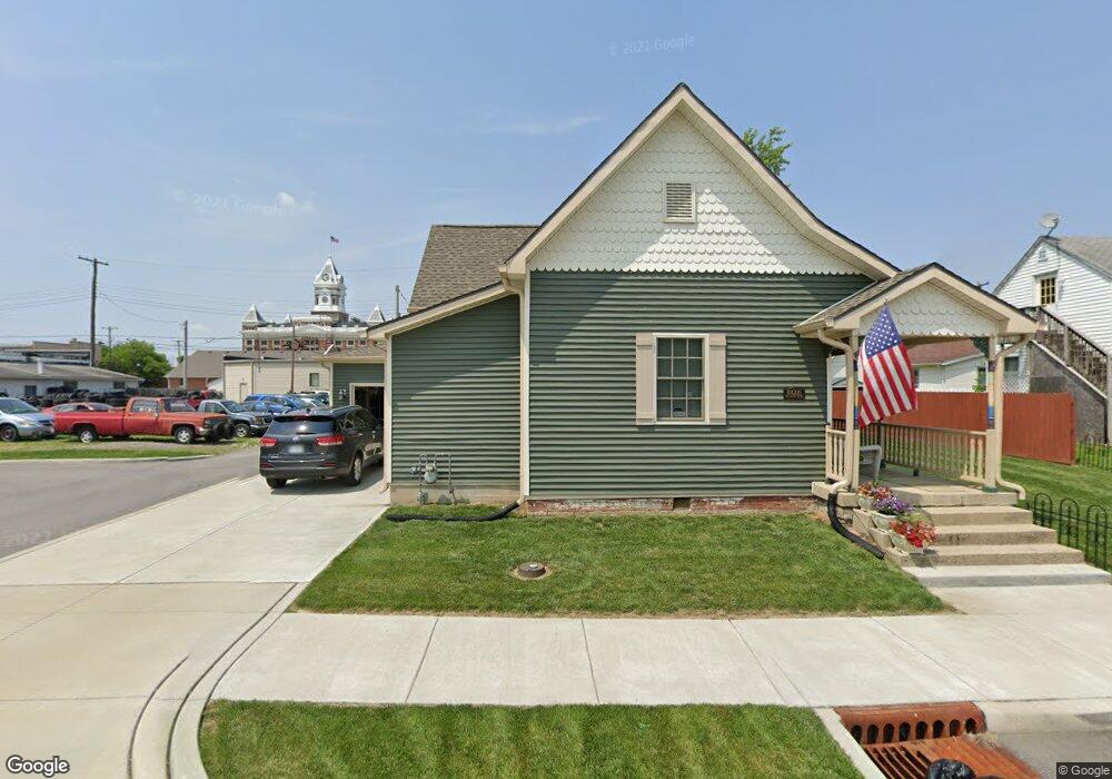
50 E Wayne St Franklin, IN 46131
Estimated Value: $96,953 - $341,000
2
Beds
2
Baths
1,928
Sq Ft
$114/Sq Ft
Est. Value
About This Home
This home is located at 50 E Wayne St, Franklin, IN 46131 and is currently estimated at $218,977, approximately $113 per square foot. 50 E Wayne St is a home located in Johnson County with nearby schools including Northwood Elementary School, Franklin Community Middle School, and Custer Baker Intermediate School.
Create a Home Valuation Report for This Property
The Home Valuation Report is an in-depth analysis detailing your home's value as well as a comparison with similar homes in the area
Home Values in the Area
Average Home Value in this Area
Tax History
| Year | Tax Paid | Tax Assessment Tax Assessment Total Assessment is a certain percentage of the fair market value that is determined by local assessors to be the total taxable value of land and additions on the property. | Land | Improvement |
|---|---|---|---|---|
| 2024 | $1,244 | $45,000 | $45,000 | $0 |
| 2023 | $1,304 | $45,000 | $45,000 | $0 |
| 2022 | $1,378 | $45,000 | $45,000 | $0 |
| 2021 | $4,170 | $187,000 | $17,000 | $170,000 |
| 2020 | $565 | $135,200 | $17,000 | $118,200 |
| 2019 | $764 | $142,600 | $10,900 | $131,700 |
| 2018 | $382 | $128,900 | $10,900 | $118,000 |
| 2017 | $304 | $121,600 | $10,900 | $110,700 |
| 2016 | -- | $121,100 | $10,900 | $110,200 |
| 2014 | $1,126 | $56,300 | $16,200 | $40,100 |
| 2013 | $1,126 | $54,900 | $16,100 | $38,800 |
Source: Public Records
Map
Nearby Homes
- 178 S Water St Unit F
- 76 E Wayne St Unit B
- 227 E Jefferson St
- 0 W 900 Hwy Unit 202537998
- 159 E King St
- 198 W King St
- 151 Julia St
- 598 Johnson Ave
- 601 Duane St
- 698 Yandes St
- 750 Hurricane St
- 801 Hurricane St
- 1102 E Jefferson St
- 631 N Shore Blvd
- 1110 Hillview Dr
- 41 Middleton Dr
- 6516 N U S Highway 31
- 17 Morning Dr
- 1240 Hillview Dr
- 925 Mallory Pkwy
- 98 E Wayne St Unit D
- 64 E Wayne St Unit A
- 198 S Water St
- 150 S Water St
- 150 S Water St Unit H
- 184 S Water St Unit E
- 162 S Water St Unit G
- 55 E Wayne St
- 49 E Wayne St
- 45 E Wayne St
- 97 E Monroe St
- 151 S Water St
- 165 S Water St
- 99 E Monroe St
- 107 S Water St
- 198 S Main St
- 148 E Wayne St
- 150 S Main St Unit 404
Your Personal Tour Guide
Ask me questions while you tour the home.