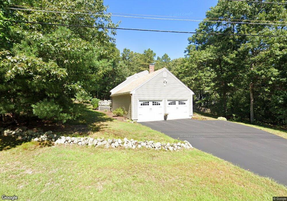
50 Hawes St Wrentham, MA 02093
Estimated Value: $645,000 - $691,000
3
Beds
2
Baths
1,574
Sq Ft
$426/Sq Ft
Est. Value
About This Home
This home is located at 50 Hawes St, Wrentham, MA 02093 and is currently estimated at $670,061, approximately $425 per square foot. 50 Hawes St is a home located in Norfolk County with nearby schools including Delaney Elementary School, Charles E Roderick, and Foxborough Regional Charter School.
Ownership History
Date
Name
Owned For
Owner Type
Purchase Details
Closed on
Apr 23, 2018
Sold by
Hession Frances M and Hession Thomas P
Bought by
Hawes Street Rt
Current Estimated Value
Purchase Details
Closed on
Jul 23, 1980
Bought by
Hession Thomas P and Hession Frances M
Create a Home Valuation Report for This Property
The Home Valuation Report is an in-depth analysis detailing your home's value as well as a comparison with similar homes in the area
Home Values in the Area
Average Home Value in this Area
Purchase History
| Date | Buyer | Sale Price | Title Company |
|---|---|---|---|
| Hawes Street Rt | -- | -- | |
| Hession Thomas P | $72,500 | -- |
Source: Public Records
Mortgage History
| Date | Status | Borrower | Loan Amount |
|---|---|---|---|
| Previous Owner | Hession Thomas P | $192,000 | |
| Previous Owner | Hession Thomas P | $184,600 |
Source: Public Records
Tax History Compared to Growth
Tax History
| Year | Tax Paid | Tax Assessment Tax Assessment Total Assessment is a certain percentage of the fair market value that is determined by local assessors to be the total taxable value of land and additions on the property. | Land | Improvement |
|---|---|---|---|---|
| 2025 | $6,507 | $561,400 | $262,900 | $298,500 |
| 2024 | $6,290 | $524,200 | $262,900 | $261,300 |
| 2023 | $6,079 | $481,700 | $238,900 | $242,800 |
| 2022 | $6,016 | $440,100 | $232,300 | $207,800 |
| 2021 | $5,838 | $414,900 | $217,100 | $197,800 |
| 2020 | $5,466 | $383,600 | $165,700 | $217,900 |
| 2019 | $5,264 | $372,800 | $165,700 | $207,100 |
| 2018 | $5,173 | $363,300 | $166,000 | $197,300 |
| 2017 | $5,092 | $357,300 | $162,700 | $194,600 |
| 2016 | $4,979 | $348,700 | $158,000 | $190,700 |
| 2015 | $4,883 | $326,000 | $151,900 | $174,100 |
| 2014 | $4,838 | $316,000 | $146,100 | $169,900 |
Source: Public Records
Map
Nearby Homes
- 120 Hawes St
- 483 Thurston St
- 155 Clark Rd Unit 155
- 65 Pond St
- 362 East St
- 319 Taunton St
- 1 Lorraine Metcalf Dr
- 10 Nature View Dr
- 15 Nature View Dr
- 270 Dedham St
- 80 Mill St
- 131 Washington St Unit 42
- 11 Goodwin Dr
- 25 Foxboro Rd
- 11 Earle Stewart Ln
- 9 Oak Dr
- Lot 1 - Blueberry 2 Car Plan at King Philip Estates
- Lot 8 - Blueberry 2 Car Plan at King Philip Estates
- Lot 5 - Hughes 2 car Plan at King Philip Estates
- Lot 6 - Blueberry 3 Car Plan at King Philip Estates