
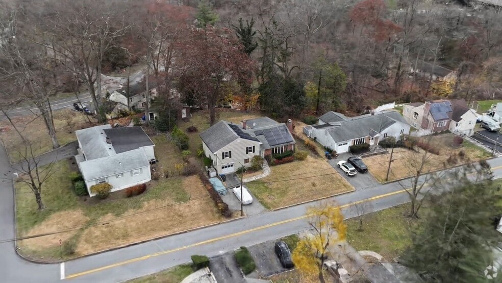


50 Kent Rd White Plains, NY 10603
Estimated payment $4,665/month
Total Views
32,469
3
Beds
2
Baths
1,581
Sq Ft
$398
Price per Sq Ft
Highlights
- Hot Property
- Stainless Steel Appliances
- Baseboard Heating
- Formal Dining Room
- Recessed Lighting
- High Speed Internet
About This Home
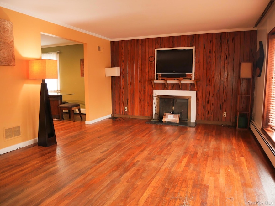
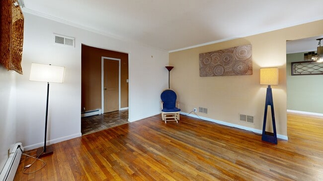
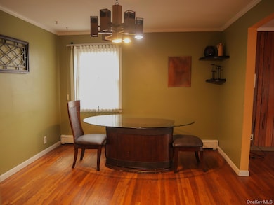
Charming 3BR/2BA with sunroom, dining room, living room, and den. Kitchen includes stainless appliances and dishwasher. Recessed lighting throughout the primary floor. 3 spacious Bedrooms that can easily accommodate king sized furniture. Well appointed back yard deck off of the sunroom leads out to a beautiful back yard. Single-car garage with driveway that can accommodate 2 additional vehicles. Great location and ready for immediate occupancy. Greenburgh is the school district for this property.
Listing Agent
Evergreen Associated Partners License #10491211077 Listed on: 12/01/2025
Home Details
Home Type
- Single Family
Est. Annual Taxes
- $16,316
Year Built
- Built in 1953
Lot Details
- 0.27 Acre Lot
Parking
- 1 Car Garage
- Driveway
Home Design
- Split Level Home
- Aluminum Siding
Interior Spaces
- 1,581 Sq Ft Home
- Recessed Lighting
- Wood Burning Fireplace
- Formal Dining Room
Kitchen
- Gas Range
- Dishwasher
- Stainless Steel Appliances
Bedrooms and Bathrooms
- 3 Bedrooms
- 2 Full Bathrooms
Laundry
- Dryer
- Washer
Schools
- Lee F Jackson Elementary School
- Woodlands Middle/High School
Utilities
- Cooling System Mounted To A Wall/Window
- Baseboard Heating
- Natural Gas Connected
- High Speed Internet
- Cable TV Available
Listing and Financial Details
- Assessor Parcel Number 2689-007-430-00250-000-0013
3D Interior and Exterior Tours
Floorplans
Map
Create a Home Valuation Report for This Property
The Home Valuation Report is an in-depth analysis detailing your home's value as well as a comparison with similar homes in the area
Home Values in the Area
Average Home Value in this Area
Tax History
| Year | Tax Paid | Tax Assessment Tax Assessment Total Assessment is a certain percentage of the fair market value that is determined by local assessors to be the total taxable value of land and additions on the property. | Land | Improvement |
|---|---|---|---|---|
| 2024 | $15,039 | $578,600 | $154,900 | $423,700 |
| 2023 | $13,368 | $536,200 | $135,900 | $400,300 |
| 2022 | $12,690 | $507,400 | $135,900 | $371,500 |
| 2021 | $11,880 | $469,100 | $135,900 | $333,200 |
| 2020 | $11,910 | $425,900 | $135,900 | $290,000 |
| 2019 | $12,808 | $425,900 | $135,900 | $290,000 |
| 2018 | $11,117 | $411,000 | $135,900 | $275,100 |
| 2017 | $4,806 | $398,800 | $135,900 | $262,900 |
| 2016 | $201,773 | $383,500 | $135,900 | $247,600 |
| 2015 | -- | $11,750 | $2,450 | $9,300 |
| 2014 | -- | $13,000 | $2,450 | $10,550 |
| 2013 | $6,986 | $13,000 | $2,450 | $10,550 |
Source: Public Records
Property History
| Date | Event | Price | List to Sale | Price per Sq Ft |
|---|---|---|---|---|
| 12/01/2025 12/01/25 | For Sale | $630,000 | -- | $398 / Sq Ft |
Source: OneKey® MLS
Purchase History
| Date | Type | Sale Price | Title Company |
|---|---|---|---|
| Bargain Sale Deed | $425,000 | Stewart Title Insurance Co | |
| Interfamily Deed Transfer | -- | -- |
Source: Public Records
Mortgage History
| Date | Status | Loan Amount | Loan Type |
|---|---|---|---|
| Open | $401,912 | FHA |
Source: Public Records
About the Listing Agent
With over 15 years of experience in real estate and millions in transactions, Kristina has a passion for helping clients navigate the exciting world of real estate. She believes in going the extra mile to provide personalized, friendly service, always putting clients' needs first. By combining years of experience with the support of a strong network, Kristina offers expert guidance every step of the way.
Active in the community and dedicated to treating everyone with fairness and
Kristina's Other Listings
Source: OneKey® MLS
MLS Number: 937116
APN: 2689-007-430-00250-000-0013
Disclaimer: Certain information contained herein is derived from information provided by parties other than Homes.com. All information provided is deemed reliable, but is not guaranteed to be accurate and should be independently verified.
![]() The data relating to real estate for sale or lease on this web site comes in part from OneKey® MLS. Real estate listings held by brokerage firms other than Ten-X are marked with the OneKey® MLS logo or an abbreviated logo and detailed information about them includes the name of the listing broker.
The data relating to real estate for sale or lease on this web site comes in part from OneKey® MLS. Real estate listings held by brokerage firms other than Ten-X are marked with the OneKey® MLS logo or an abbreviated logo and detailed information about them includes the name of the listing broker.
IDX information is provided exclusively for personal, non-commercial use, and may not be used for any purpose other than to identify prospective properties consumers may be interested in purchasing.
Information is deemed reliable but not guaranteed.
Copyright 2025 OneKey® MLS. All rights reserved.
Nearby Homes
- 135 Old Tarrytown Rd
- 614 Woodland Hills Rd
- 325 County Center Rd
- 38 Manitou Trail
- 30 Randolph Rd
- 379 Church St
- 155 Ferris Ave Unit 12L
- 155 Ferris Ave Unit 1E
- 155 Ferris Ave Unit 11B
- 155 Ferris Ave Unit 7F
- 147 N Broadway Unit 2
- 17 Manitou Trail
- 499 N Broadway Unit 3E
- 499 N Broadway Unit 1J
- 60 Lincoln Place
- 121 N Broadway Unit 21E
- 121 N Broadway Unit 12A
- 121 N Broadway Unit 11-E
- 377 County Center Rd
- 302 Church St Unit 1H
- 203 Park Ridge Ln
- 4 Wyndover Woods Ln Unit 12
- 152 N Broadway Unit 2G
- 25 County Center Rd
- 95 N Broadway
- 199 S Rd Unit ID1299991P
- 85 N Broadway Unit 3I
- 162 North Rd
- 87 N Broadway Unit 2L
- 108 Park Ave Unit 2
- 83 N Broadway Unit 3E
- 21 Hillside Terrace Unit C
- 25 Rockledge Ave Unit 606
- 25 Rockledge Ave Unit 410
- 25 Rockledge Ave Unit 301 West
- 55 N Broadway Unit Bldg 3 Apt. 9
- 55 N Broadway Unit 221
- 2 Granada Crescent Unit 8
- 55 N Broadway Unit 1-25
- 55 N Broadway Unit 3-7