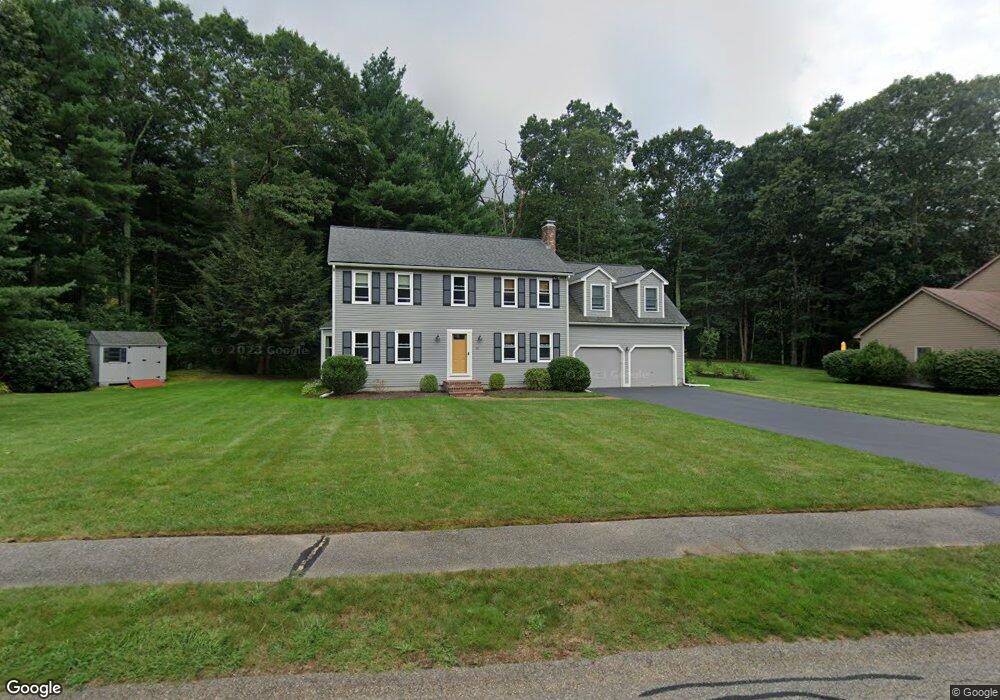
50 Kevin Joes Way Wrentham, MA 02093
Estimated Value: $776,537 - $938,000
4
Beds
4
Baths
2,318
Sq Ft
$368/Sq Ft
Est. Value
About This Home
This home is located at 50 Kevin Joes Way, Wrentham, MA 02093 and is currently estimated at $851,884, approximately $367 per square foot. 50 Kevin Joes Way is a home located in Norfolk County with nearby schools including Delaney Elementary School and Charles E Roderick.
Ownership History
Date
Name
Owned For
Owner Type
Purchase Details
Closed on
Sep 1, 1992
Sold by
Solid Built Corp
Bought by
Luce Michael T
Current Estimated Value
Home Financials for this Owner
Home Financials are based on the most recent Mortgage that was taken out on this home.
Original Mortgage
$145,000
Interest Rate
8.09%
Mortgage Type
Purchase Money Mortgage
Create a Home Valuation Report for This Property
The Home Valuation Report is an in-depth analysis detailing your home's value as well as a comparison with similar homes in the area
Home Values in the Area
Average Home Value in this Area
Purchase History
| Date | Buyer | Sale Price | Title Company |
|---|---|---|---|
| Luce Michael T | $202,300 | -- |
Source: Public Records
Mortgage History
| Date | Status | Borrower | Loan Amount |
|---|---|---|---|
| Open | Luce Michael T | $100,000 | |
| Closed | Luce Michael T | $25,000 | |
| Closed | Luce Michael T | $145,000 |
Source: Public Records
Tax History Compared to Growth
Tax History
| Year | Tax Paid | Tax Assessment Tax Assessment Total Assessment is a certain percentage of the fair market value that is determined by local assessors to be the total taxable value of land and additions on the property. | Land | Improvement |
|---|---|---|---|---|
| 2025 | $7,848 | $677,100 | $289,500 | $387,600 |
| 2024 | $7,518 | $626,500 | $289,500 | $337,000 |
| 2023 | $7,390 | $585,600 | $263,200 | $322,400 |
| 2022 | $7,076 | $517,600 | $245,600 | $272,000 |
| 2021 | $6,540 | $464,800 | $214,400 | $250,400 |
| 2020 | $6,539 | $458,900 | $190,700 | $268,200 |
| 2019 | $6,307 | $446,700 | $190,700 | $256,000 |
| 2018 | $6,186 | $434,400 | $190,800 | $243,600 |
| 2017 | $6,045 | $424,200 | $187,100 | $237,100 |
| 2016 | $5,916 | $414,300 | $181,700 | $232,600 |
| 2015 | $5,799 | $387,100 | $174,700 | $212,400 |
| 2014 | $5,741 | $375,000 | $168,000 | $207,000 |
Source: Public Records
Map
Nearby Homes
- 270 Dedham St
- 1 Lorraine Metcalf Dr
- 10 Nature View Dr
- 15 Nature View Dr
- 362 East St
- 131 Creek St Unit 7
- 319 Taunton St
- 246 Forest Grove Ave
- 570 Franklin St
- 11 Earle Stewart Ln
- Lot 3 - 14 Earle Stewart Ln
- Lot 1 - Blueberry 2 Car Plan at King Philip Estates
- Lot 8 - Blueberry 2 Car Plan at King Philip Estates
- Lot 5 - Hughes 2 car Plan at King Philip Estates
- Lot 6 - Blueberry 3 Car Plan at King Philip Estates
- Lot 2 - Camden 2 Car Plan at King Philip Estates
- Lot 7 - Cedar Plan at King Philip Estates
- Lot 4 - Hemingway 2 Car Plan at King Philip Estates
- Lot 3 - Blueberry 2 Car Plan at King Philip Estates
- 3 Oak Rd
- 40 Kevin Joes Way
- 60 Kevin Joes Way
- 30 Kevin Joes Way
- 45 Kevin Joes Way
- 151 Dedham St
- 55 Kevin Joes Way
- 20 Kevin Joes Way
- 140 Dedham St
- 150 Dedham St
- 10 Kevin Joes Way
- 35 Kevin Joes Way
- 205 Dedham St
- 130 Dedham St
- 72 Circle Dr
- 25 Kevin Joes Way
- 213 Dedham St
- 160 Dedham St
- 158 Dedham St
- 158 Dedham St Unit 158
- 15 Kevin Joes Way