


50 Lazy r Way Roundup, MT 59072
Estimated payment $1,208/month
Highlights
- 40.2 Acre Lot
- Wooded Lot
- Southern Exposure
- Secluded Lot
- Views
- Lot Has A Rolling Slope
About This Lot
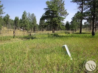
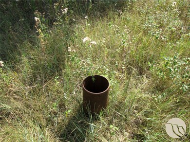
Is Montana calling you to a secluded get-away? These 40 acres could be the place! This property is very private, with lots of Ponderosa Pines and some beautiful meadows. There is an old well on it that may be usable! Phone and Fiber optic lines along Lazy R! Would this work for your off-grid cabin or home far from the city lights? Located in the Bull Mountains 40 miles north of Billings and 10 miles south of Roundup, it is only about 5.5 miles off highway 87N, with approx. 2.5 miles of dirt/gravel road from the pavement. The road is only privately maintained as the neighbors determine, so a 4x4 is recommended when wet. Wildlife here includes Deer, Elk, Black bear, Turkeys, and Coyotes. 50% of the land suffered a burn 5+ years ago (see photos). Power is about a 1/4 of a mile to the south of the southeast corner. The owner would like a contract for deed...terms would be 25% or more down.
Listing Agent
Mountainlands of MT Realty Brokerage Phone: 406-580-3372 License #RRE-BRO-LIC-11777 Listed on: 09/12/2025
Co-Listing Agent
Jerry Allen
Mountainlands of MT Realty Brokerage Phone: 406-580-3372 License #RRE-RBS-LIC-24516
Property Details
Property Type
- Land
Lot Details
- 40.2 Acre Lot
- Dirt Road
- Southern Exposure
- Secluded Lot
- Lot Has A Rolling Slope
- Wooded Lot
- Landscaped with Trees
- 2 Lots in the community
Schools
- Roundup Elementary And Middle School
- Roundup High School
Utilities
- Natural Gas Not Available
- Phone Available
Additional Features
- Property Views
Community Details
- Evergreen Hills Tracts Subdivision
Listing and Financial Details
- Tax Lot EH-1 & 13
- Assessor Parcel Number 9585000000
Map
Home Values in the Area
Average Home Value in this Area
Tax History
| Year | Tax Paid | Tax Assessment Tax Assessment Total Assessment is a certain percentage of the fair market value that is determined by local assessors to be the total taxable value of land and additions on the property. | Land | Improvement |
|---|---|---|---|---|
| 2025 | $5 | $1,291 | $0 | $0 |
| 2024 | $5 | $1,045 | $0 | $0 |
| 2023 | $5 | $1,045 | $0 | $0 |
| 2022 | $5 | $1,045 | $0 | $0 |
| 2021 | $2 | $1,045 | $0 | $0 |
| 2020 | $5 | $2,226 | $0 | $0 |
| 2019 | $5 | $2,226 | $0 | $0 |
| 2018 | $5 | $2,226 | $0 | $0 |
| 2017 | $5 | $2,226 | $0 | $0 |
| 2016 | $5 | $2,226 | $0 | $0 |
| 2015 | $4 | $2,226 | $0 | $0 |
| 2014 | $5 | $3,555 | $0 | $0 |
Property History
| Date | Event | Price | List to Sale | Price per Sq Ft |
|---|---|---|---|---|
| 10/28/2025 10/28/25 | Price Changed | $229,900 | -4.2% | -- |
| 09/12/2025 09/12/25 | For Sale | $239,900 | -- | -- |
Purchase History
| Date | Type | Sale Price | Title Company |
|---|---|---|---|
| Deed | -- | -- |
Source: Billings Multiple Listing Service
MLS Number: 355502
APN: 23161713101060000
Disclaimer: Certain information contained herein is derived from information provided by parties other than Homes.com. All information provided is deemed reliable, but is not guaranteed to be accurate and should be independently verified.
![]() IDX information is provided exclusively for personal, non-commercial use, and may not be used for any purpose other than to identify prospective properties consumers may be interested in purchasing. Information is deemed reliable but not guaranteed.
IDX information is provided exclusively for personal, non-commercial use, and may not be used for any purpose other than to identify prospective properties consumers may be interested in purchasing. Information is deemed reliable but not guaranteed.
- 50 Lazy r Way Unit EH-1&13
- 21 Smith Trail
- Deer Lane Lot: Eh-13
- Nhn Deer Lane Unit: Eh-13
- TBD Smith Ct
- 000 Smith Rd
- 101 Smith Rd
- 448 W Parrot Creek Rd
- TBD W Parrot Creek Road Parcel 20
- 245 Johnny's Coal Rd
- 50 Pleasant Grove Rd
- 47 Ambush Rd
- 119 Log Cabin Rd
- 32 Spring Hollow
- 170 Canyon Rd
- 470 Road 4
- 31 Three Forks Way
- 81 N Canyon Dr
- 32 Montana St
- 86 Remington Trail
