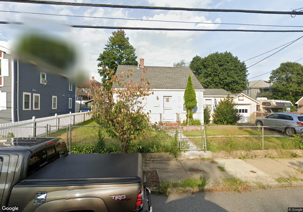
50 Lewiston St Hyde Park, MA 02136
Hyde Park NeighborhoodEstimated Value: $568,000 - $628,000
2
Beds
1
Bath
946
Sq Ft
$624/Sq Ft
Est. Value
About This Home
This home is located at 50 Lewiston St, Hyde Park, MA 02136 and is currently estimated at $590,405, approximately $624 per square foot. 50 Lewiston St is a home located in Suffolk County with nearby schools including Boston Preparatory Charter Public School and New Beginnings Academy.
Ownership History
Date
Name
Owned For
Owner Type
Purchase Details
Closed on
Nov 24, 2004
Sold by
Marrero-Luna Wilma I and Luna Dante M
Bought by
Marrero-Luna Wilma I
Current Estimated Value
Purchase Details
Closed on
Dec 11, 2000
Sold by
Dull Nellie
Bought by
Burk Robert
Home Financials for this Owner
Home Financials are based on the most recent Mortgage that was taken out on this home.
Original Mortgage
$80,000
Interest Rate
7.64%
Mortgage Type
Purchase Money Mortgage
Create a Home Valuation Report for This Property
The Home Valuation Report is an in-depth analysis detailing your home's value as well as a comparison with similar homes in the area
Home Values in the Area
Average Home Value in this Area
Purchase History
| Date | Buyer | Sale Price | Title Company |
|---|---|---|---|
| Marrero-Luna Wilma I | -- | -- | |
| Burk Robert | $147,000 | -- |
Source: Public Records
Mortgage History
| Date | Status | Borrower | Loan Amount |
|---|---|---|---|
| Previous Owner | Burk Robert | $80,000 |
Source: Public Records
Tax History Compared to Growth
Tax History
| Year | Tax Paid | Tax Assessment Tax Assessment Total Assessment is a certain percentage of the fair market value that is determined by local assessors to be the total taxable value of land and additions on the property. | Land | Improvement |
|---|---|---|---|---|
| 2025 | $5,441 | $469,900 | $184,100 | $285,800 |
| 2024 | $4,961 | $455,100 | $185,800 | $269,300 |
| 2023 | $4,567 | $425,200 | $173,600 | $251,600 |
| 2022 | $4,285 | $393,800 | $160,800 | $233,000 |
| 2021 | $3,774 | $353,700 | $148,900 | $204,800 |
| 2020 | $3,493 | $330,800 | $144,400 | $186,400 |
| 2019 | $3,319 | $314,900 | $116,600 | $198,300 |
| 2018 | $3,143 | $299,900 | $116,600 | $183,300 |
| 2017 | $2,887 | $272,600 | $116,600 | $156,000 |
| 2016 | $2,940 | $267,300 | $116,600 | $150,700 |
| 2015 | $2,737 | $226,000 | $98,400 | $127,600 |
| 2014 | $2,654 | $211,000 | $98,400 | $112,600 |
Source: Public Records
Map
Nearby Homes
- 0 Tina Ave
- 7 Winborough St
- 27 Lexington Ave
- 656-658 E Metropolitan Ave
- 265 Hebron St
- 34 Ridlon Rd
- 514 Metropolitan Ave Unit 514A
- 25 Alpine St Unit 7
- 492 Metropolitan Ave
- 42 Osceola St
- 23 Caton St
- 20 Massasoit St
- 107 West St
- 895 Hyde Park Ave Unit 2
- 179 Hebron St
- 839-843 Cummins Hwy
- 90 Hollingsworth St
- 645 River St
- 175 Clare Ave Unit B3
- 74 Davison St
- 46 Lewiston St
- 58 Lewiston St
- 42 Lewiston St
- 235 Wood Ave Unit 237
- 239 Wood Ave Unit 241
- 231 Wood Ave Unit 233
- 231 Wood Ave Unit 1
- 227 Wood Ave Unit 229
- 51 Lewiston St
- 55 Lewiston St
- 243 Wood Ave Unit 245
- 245 Wood Ave Unit 1
- 47 Lewiston St
- 66 Lewiston St
- 59 Lewiston St
- 185 Westminster St
- 247 Wood Ave Unit 249
- 247-249 Wood Ave
- 63 Lewiston St
- 219 Wood Ave Unit 221