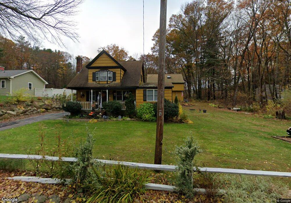
50 Maple Ave South Grafton, MA 01560
Estimated Value: $444,000 - $496,212
3
Beds
3
Baths
1,140
Sq Ft
$411/Sq Ft
Est. Value
About This Home
This home is located at 50 Maple Ave, South Grafton, MA 01560 and is currently estimated at $468,803, approximately $411 per square foot. 50 Maple Ave is a home located in Worcester County with nearby schools including Grafton High School, Silver Spruce Montessori School, and Touchstone Community School.
Ownership History
Date
Name
Owned For
Owner Type
Purchase Details
Closed on
Aug 20, 2013
Sold by
Herbst Janice M and Herbst William T
Bought by
Maranda Mark R
Current Estimated Value
Home Financials for this Owner
Home Financials are based on the most recent Mortgage that was taken out on this home.
Original Mortgage
$100,000
Outstanding Balance
$74,128
Interest Rate
4.31%
Mortgage Type
New Conventional
Estimated Equity
$394,675
Create a Home Valuation Report for This Property
The Home Valuation Report is an in-depth analysis detailing your home's value as well as a comparison with similar homes in the area
Home Values in the Area
Average Home Value in this Area
Purchase History
| Date | Buyer | Sale Price | Title Company |
|---|---|---|---|
| Maranda Mark R | $87,000 | -- |
Source: Public Records
Mortgage History
| Date | Status | Borrower | Loan Amount |
|---|---|---|---|
| Open | Maranda Mark R | $100,000 | |
| Closed | Maranda Mark R | $100,000 |
Source: Public Records
Tax History Compared to Growth
Tax History
| Year | Tax Paid | Tax Assessment Tax Assessment Total Assessment is a certain percentage of the fair market value that is determined by local assessors to be the total taxable value of land and additions on the property. | Land | Improvement |
|---|---|---|---|---|
| 2025 | $5,708 | $409,500 | $202,800 | $206,700 |
| 2024 | $5,595 | $391,000 | $193,200 | $197,800 |
| 2023 | $5,549 | $353,200 | $193,200 | $160,000 |
| 2022 | $5,478 | $324,500 | $165,600 | $158,900 |
| 2021 | $5,257 | $306,000 | $150,400 | $155,600 |
| 2020 | $5,049 | $306,000 | $150,400 | $155,600 |
| 2019 | $4,660 | $279,700 | $136,000 | $143,700 |
| 2018 | $4,486 | $270,400 | $135,300 | $135,100 |
| 2017 | $4,400 | $268,300 | $127,500 | $140,800 |
| 2016 | $3,896 | $232,600 | $105,200 | $127,400 |
| 2015 | $3,840 | $232,700 | $104,000 | $128,700 |
| 2014 | $3,862 | $253,100 | $121,800 | $131,300 |
Source: Public Records
Map
Nearby Homes
- 25 Poplar St
- 150 Sprague St
- 331 Providence Rd
- 191 Hartness Rd
- 102 Kennedy Cir
- 4 Greenlawn Ave
- 52 Fisherville Terrace
- 24 Summerfield Dr Unit 24
- 2 Lindsey Ln Unit 2
- 395 Providence Rd Unit 4
- 9 Brookside Dr
- 86 Mikes Way Unit 86
- 84 Mikes Way Unit 84
- 29 Chipper Hill Rd
- 19 Milford Rd
- 55 Fisherville Terrace
- 44 Fisherville Terrace
- 51 Fisherville Terrace
- 47 Fisherville Terrace
- 12 Central Turnpike