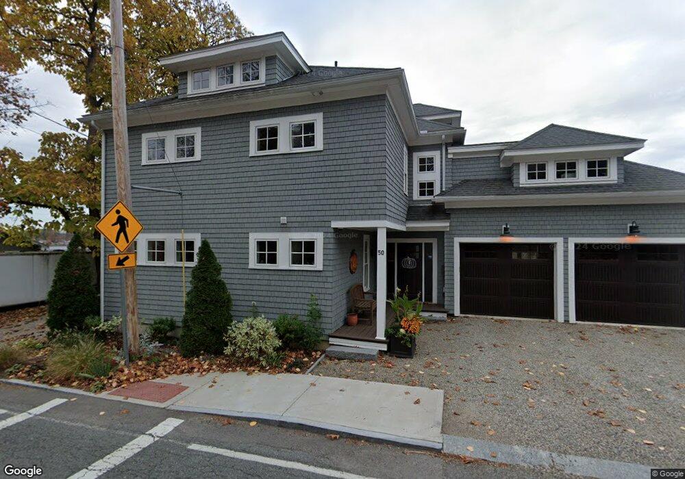
50 Merrimac St Amesbury, MA 01913
Estimated Value: $908,000 - $1,347,000
2
Beds
1
Bath
1,119
Sq Ft
$971/Sq Ft
Est. Value
About This Home
This home is located at 50 Merrimac St, Amesbury, MA 01913 and is currently estimated at $1,086,989, approximately $971 per square foot. 50 Merrimac St is a home located in Essex County with nearby schools including Amesbury High School and Amesbury Seventh-Day Adventist School.
Ownership History
Date
Name
Owned For
Owner Type
Purchase Details
Closed on
Oct 14, 2021
Sold by
Boudrow Lori and Boudrow Richard P
Bought by
Boudrow Ft
Current Estimated Value
Purchase Details
Closed on
Feb 6, 2014
Sold by
Manning Richard J and Ashton-Manning Susan
Bought by
Boudrow Richard P and Boudrow Lori
Home Financials for this Owner
Home Financials are based on the most recent Mortgage that was taken out on this home.
Original Mortgage
$188,000
Interest Rate
4.47%
Mortgage Type
New Conventional
Purchase Details
Closed on
Mar 22, 2004
Sold by
Manning Susan A
Bought by
Manning Susan A
Purchase Details
Closed on
Aug 31, 2001
Sold by
Kelleher Richard C and Kelleher Gloria J
Bought by
Manning Susan A
Create a Home Valuation Report for This Property
The Home Valuation Report is an in-depth analysis detailing your home's value as well as a comparison with similar homes in the area
Home Values in the Area
Average Home Value in this Area
Purchase History
| Date | Buyer | Sale Price | Title Company |
|---|---|---|---|
| Boudrow Ft | -- | None Available | |
| Boudrow Richard P | $235,000 | -- | |
| Manning Susan A | -- | -- | |
| Manning Susan A | $273,900 | -- |
Source: Public Records
Mortgage History
| Date | Status | Borrower | Loan Amount |
|---|---|---|---|
| Previous Owner | Boudrow Richard P | $188,000 | |
| Previous Owner | Manning Susan A | $200,000 | |
| Previous Owner | Manning Susan A | $350,000 |
Source: Public Records
Tax History Compared to Growth
Tax History
| Year | Tax Paid | Tax Assessment Tax Assessment Total Assessment is a certain percentage of the fair market value that is determined by local assessors to be the total taxable value of land and additions on the property. | Land | Improvement |
|---|---|---|---|---|
| 2025 | $18,002 | $1,176,600 | $515,300 | $661,300 |
| 2024 | $15,674 | $1,002,200 | $383,800 | $618,400 |
| 2023 | $14,701 | $899,700 | $348,800 | $550,900 |
| 2022 | $14,217 | $803,700 | $302,300 | $501,400 |
| 2021 | $13,308 | $729,200 | $290,700 | $438,500 |
| 2020 | $12,189 | $709,500 | $290,700 | $418,800 |
| 2019 | $11,939 | $649,900 | $265,900 | $384,000 |
| 2018 | $11,973 | $630,500 | $253,300 | $377,200 |
| 2017 | $10,198 | $511,200 | $253,300 | $257,900 |
| 2016 | $7,676 | $378,500 | $274,400 | $104,100 |
| 2015 | $7,655 | $372,700 | $274,400 | $98,300 |
| 2014 | $7,589 | $361,900 | $274,400 | $87,500 |
Source: Public Records
Map
Nearby Homes
- 35 Merrimac St
- 60 Merrimac St Unit 604
- 47 Cutter Ln Unit 47
- 19 Cutter Ln Unit 19
- 356 Main St
- 13 Bailey Pond Ln Unit 13
- 28 Beacon St
- 3 Laurel Place
- 382 Main St
- 394 Main St
- 47 Macy St
- 45 Macy St Unit b101
- 45 Macy St Unit 301C
- 45 Macy St Unit 302C
- 4 Greenwood St
- 486 Main St
- 49 W Greenwood St
- 21 Clarks Rd Unit 203
- 8 Brown Ave
- 4 Larnard Ct
- 46 Merrimac St
- 52 Merrimac St
- 54 Merrimac St
- 49 Merrimac St
- 44 Merrimac St
- 3 Swetts Hill
- 56 Merrimac St
- 47 Merrimac St
- 1 Swetts Hill
- 5 Swetts Hill
- 43 Merrimac St
- 9 Swetts Hill
- 42 Merrimac St
- 40 Merrimac St
- 40 1/2 Merrimac St Unit 1
- 40 1/2 Merrimac St
- 6 Swetts Hill
- 8 Swetts Hill
- 39 Merrimac St
- 4 Swetts Hill