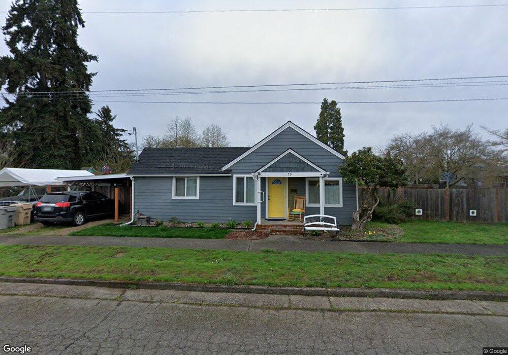
50 N 6th St Lebanon, OR 97355
Estimated Value: $295,883 - $307,000
2
Beds
1
Bath
832
Sq Ft
$362/Sq Ft
Est. Value
About This Home
This home is located at 50 N 6th St, Lebanon, OR 97355 and is currently estimated at $301,442, approximately $362 per square foot. 50 N 6th St is a home located in Linn County with nearby schools including Pioneer School, Lebanon High School, and East Linn Christian Academy.
Ownership History
Date
Name
Owned For
Owner Type
Purchase Details
Closed on
Apr 29, 2021
Sold by
Harms Danny
Bought by
Harms Danny and Miller Katherine
Current Estimated Value
Home Financials for this Owner
Home Financials are based on the most recent Mortgage that was taken out on this home.
Original Mortgage
$85,000
Outstanding Balance
$76,911
Interest Rate
3%
Mortgage Type
New Conventional
Estimated Equity
$224,531
Purchase Details
Closed on
Aug 6, 2019
Sold by
Langsdorf John H and Langsdorf Bonita K
Bought by
Harms Danny
Home Financials for this Owner
Home Financials are based on the most recent Mortgage that was taken out on this home.
Original Mortgage
$81,209
Interest Rate
3.73%
Mortgage Type
New Conventional
Purchase Details
Closed on
Oct 22, 2004
Sold by
Evers Joseph and Evers Lynn Goecks
Bought by
Langsdorf John H and Langsdorf Bonita K
Create a Home Valuation Report for This Property
The Home Valuation Report is an in-depth analysis detailing your home's value as well as a comparison with similar homes in the area
Home Values in the Area
Average Home Value in this Area
Purchase History
| Date | Buyer | Sale Price | Title Company |
|---|---|---|---|
| Harms Danny | -- | Ticor Title Co | |
| Harms Danny | $83,800 | Ticor Title | |
| Langsdorf John H | $75,000 | First American Title |
Source: Public Records
Mortgage History
| Date | Status | Borrower | Loan Amount |
|---|---|---|---|
| Open | Harms Danny | $85,000 | |
| Closed | Harms Danny | $81,209 |
Source: Public Records
Tax History Compared to Growth
Tax History
| Year | Tax Paid | Tax Assessment Tax Assessment Total Assessment is a certain percentage of the fair market value that is determined by local assessors to be the total taxable value of land and additions on the property. | Land | Improvement |
|---|---|---|---|---|
| 2024 | $1,526 | $72,600 | -- | -- |
| 2023 | $1,476 | $70,490 | $0 | $0 |
| 2022 | $1,445 | $68,440 | $0 | $0 |
| 2021 | $1,394 | $66,450 | $0 | $0 |
| 2020 | $1,377 | $64,520 | $0 | $0 |
| 2019 | $1,308 | $62,650 | $0 | $0 |
| 2018 | $1,298 | $60,830 | $0 | $0 |
| 2017 | $1,268 | $59,060 | $0 | $0 |
| 2016 | $1,229 | $57,340 | $0 | $0 |
| 2015 | $1,197 | $55,670 | $0 | $0 |
| 2014 | $1,177 | $54,050 | $0 | $0 |
Source: Public Records
Map
Nearby Homes
- 440 Tangent St
- 515 W Mary St
- 161 W Mary St
- 720 W Rose St
- 35 W Mary St
- 294 S 2nd St
- 178 S Main St
- 180 Eaton St
- 591 W Sherman St
- 59 Eaton St
- 64 W Vine St
- 324 W Sherman St
- 760 S 2nd St
- 54 W Sherman St
- 121 S Williams (125) St
- 330 Wheeler St
- 330 Wheeler Behind - Parcel 3 St
- 20 Hiatt St
- 945 W Oak St
- 850 W Oak St