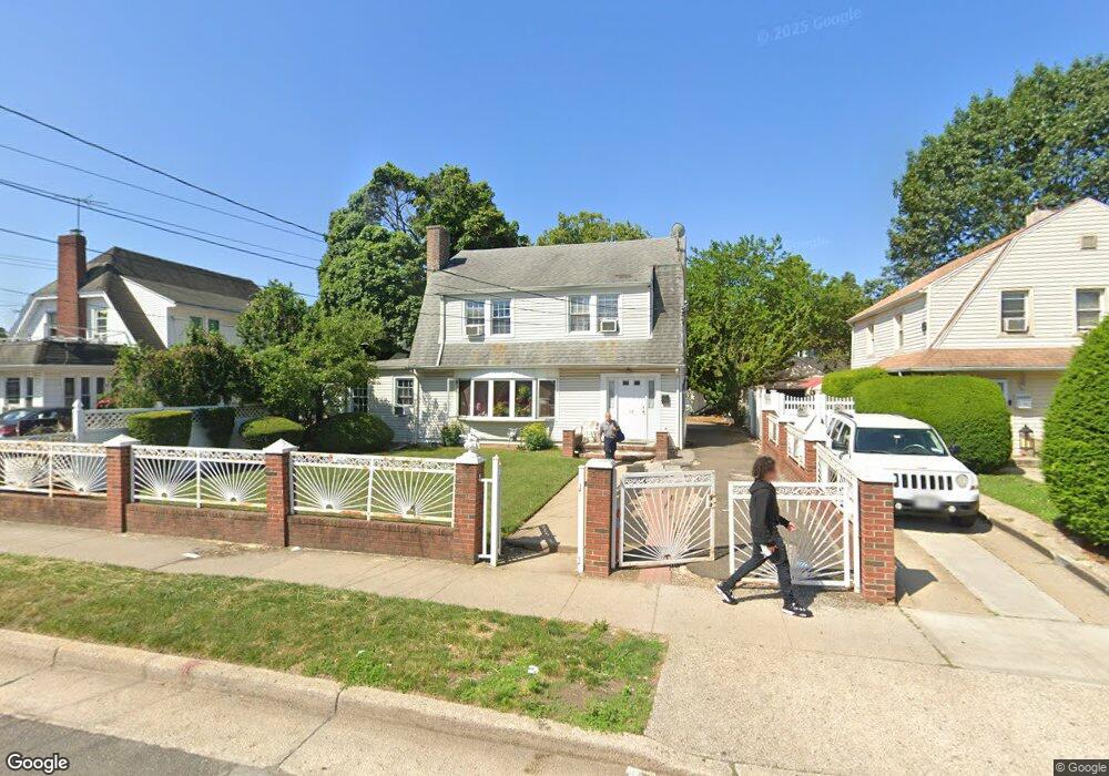
50 Nassau Place Hempstead, NY 11550
Estimated Value: $599,556 - $666,000
4
Beds
3
Baths
1,714
Sq Ft
$369/Sq Ft
Est. Value
About This Home
This home is located at 50 Nassau Place, Hempstead, NY 11550 and is currently estimated at $632,778, approximately $369 per square foot. 50 Nassau Place is a home located in Nassau County with nearby schools including The Academy Charter School and Crescent School.
Ownership History
Date
Name
Owned For
Owner Type
Purchase Details
Closed on
Apr 9, 2007
Sold by
Bank Of New York
Current Estimated Value
Purchase Details
Closed on
Feb 13, 2007
Sold by
Sidrane Steve D
Purchase Details
Closed on
Sep 13, 2005
Sold by
Antoine Natasha
Bought by
Guerrier Clautaire
Purchase Details
Closed on
Nov 23, 2004
Sold by
Pottinger Derek
Purchase Details
Closed on
Jul 18, 2003
Sold by
Antoine Natasha
Bought by
Pottinger Derek
Purchase Details
Closed on
Oct 17, 1997
Sold by
Easa Jack
Bought by
Antoine Natacha and Antoine Pierre
Purchase Details
Closed on
May 2, 1995
Sold by
Easa
Bought by
Easa Patricia
Create a Home Valuation Report for This Property
The Home Valuation Report is an in-depth analysis detailing your home's value as well as a comparison with similar homes in the area
Home Values in the Area
Average Home Value in this Area
Purchase History
| Date | Buyer | Sale Price | Title Company |
|---|---|---|---|
| -- | $222,000 | -- | |
| -- | $379,121 | -- | |
| Guerrier Clautaire | $445,000 | -- | |
| -- | -- | -- | |
| Pottinger Derek | $255,000 | -- | |
| Antoine Natacha | $121,500 | -- | |
| Easa Patricia | -- | -- |
Source: Public Records
Tax History Compared to Growth
Tax History
| Year | Tax Paid | Tax Assessment Tax Assessment Total Assessment is a certain percentage of the fair market value that is determined by local assessors to be the total taxable value of land and additions on the property. | Land | Improvement |
|---|---|---|---|---|
| 2025 | $8,527 | $336 | $107 | $229 |
| 2024 | $868 | $345 | $110 | $235 |
| 2023 | $7,919 | $345 | $110 | $235 |
| 2022 | $7,919 | $345 | $110 | $235 |
| 2021 | $10,935 | $335 | $107 | $228 |
| 2020 | $7,052 | $361 | $327 | $34 |
| 2019 | $6,090 | $346 | $307 | $39 |
| 2018 | $5,610 | $369 | $0 | $0 |
| 2017 | $5,121 | $392 | $239 | $153 |
| 2016 | $5,807 | $469 | $286 | $183 |
| 2015 | $899 | $537 | $286 | $251 |
| 2014 | $899 | $537 | $286 | $251 |
| 2013 | $832 | $537 | $286 | $251 |
Source: Public Records
Map
Nearby Homes
- 43 Peninsula Blvd
- 72 Ingraham Blvd
- 59 Ingraham Blvd
- 93 Vermont Ave
- 27 Hoff Ct
- 66 Warner Ave
- 109 Leverich St
- 23 Elizabeth Ct
- 4 Duryea Place
- 47 Gladys Ave
- 11 Hoff Ct
- 66 Henry St Unit 1
- 361 E Columbia St
- 28 Cornwall Ln
- 676 Front St Unit 2F
- 50 Cameron Ave
- 65 Surrey Ln
- 142 Henry St
- 199 William St
- 53 James L Burrell Ave
- 44 Nassau Place
- 513 Front St
- 495 Front St
- 40 Nassau Place
- 32 Nassau Place
- 32 Nassau Place Unit 1st Fl
- 39 Nassau Place
- 539 Front St Unit 4D
- 539 Front St Unit 4C
- 539 Front St Unit 4B
- 539 Front St Unit 3D
- 539 Front St Unit 3C
- 539 Front St Unit 3A
- 539 Front St Unit 2D
- 539 Front St Unit 2C
- 539 Front St Unit 2B
- 539 Front St Unit 2A
- 539 Front St Unit 1D
- 539 Front St Unit 1B
- 539 Front St Unit 1C