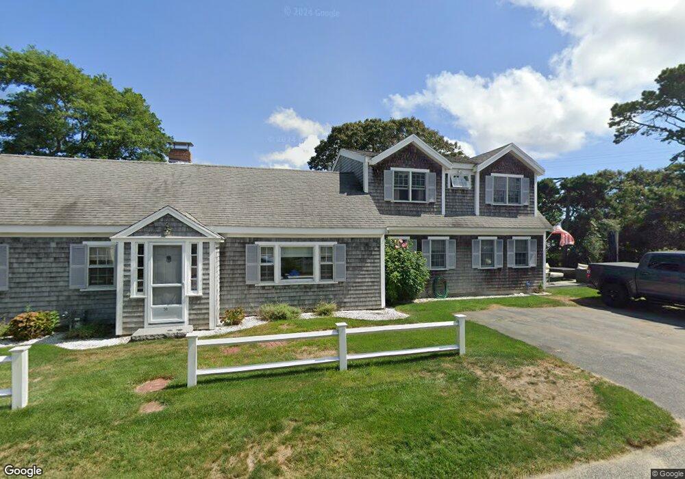
50 Oak St Dennis Port, MA 02639
Dennis Port NeighborhoodEstimated Value: $1,021,000 - $1,356,190
6
Beds
3
Baths
2,226
Sq Ft
$530/Sq Ft
Est. Value
About This Home
This home is located at 50 Oak St, Dennis Port, MA 02639 and is currently estimated at $1,179,798, approximately $530 per square foot. 50 Oak St is a home located in Barnstable County with nearby schools including Dennis-Yarmouth Regional High School and St. Pius X. School.
Ownership History
Date
Name
Owned For
Owner Type
Purchase Details
Closed on
Jan 12, 2010
Sold by
Cullen William P and Cullen Beverly A
Bought by
Cullen Robert P and Cullen Patricia
Current Estimated Value
Purchase Details
Closed on
Jan 2, 2009
Sold by
Cullen Beverly A and Cullen William P
Bought by
Cullen Beverly A and Cullen Denise
Purchase Details
Closed on
Feb 26, 2008
Sold by
Cullen Beverly A and Cullen William P
Bought by
Cullen Beverly A and Cullen Denise
Purchase Details
Closed on
May 9, 2007
Sold by
Cullen Beverly A and Cullen William P
Bought by
Cullen Denise and Cullen Patricia
Purchase Details
Closed on
Nov 27, 2006
Sold by
Cullen Beverly A and Cullen William P
Bought by
Cullen Beverly A and Cullen Denise
Purchase Details
Closed on
Aug 30, 1973
Bought by
Cullen William E
Create a Home Valuation Report for This Property
The Home Valuation Report is an in-depth analysis detailing your home's value as well as a comparison with similar homes in the area
Home Values in the Area
Average Home Value in this Area
Purchase History
| Date | Buyer | Sale Price | Title Company |
|---|---|---|---|
| Cullen Robert P | -- | -- | |
| Cullen William E | -- | -- | |
| Cullen Beverly A | -- | -- | |
| Cullen Beverly A | -- | -- | |
| Cullen Denise | -- | -- | |
| Cullen Beverly A | -- | -- | |
| Cullen William E | -- | -- |
Source: Public Records
Tax History Compared to Growth
Tax History
| Year | Tax Paid | Tax Assessment Tax Assessment Total Assessment is a certain percentage of the fair market value that is determined by local assessors to be the total taxable value of land and additions on the property. | Land | Improvement |
|---|---|---|---|---|
| 2025 | $5,041 | $1,164,200 | $337,200 | $827,000 |
| 2024 | $4,936 | $1,124,400 | $324,300 | $800,100 |
| 2023 | $4,775 | $1,022,400 | $294,800 | $727,600 |
| 2022 | $3,905 | $697,400 | $277,900 | $419,500 |
| 2021 | $3,756 | $628,300 | $272,500 | $355,800 |
| 2020 | $4,634 | $638,100 | $302,700 | $335,400 |
| 2019 | $4,176 | $676,800 | $296,800 | $380,000 |
| 2018 | $3,452 | $544,500 | $237,300 | $307,200 |
| 2017 | $3,349 | $544,500 | $237,300 | $307,200 |
| 2016 | $3,222 | $493,400 | $231,700 | $261,700 |
| 2015 | $3,158 | $493,400 | $231,700 | $261,700 |
| 2014 | $3,097 | $487,700 | $226,000 | $261,700 |
Source: Public Records
Map
Nearby Homes
- 262 Old Wharf Rd Unit 67
- 262 Old Wharf Rd Unit 5
- 262 Old Wharf Rd Unit 5
- 262 Old Wharf Rd Unit 20
- 262 Old Wharf Rd Unit 87
- 37 Beach Hills Rd
- 37-A Beach Hills Rd
- 241 Old Wharf Rd Unit 82
- 241 Old Wharf Rd Unit 127
- 241 Old Wharf Rd Unit 90
- 217 Old Wharf Rd Unit 64
- 22 Ferncliff Rd
- 102 Sea St
- 154 Old Wharf Rd Unit 26
- 154 Old Wharf Rd Unit 14
- 402 Old Wharf Rd
- 402 Old Wharf Rd
- 405 Old Wharf Rd Unit B204
- 405 Old Wharf Rd Unit B204
- 31 Easy St
- 280 Old Wharf Rd
- 44 Oak St
- 59 Oak St
- 284 Old Wharf Rd
- 55 Oak St
- 63 Oak St
- 268 Old Wharf Rd
- 286 Old Wharf Rd
- 286 Old Wharf Rd Unit 1
- 286 Old Wharf Rd Unit A
- 286 Old Wharf Rd Unit 2
- 5 Franklin Rd
- 51 Oak St
- 40 Oak St
- 0 Oak St
- 4 Franklin Rd
- 262 Old Wharf Rd Unit 123
- 262 Old Wharf Rd
- 266 Old Wharf Rd
- 262 Old Wharf Rd Unit U-11