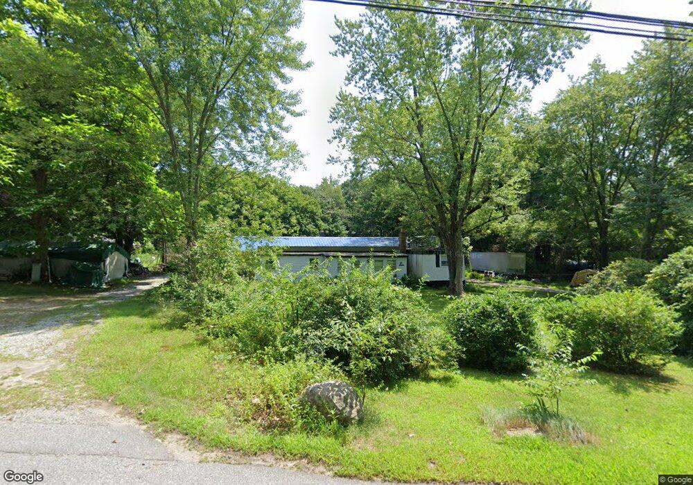
50 Old Cranston Rd Sterling, CT 06377
Estimated Value: $166,586 - $265,000
--
Bed
--
Bath
--
Sq Ft
2
Acres
About This Home
This home is located at 50 Old Cranston Rd, Sterling, CT 06377 and is currently estimated at $226,647. 50 Old Cranston Rd is a home located in Windham County with nearby schools including Sterling Community School.
Ownership History
Date
Name
Owned For
Owner Type
Purchase Details
Closed on
Feb 16, 2016
Sold by
Whitford Phyllis C
Bought by
Rajchel David W and Whitford Phyllis C
Current Estimated Value
Purchase Details
Closed on
May 26, 2004
Sold by
Chiodo Richard Gabriel
Bought by
Whitford Phyllis C
Home Financials for this Owner
Home Financials are based on the most recent Mortgage that was taken out on this home.
Original Mortgage
$55,000
Interest Rate
5.88%
Create a Home Valuation Report for This Property
The Home Valuation Report is an in-depth analysis detailing your home's value as well as a comparison with similar homes in the area
Home Values in the Area
Average Home Value in this Area
Purchase History
| Date | Buyer | Sale Price | Title Company |
|---|---|---|---|
| Rajchel David W | -- | -- | |
| Rajchel David W | -- | -- | |
| Whitford Phyllis C | $75,000 | -- | |
| Whitford Phyllis C | $75,000 | -- |
Source: Public Records
Mortgage History
| Date | Status | Borrower | Loan Amount |
|---|---|---|---|
| Previous Owner | Whitford Phyllis C | $55,000 |
Source: Public Records
Tax History Compared to Growth
Tax History
| Year | Tax Paid | Tax Assessment Tax Assessment Total Assessment is a certain percentage of the fair market value that is determined by local assessors to be the total taxable value of land and additions on the property. | Land | Improvement |
|---|---|---|---|---|
| 2025 | $1,767 | $80,300 | $42,000 | $38,300 |
| 2024 | $1,899 | $80,300 | $42,000 | $38,300 |
| 2023 | $1,784 | $80,300 | $42,000 | $38,300 |
| 2022 | $1,189 | $37,230 | $21,700 | $15,530 |
| 2021 | $1,189 | $37,230 | $21,700 | $15,530 |
| 2020 | $1,189 | $37,230 | $21,700 | $15,530 |
| 2019 | $1,189 | $37,230 | $21,700 | $15,530 |
| 2018 | $1,184 | $37,230 | $21,700 | $15,530 |
| 2017 | $1,302 | $40,940 | $28,000 | $12,940 |
| 2016 | $1,294 | $40,940 | $28,000 | $12,940 |
| 2015 | $1,294 | $40,940 | $28,000 | $12,940 |
| 2014 | $1,290 | $40,940 | $28,000 | $12,940 |
Source: Public Records
Map
Nearby Homes
- 581 Sterling Rd
- 38 Deerfield Dr
- 1 Johns Cir
- 5 John's Cir Unit Lot 35
- 1 John's Cir Unit Lot 37
- 8 John's Cir Unit Lot 33
- 4 Johns Cir Unit Lot 31
- 7 Johns Cir Unit Lot 34
- 197 Church St
- 35 River Rd
- 126 Pine Hill Rd
- 18 Ledge Hill Rd
- 24 River Rd
- 367 Pine Hill Rd
- 58 New Rd
- 532 Lewis Farm Rd
- 0 Rice City Rd
- 10 Ralph St
- 6356 Flat River Rd
- 176 Hopkins Hollow Rd
- 42 Old Cranston Rd
- 58 Old Cranston Rd
- 34 Old Cranston Rd
- 53 Old Cranston Rd
- 61 Old Cranston Rd
- 41 Old Cranston Rd
- 30 Old Cranston Rd
- 73 Old Cranston Rd
- 70 Old Cranston Rd
- 31 Old Cranston Rd
- 77 Old Cranston Rd
- 21 Old Cranston Rd
- 81 Old Cranston Rd
- 78 Old Cranston Rd
- 792 Sterling Rd
- 794 Sterling Rd
- 84 Old Cranston Rd
- 13 Old Cranston Rd
- 87 Old Cranston Rd
- 95 Old Cranston Rd