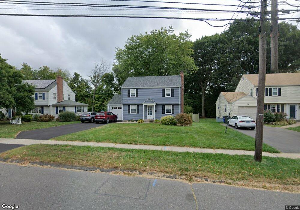
50 Overbrook Rd West Hartford, CT 06107
Estimated Value: $423,726 - $490,000
3
Beds
2
Baths
1,470
Sq Ft
$313/Sq Ft
Est. Value
About This Home
This home is located at 50 Overbrook Rd, West Hartford, CT 06107 and is currently estimated at $460,432, approximately $313 per square foot. 50 Overbrook Rd is a home located in Hartford County with nearby schools including Webster Hill School, Sedgwick Middle School, and Conard High School.
Ownership History
Date
Name
Owned For
Owner Type
Purchase Details
Closed on
Dec 22, 2003
Sold by
Vannie Christine C
Bought by
Grary Timothy J and Grery Erin D
Current Estimated Value
Home Financials for this Owner
Home Financials are based on the most recent Mortgage that was taken out on this home.
Original Mortgage
$223,250
Outstanding Balance
$104,028
Interest Rate
5.96%
Estimated Equity
$356,404
Purchase Details
Closed on
Apr 16, 2001
Sold by
Sigurdson Paul and Hart Priscilla M
Bought by
Vannie Christine C
Home Financials for this Owner
Home Financials are based on the most recent Mortgage that was taken out on this home.
Original Mortgage
$144,000
Interest Rate
6.97%
Purchase Details
Closed on
Mar 27, 2000
Sold by
Marr Catherine A and Marr David
Bought by
Hart Priscilla M and Sigurdson Paul
Create a Home Valuation Report for This Property
The Home Valuation Report is an in-depth analysis detailing your home's value as well as a comparison with similar homes in the area
Home Values in the Area
Average Home Value in this Area
Purchase History
| Date | Buyer | Sale Price | Title Company |
|---|---|---|---|
| Grary Timothy J | $235,000 | -- | |
| Vannie Christine C | $180,000 | -- | |
| Hart Priscilla M | $169,900 | -- |
Source: Public Records
Mortgage History
| Date | Status | Borrower | Loan Amount |
|---|---|---|---|
| Open | Hart Priscilla M | $223,250 | |
| Previous Owner | Hart Priscilla M | $144,000 | |
| Previous Owner | Hart Priscilla M | $160,198 |
Source: Public Records
Tax History Compared to Growth
Tax History
| Year | Tax Paid | Tax Assessment Tax Assessment Total Assessment is a certain percentage of the fair market value that is determined by local assessors to be the total taxable value of land and additions on the property. | Land | Improvement |
|---|---|---|---|---|
| 2025 | $8,313 | $185,640 | $81,760 | $103,880 |
| 2024 | $7,862 | $185,640 | $81,760 | $103,880 |
| 2023 | $7,596 | $185,640 | $81,760 | $103,880 |
| 2022 | $7,147 | $175,700 | $81,760 | $93,940 |
| 2021 | $6,942 | $163,660 | $75,300 | $88,360 |
| 2020 | $6,841 | $163,660 | $70,400 | $93,260 |
| 2019 | $6,841 | $163,660 | $70,420 | $93,240 |
| 2018 | $6,710 | $163,660 | $70,420 | $93,240 |
| 2017 | $6,717 | $163,660 | $70,420 | $93,240 |
| 2016 | $6,303 | $159,530 | $53,760 | $105,770 |
| 2015 | $6,112 | $159,530 | $53,760 | $105,770 |
| 2014 | $5,962 | $159,530 | $53,760 | $105,770 |
Source: Public Records
Map
Nearby Homes
- 61 Woodmere Rd
- 395 Park Rd
- 1640 Boulevard
- 50 Acadia St
- 394 Trout Brook Dr
- 72 Saint Charles St
- 89 Price Blvd
- 85 Memorial Rd Unit 512
- 101 Englewood Ave
- 69 Saint Augustine St
- 25 Ellsworth Rd
- 2 Arapahoe Rd Unit 313
- 2 Arapahoe Rd Unit 308
- 2 Arapahoe Rd Unit 611
- 2 Arapahoe Rd Unit 601
- 2 Arapahoe Rd Unit 510
- 2 Arapahoe Rd Unit 505
- 2 Arapahoe Rd Unit 604
- 2 Arapahoe Rd Unit 609
- 2 Arapahoe Rd Unit 607
- 52 Overbrook Rd
- 46 Overbrook Rd
- 56 Overbrook Rd
- 44 Overbrook Rd
- 58 Overbrook Rd
- 42 Overbrook Rd
- 51 Overbrook Rd
- 47 Overbrook Rd
- 53 Overbrook Rd
- 60 Overbrook Rd
- 55 Overbrook Rd
- 40 Overbrook Rd
- 45 Overbrook Rd
- 59 Overbrook Rd
- 64 Overbrook Rd
- 41 Overbrook Rd
- 36 Overbrook Rd
- 63 Overbrook Rd
- 3 Westbrook Rd
- 66 Overbrook Rd