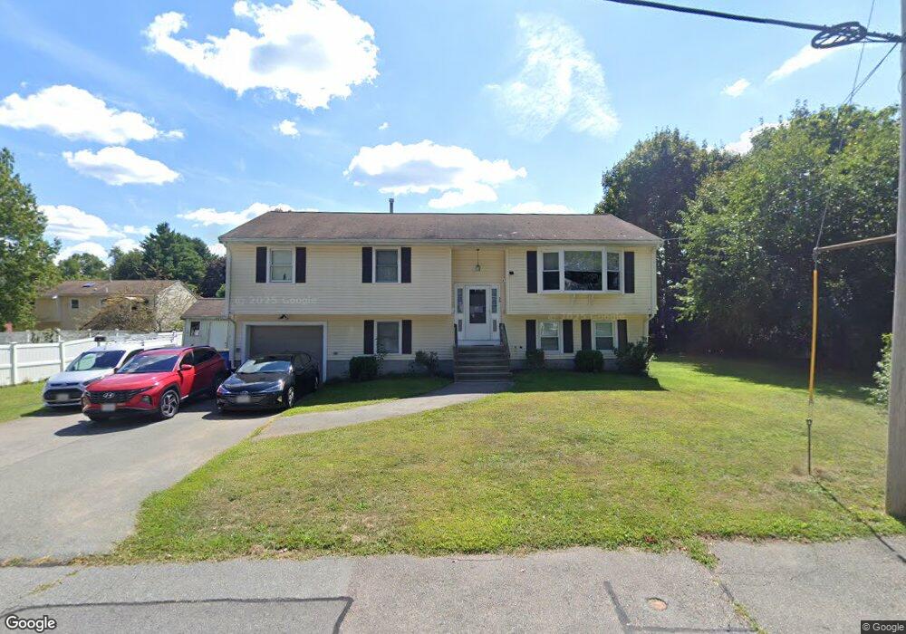
50 Pauline St Randolph, MA 02368
North Randolph NeighborhoodEstimated Value: $590,000 - $642,000
3
Beds
2
Baths
1,388
Sq Ft
$443/Sq Ft
Est. Value
About This Home
This home is located at 50 Pauline St, Randolph, MA 02368 and is currently estimated at $614,224, approximately $442 per square foot. 50 Pauline St is a home located in Norfolk County with nearby schools including Randolph High School and Thayer Academy.
Create a Home Valuation Report for This Property
The Home Valuation Report is an in-depth analysis detailing your home's value as well as a comparison with similar homes in the area
Home Values in the Area
Average Home Value in this Area
Tax History Compared to Growth
Tax History
| Year | Tax Paid | Tax Assessment Tax Assessment Total Assessment is a certain percentage of the fair market value that is determined by local assessors to be the total taxable value of land and additions on the property. | Land | Improvement |
|---|---|---|---|---|
| 2025 | $6,549 | $564,100 | $223,800 | $340,300 |
| 2024 | $6,616 | $577,800 | $219,400 | $358,400 |
| 2023 | $6,257 | $518,000 | $199,400 | $318,600 |
| 2022 | $6,030 | $443,400 | $166,100 | $277,300 |
| 2021 | $5,831 | $394,500 | $138,500 | $256,000 |
| 2020 | $5,652 | $379,100 | $138,500 | $240,600 |
| 2019 | $5,746 | $383,600 | $131,900 | $251,700 |
| 2018 | $5,614 | $353,500 | $119,900 | $233,600 |
| 2017 | $5,265 | $325,400 | $111,800 | $213,600 |
| 2016 | $5,120 | $294,400 | $101,600 | $192,800 |
| 2015 | $5,001 | $276,300 | $96,800 | $179,500 |
Source: Public Records
Map
Nearby Homes
- 304 High St
- 23 Emeline St
- 10 Michael Rd
- 11 Royal Crest Dr Unit 5
- 9 Royal Crest Dr Unit 12
- 33 Michael Rd
- 232 Canton St Unit 104
- 232 Canton St Unit 112
- 1277 N Main St
- 11 Rockefeller St
- 902 Irving Rd Unit 902
- 12 Webster St
- 7 Webster St
- 229 Chestnut St
- 26 Knights Crescent St
- 172 Russ St
- 2 Smith Rd
- 34 Orchard St
- 79 Gold St
- 1 Clark Cir