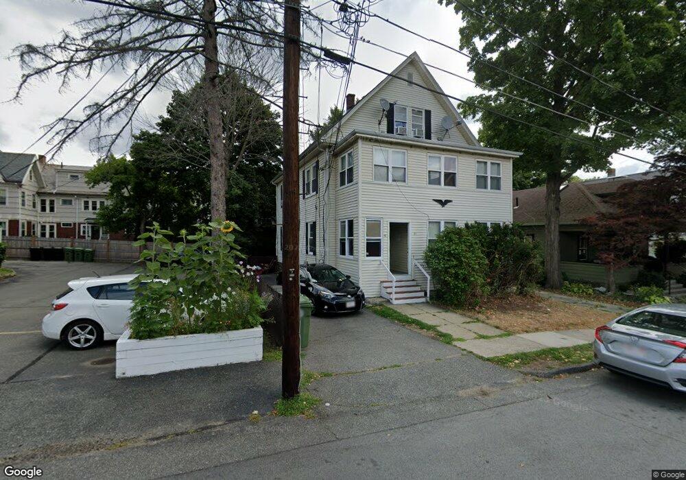
50 Phillips St Watertown, MA 02472
East Watertown NeighborhoodEstimated Value: $1,081,000 - $1,213,000
4
Beds
3
Baths
2,636
Sq Ft
$436/Sq Ft
Est. Value
About This Home
This home is located at 50 Phillips St, Watertown, MA 02472 and is currently estimated at $1,149,937, approximately $436 per square foot. 50 Phillips St is a home located in Middlesex County with nearby schools including The Kendall School, St. Stephen's Armenian Elementary School, and Jackson Walnut Park School.
Ownership History
Date
Name
Owned For
Owner Type
Purchase Details
Closed on
Jul 22, 1999
Sold by
Neal Ft and Purrini
Bought by
Yang Lin
Current Estimated Value
Home Financials for this Owner
Home Financials are based on the most recent Mortgage that was taken out on this home.
Original Mortgage
$240,000
Outstanding Balance
$66,855
Interest Rate
7.49%
Mortgage Type
Purchase Money Mortgage
Estimated Equity
$1,083,082
Create a Home Valuation Report for This Property
The Home Valuation Report is an in-depth analysis detailing your home's value as well as a comparison with similar homes in the area
Home Values in the Area
Average Home Value in this Area
Purchase History
| Date | Buyer | Sale Price | Title Company |
|---|---|---|---|
| Yang Lin | $324,500 | -- |
Source: Public Records
Mortgage History
| Date | Status | Borrower | Loan Amount |
|---|---|---|---|
| Open | Yang Lin | $240,000 |
Source: Public Records
Tax History Compared to Growth
Tax History
| Year | Tax Paid | Tax Assessment Tax Assessment Total Assessment is a certain percentage of the fair market value that is determined by local assessors to be the total taxable value of land and additions on the property. | Land | Improvement |
|---|---|---|---|---|
| 2025 | $10,408 | $891,100 | $463,400 | $427,700 |
| 2024 | $9,670 | $826,500 | $449,800 | $376,700 |
| 2023 | $10,970 | $807,800 | $435,300 | $372,500 |
| 2022 | $10,167 | $767,300 | $391,700 | $375,600 |
| 2021 | $9,157 | $747,500 | $384,500 | $363,000 |
| 2020 | $8,809 | $725,600 | $370,000 | $355,600 |
| 2019 | $8,371 | $649,900 | $355,500 | $294,400 |
| 2018 | $7,835 | $581,700 | $315,600 | $266,100 |
| 2017 | $8,080 | $581,700 | $315,600 | $266,100 |
| 2016 | $7,510 | $549,000 | $282,900 | $266,100 |
| 2015 | $7,049 | $469,000 | $268,400 | $200,600 |
| 2014 | $7,016 | $469,000 | $268,400 | $200,600 |
Source: Public Records
Map
Nearby Homes
- 55 Phillips St
- 101 N Beacon St Unit 206
- 93 Spring St Unit 29
- 14 N Beacon Ct
- 11 Broadway Unit 11
- 185 Arsenal St
- 32 Royal St Unit 2
- 118 Spring St Unit 118
- 194 N Beacon St
- 67 Walnut St
- 25 Barnard Ave
- 21 Fayette St Unit 1
- 61-63 Church St
- 24-26 Louise St
- 68 Barnard Ave
- 37 Paul St Unit 39
- 73 Charlesbank Rd Unit 105
- 110 Fayette St
- 20 Oakley Rd
- 71 Whites Ave Unit 71
- 58 Phillips St
- 47 Parker St
- 49 Parker St Unit 3
- 51 Parker St
- 51 Parker St Unit 3
- 53 Parker St Unit 3
- 60 Phillips St
- 43 Parker St Unit 43A
- 43 Parker St
- 41 Parker St Unit 41A
- 41 Parker St
- 45 Parker St Unit 45A
- 45 Parker St
- 45 Parker St Unit 45,45
- 43A Parker St Unit 43A
- 43A Parker St Unit 43-A
- 45A Parker St Unit 45A
- 57 Parker St Unit 3
- 57 Parker St Unit 2
- 51 Phillips St Unit 51