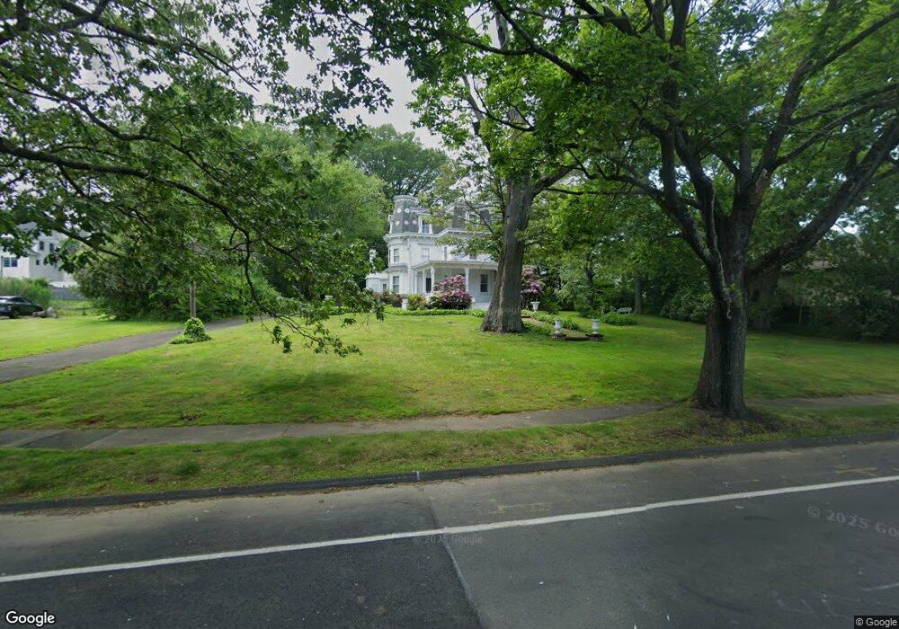
50 Platt Ave West Haven, CT 06516
West Shore NeighborhoodEstimated Value: $424,000 - $770,000
6
Beds
3
Baths
2,428
Sq Ft
$257/Sq Ft
Est. Value
About This Home
This home is located at 50 Platt Ave, West Haven, CT 06516 and is currently estimated at $623,281, approximately $256 per square foot. 50 Platt Ave is a home located in New Haven County with nearby schools including Carrigan 5/6 Intermediate School, Harry M. Bailey Middle School, and West Haven High School.
Ownership History
Date
Name
Owned For
Owner Type
Purchase Details
Closed on
Nov 12, 2010
Sold by
Perrone Stephen
Bought by
Pictruska Michelle
Current Estimated Value
Create a Home Valuation Report for This Property
The Home Valuation Report is an in-depth analysis detailing your home's value as well as a comparison with similar homes in the area
Home Values in the Area
Average Home Value in this Area
Purchase History
We collect this data history from publicly available records. To have your information removed, we recommend requesting removal directly through your county’s website.
| Date | Buyer | Sale Price | Title Company |
|---|---|---|---|
| Pictruska Michelle | $352,500 | -- | |
| Pictruska Michelle | $352,500 | -- |
Source: Public Records
Mortgage History
We collect this data history from publicly available records. To have your information removed, we recommend requesting removal directly through your county’s website.
| Date | Status | Borrower | Loan Amount |
|---|---|---|---|
| Open | Pictruska Michelle | $47,025 | |
| Open | Pictruska Michelle | $316,000 |
Source: Public Records
Tax History
| Year | Tax Paid | Tax Assessment Tax Assessment Total Assessment is a certain percentage of the fair market value that is determined by local assessors to be the total taxable value of land and additions on the property. | Land | Improvement |
|---|---|---|---|---|
| 2025 | $12,943 | $393,750 | $150,570 | $243,180 |
| 2024 | $12,701 | $271,040 | $105,700 | $165,340 |
| 2023 | $12,224 | $271,040 | $105,700 | $165,340 |
| 2022 | $12,004 | $271,040 | $105,700 | $165,340 |
| 2021 | $12,004 | $271,040 | $105,700 | $165,340 |
| 2020 | $12,307 | $253,190 | $100,940 | $152,250 |
| 2019 | $11,915 | $253,190 | $100,940 | $152,250 |
| 2018 | $11,745 | $253,190 | $100,940 | $152,250 |
| 2017 | $11,429 | $253,190 | $100,940 | $152,250 |
| 2016 | $11,302 | $253,190 | $100,940 | $152,250 |
| 2015 | $10,379 | $260,260 | $106,400 | $153,860 |
| 2014 | $10,379 | $260,260 | $106,400 | $153,860 |
Source: Public Records
Map
Nearby Homes
- 206 Highland Ave
- 153 Laurel St
- 100 Sumac St
- 113 Prospect Ave
- 761 Jones Hill Rd
- 45 Arlington St
- 102 Dawson Ave
- 19 Harding Ave
- 58 Parker Ave
- 54 Overlook Ave
- 49 Seaview Ave
- 73 Honor Rd
- 16 Sorensen Rd
- 330 Savin Ave Unit 76
- 40 Atwood Ave
- 281 Kelsey Ave
- 174 Park Terrace Ave
- 18 Grand St
- 461R Ocean Ave
- 456 Jones Hill Rd
Your Personal Tour Guide
Ask me questions while you tour the home.