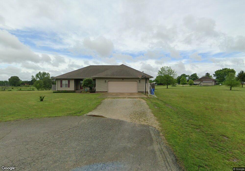
50 Ray Gene Paragould, AR 72450
Estimated Value: $209,000 - $282,000
--
Bed
2
Baths
1,940
Sq Ft
$130/Sq Ft
Est. Value
About This Home
This home is located at 50 Ray Gene, Paragould, AR 72450 and is currently estimated at $252,293, approximately $130 per square foot. 50 Ray Gene is a home located in Greene County with nearby schools including Paragould High School.
Ownership History
Date
Name
Owned For
Owner Type
Purchase Details
Closed on
Aug 25, 2010
Sold by
Massey Shannon
Bought by
Lewis Gary M and Lewis Jennifer
Current Estimated Value
Home Financials for this Owner
Home Financials are based on the most recent Mortgage that was taken out on this home.
Original Mortgage
$144,559
Outstanding Balance
$95,241
Interest Rate
4.55%
Mortgage Type
New Conventional
Estimated Equity
$157,052
Purchase Details
Closed on
Jun 19, 2007
Sold by
Wells Fargo Bank
Bought by
Massey Shannon
Home Financials for this Owner
Home Financials are based on the most recent Mortgage that was taken out on this home.
Original Mortgage
$80,000
Interest Rate
6.37%
Mortgage Type
Adjustable Rate Mortgage/ARM
Purchase Details
Closed on
Mar 16, 1999
Bought by
Carrell Michael W and Carrell Theresa R
Create a Home Valuation Report for This Property
The Home Valuation Report is an in-depth analysis detailing your home's value as well as a comparison with similar homes in the area
Home Values in the Area
Average Home Value in this Area
Purchase History
| Date | Buyer | Sale Price | Title Company |
|---|---|---|---|
| Lewis Gary M | $137,000 | None Available | |
| Massey Shannon | $96,000 | Associated Closing & Title | |
| Carrell Michael W | $9,000 | -- |
Source: Public Records
Mortgage History
| Date | Status | Borrower | Loan Amount |
|---|---|---|---|
| Open | Lewis Gary M | $144,559 | |
| Previous Owner | Massey Shannon | $80,000 |
Source: Public Records
Tax History Compared to Growth
Tax History
| Year | Tax Paid | Tax Assessment Tax Assessment Total Assessment is a certain percentage of the fair market value that is determined by local assessors to be the total taxable value of land and additions on the property. | Land | Improvement |
|---|---|---|---|---|
| 2025 | $1,310 | $39,520 | $5,400 | $34,120 |
| 2024 | $1,310 | $39,520 | $5,400 | $34,120 |
| 2023 | $1,201 | $30,740 | $6,400 | $24,340 |
| 2022 | $826 | $30,740 | $6,400 | $24,340 |
| 2021 | $771 | $30,740 | $6,400 | $24,340 |
| 2020 | $1,092 | $24,140 | $2,000 | $22,140 |
| 2019 | $717 | $24,140 | $2,000 | $22,140 |
| 2018 | $742 | $24,140 | $2,000 | $22,140 |
| 2017 | $1,067 | $24,140 | $2,000 | $22,140 |
| 2016 | $717 | $24,140 | $2,000 | $22,140 |
| 2015 | $690 | $23,520 | $2,000 | $21,520 |
| 2014 | -- | $23,520 | $2,000 | $21,520 |
Source: Public Records
Map
Nearby Homes
- 422 Sunset Dr
- 181 Misty Marie
- 205 Raymond
- 522 Vaughn Dr
- 193 Granny Jean Ln
- 233 Lois Ln
- 44 Oak Grove Rd
- 146 Messer Dr
- 3613 Purcell Rd
- Tract 4 Greene 726 Rd
- Tract 3 Greene 726 Rd
- Tract 2 Greene 726 Rd
- 000 Hwy 412 Byp Everett Dr
- 3505 Purcell Rd
- 0 Hwy 49s Unit 10124883
- 3407 Sweet Gum St
- 3505 Sweet Gum St
- 0 Acres Highway 49n Unit 10121154
- 3501 Sweet Gum St
- 5 Acres Greene 726 Rd Tract 4
- 44 Ray Gene
- 51 Ray Gene
- 170 Mason Dr
- 333 Sunset Dr
- 319 Sunset Dr
- 43 Ray Gene
- 144 Mason Dr
- 76 Vaughn Dr
- 110 Vaughn Dr
- 12 Mason Dr
- 12 Mason Dr
- 291 Sunset Dr
- 399 Sunset Dr
- 52 Theresa Ann
- 42 Theresa Ann
- 52 Theresa Ann
- 344 Sunset Dr
- 0 James Devaughn Dr Unit 20004339
- 0 James Devaughn Dr Unit 20004335
- 170 Vaughn Dr