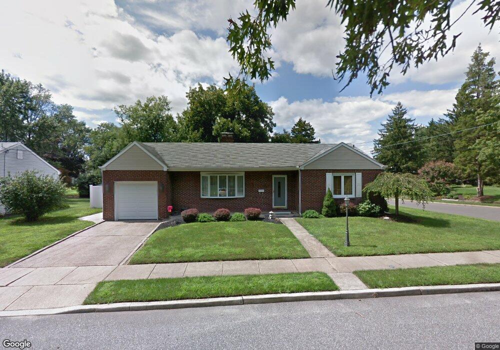
50 S Locust Ave Marlton, NJ 08053
Estimated Value: $357,942 - $482,000
--
Bed
--
Bath
1,216
Sq Ft
$346/Sq Ft
Est. Value
About This Home
This home is located at 50 S Locust Ave, Marlton, NJ 08053 and is currently estimated at $420,986, approximately $346 per square foot. 50 S Locust Ave is a home located in Burlington County with nearby schools including Marlton Middle School, Cherokee High School, and Lenape High School.
Ownership History
Date
Name
Owned For
Owner Type
Purchase Details
Closed on
Aug 30, 2001
Sold by
Keegan Joan
Bought by
Powell Barbara A
Current Estimated Value
Home Financials for this Owner
Home Financials are based on the most recent Mortgage that was taken out on this home.
Original Mortgage
$104,000
Outstanding Balance
$40,525
Interest Rate
6.98%
Estimated Equity
$380,461
Create a Home Valuation Report for This Property
The Home Valuation Report is an in-depth analysis detailing your home's value as well as a comparison with similar homes in the area
Home Values in the Area
Average Home Value in this Area
Purchase History
| Date | Buyer | Sale Price | Title Company |
|---|---|---|---|
| Powell Barbara A | $130,000 | Congress Title Corp |
Source: Public Records
Mortgage History
| Date | Status | Borrower | Loan Amount |
|---|---|---|---|
| Open | Powell Barbara A | $104,000 |
Source: Public Records
Tax History Compared to Growth
Tax History
| Year | Tax Paid | Tax Assessment Tax Assessment Total Assessment is a certain percentage of the fair market value that is determined by local assessors to be the total taxable value of land and additions on the property. | Land | Improvement |
|---|---|---|---|---|
| 2025 | $6,956 | $203,700 | $89,500 | $114,200 |
| 2024 | $6,545 | $203,700 | $89,500 | $114,200 |
| 2023 | $6,545 | $203,700 | $89,500 | $114,200 |
| 2022 | $6,252 | $203,700 | $89,500 | $114,200 |
| 2021 | $6,105 | $203,700 | $89,500 | $114,200 |
| 2020 | $6,025 | $203,700 | $89,500 | $114,200 |
| 2019 | $5,563 | $189,600 | $89,500 | $100,100 |
| 2018 | $5,485 | $189,600 | $89,500 | $100,100 |
| 2017 | $5,421 | $189,600 | $89,500 | $100,100 |
| 2016 | $5,288 | $189,600 | $89,500 | $100,100 |
| 2015 | $5,195 | $189,600 | $89,500 | $100,100 |
| 2014 | $5,047 | $189,600 | $89,500 | $100,100 |
Source: Public Records
Map
Nearby Homes
- 42 S Locust Ave
- 31 Flintstone Dr
- 61 S Maple Ave
- 30 Cooper Ave
- 15 W Main St
- 5 Marlborough Ave
- 22 Bettlewood Rd
- 20 Marlborough Ave
- 100 Cambridge Ave
- 29 Marlborough Ave
- 1 Sunnyside Ct
- 118 Cambridge Ave
- 607 Lindsey Ct
- 7 Quaker St
- 128 Cambridge Ave
- 31 Ashley Ct
- 63 Banner Ct Unit 63
- 22 Hawk Ln
- 38 Ashley Ct Unit 38
- 1525 Squire Ln
- 52 S Locust Ave
- 22 Florence Ave
- 48 S Locust Ave
- 54 S Locust Ave
- 20 Florence Ave
- 200 Munger Ave
- 49 S Locust Ave
- 21 Florence Ave
- 198 Munger Ave
- 53 S Locust Ave
- 46 S Locust Ave
- 18 Florence Ave
- 47 S Locust Ave
- 52 Oak Ave
- 55 S Locust Ave
- 44 S Locust Ave
- 196 Munger Ave
- 16 Florence Ave
- 50 Oak Ave
- 199 Munger Ave