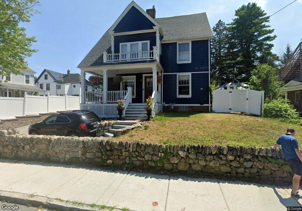
50 Sparhawk St Amesbury, MA 01913
Estimated Value: $803,000 - $1,036,000
5
Beds
3
Baths
3,246
Sq Ft
$279/Sq Ft
Est. Value
About This Home
This home is located at 50 Sparhawk St, Amesbury, MA 01913 and is currently estimated at $905,735, approximately $279 per square foot. 50 Sparhawk St is a home located in Essex County with nearby schools including Amesbury High School and Amesbury Seventh-Day Adventist School.
Ownership History
Date
Name
Owned For
Owner Type
Purchase Details
Closed on
May 28, 2004
Sold by
Raimondi Donna and Raimondi Robert Skerry
Bought by
Boutin-Leary Christina A and Leary Brian N
Current Estimated Value
Purchase Details
Closed on
Jan 30, 1997
Sold by
Khairi Siamak and Khairi Joan E
Bought by
Skerry W Robert and Raimondi Donna
Purchase Details
Closed on
Oct 1, 1992
Sold by
Verrette George A and Verrette Janice
Bought by
Khairi Siamak and Khairi Joan
Create a Home Valuation Report for This Property
The Home Valuation Report is an in-depth analysis detailing your home's value as well as a comparison with similar homes in the area
Home Values in the Area
Average Home Value in this Area
Purchase History
| Date | Buyer | Sale Price | Title Company |
|---|---|---|---|
| Boutin-Leary Christina A | $490,000 | -- | |
| Skerry W Robert | $165,000 | -- | |
| Khairi Siamak | $144,000 | -- |
Source: Public Records
Mortgage History
| Date | Status | Borrower | Loan Amount |
|---|---|---|---|
| Open | Khairi Siamak | $299,414 | |
| Closed | Khairi Siamak | $200,000 | |
| Closed | Khairi Siamak | $333,700 |
Source: Public Records
Tax History Compared to Growth
Tax History
| Year | Tax Paid | Tax Assessment Tax Assessment Total Assessment is a certain percentage of the fair market value that is determined by local assessors to be the total taxable value of land and additions on the property. | Land | Improvement |
|---|---|---|---|---|
| 2025 | $12,572 | $821,700 | $208,800 | $612,900 |
| 2024 | $11,836 | $756,800 | $197,000 | $559,800 |
| 2023 | $11,945 | $731,000 | $171,200 | $559,800 |
| 2022 | $12,217 | $690,600 | $148,900 | $541,700 |
| 2021 | $11,083 | $607,300 | $118,400 | $488,900 |
| 2020 | $10,597 | $616,800 | $113,900 | $502,900 |
| 2019 | $9,097 | $495,200 | $113,900 | $381,300 |
| 2018 | $9,047 | $476,400 | $108,500 | $367,900 |
| 2017 | $9,440 | $473,200 | $108,500 | $364,700 |
| 2016 | $8,941 | $440,900 | $108,500 | $332,400 |
| 2015 | $8,836 | $430,200 | $108,500 | $321,700 |
| 2014 | $8,862 | $422,600 | $108,500 | $314,100 |
Source: Public Records
Map
Nearby Homes
- 4 Larnard Ct
- 49 W Greenwood St
- 93 Friend St
- 31 Whitter Meadows Dr Unit 31
- 4 Greenwood St
- 43 Aubin St Unit 43
- 18 E Greenwood St
- 37 Millyard Unit 204
- 4 Winter St
- 13 High St Unit 2
- 4 Clark St
- 5 Moncrief St Unit 5
- 188 Lions Mouth Rd
- 48 Orchard St
- 5 Richs Ct Unit 3
- 97 Elm St
- 45 Macy St Unit b101
- 45 Macy St Unit 301C
- 45 Macy St Unit 302C
- 118 Elm St
- 11 Whittier St
- 46 Sparhawk St
- 3-5 Harrison Ave
- 5 1/2 Harrison Ave Unit A
- 3 Harrison Ave
- 5 1/2 Harrison Ave Unit 5A
- 3 1/2 Harrison Ave Unit 3A
- 5.5 Harrison Ave Unit 5.5
- 3 Harrison Ave Unit 3
- 3 1/2 Harrison Ave Unit 3 1/2
- 5-1/2 Harrison Ave Unit 5 1/2
- 5 Harrison Ave
- 5 Harrison Ave Unit 5
- 49 Sparhawk St Unit 2
- 49 Sparhawk St Unit 1
- 49 Sparhawk St
- 35 Harrison Ave
- 15 Whittier St
- 54 Sparhawk St
- 49 Sparhawk St Unit 2