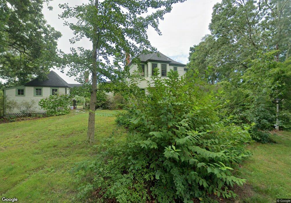
50 Squeteague Harbor Rd Pocasset, MA 2559
Cataumet NeighborhoodEstimated Value: $1,366,000 - $1,653,565
4
Beds
2
Baths
1,870
Sq Ft
$791/Sq Ft
Est. Value
About This Home
This home is located at 50 Squeteague Harbor Rd, Pocasset, MA 2559 and is currently estimated at $1,479,141, approximately $790 per square foot. 50 Squeteague Harbor Rd is a home located in Barnstable County with nearby schools including Bourne High School, Cadence Academy Preschool - Bourne, and Heritage Christian Academy.
Ownership History
Date
Name
Owned For
Owner Type
Purchase Details
Closed on
Sep 15, 1997
Sold by
Fox C James
Bought by
Fox William K and Fox Erika S
Current Estimated Value
Home Financials for this Owner
Home Financials are based on the most recent Mortgage that was taken out on this home.
Original Mortgage
$125,000
Outstanding Balance
$19,099
Interest Rate
7.31%
Mortgage Type
Purchase Money Mortgage
Estimated Equity
$1,460,042
Create a Home Valuation Report for This Property
The Home Valuation Report is an in-depth analysis detailing your home's value as well as a comparison with similar homes in the area
Home Values in the Area
Average Home Value in this Area
Purchase History
| Date | Buyer | Sale Price | Title Company |
|---|---|---|---|
| Fox William K | $225,000 | -- | |
| Fox William K | $225,000 | -- |
Source: Public Records
Mortgage History
| Date | Status | Borrower | Loan Amount |
|---|---|---|---|
| Open | Fox William K | $125,000 | |
| Closed | Fox William K | $125,000 |
Source: Public Records
Tax History Compared to Growth
Tax History
| Year | Tax Paid | Tax Assessment Tax Assessment Total Assessment is a certain percentage of the fair market value that is determined by local assessors to be the total taxable value of land and additions on the property. | Land | Improvement |
|---|---|---|---|---|
| 2025 | $14,014 | $1,794,400 | $1,502,600 | $291,800 |
| 2024 | $13,895 | $1,732,600 | $1,430,900 | $301,700 |
| 2023 | $13,510 | $1,533,500 | $1,266,400 | $267,100 |
| 2022 | $14,623 | $1,449,300 | $1,228,900 | $220,400 |
| 2021 | $14,207 | $1,319,100 | $1,118,400 | $200,700 |
| 2020 | $14,700 | $1,368,700 | $1,107,700 | $261,000 |
| 2019 | $14,235 | $1,354,400 | $1,107,700 | $246,700 |
| 2018 | $13,602 | $1,290,500 | $1,055,100 | $235,400 |
| 2017 | $13,112 | $1,273,000 | $1,045,200 | $227,800 |
| 2016 | $12,610 | $1,241,100 | $1,045,200 | $195,900 |
| 2015 | $12,498 | $1,241,100 | $1,045,200 | $195,900 |
Source: Public Records
Map
Nearby Homes
- 10 Squeteague Harbor Rd
- 250 Scraggy Neck Rd
- 31 Baxendale Rd
- 48 Garnet Ave
- 75 Winsor Rd
- 23 Wohelo Dr
- 1234 Route 28a
- 48 Red Brook Harbor Rd
- 289 Old Main Rd
- 1234 Route 28a
- 3 Red Brook Pond Dr
- 1094 County Rd
- 22 Nairn Rd
- 24 Fiddlers Cove Rd
- 2 Tricia Rd
- 14 Ryder Rd
- 37 Five Gate Ln
- 940 County Rd
- 9 Seascape Ln
- 40 Squeteague Harbor Rd
- 51 Squeteague Harbor Rd
- 51 Squeteague Harbor Rd
- 40 Squeteague Harbor Rd
- 62 Squeteague Harbor Rd
- 47 Squeteague Harbor
- 47 Squeteague Harbor Rd
- 62 Squeteague Harbor Rd
- 37 Squeteague Harbor Rd
- 56 Megansett Rd
- 37 Harbor Dr
- 36 Squeteague Harbor Rd
- 36 Squeteague Harbor Rd
- 53 Ocean Ave
- 34 Squeteague Harbor Rd
- 31 Squeteague Harbor Rd
- 66 Megansett Rd
- 53 Megansett Rd
- 32 Squeteague Harbor Rd
- 32 Squeteague Harbor Rd