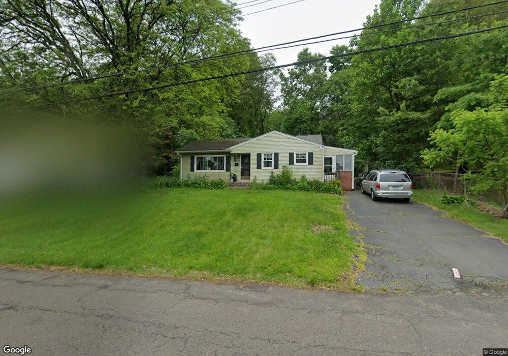
50 Susan Rd New Britain, CT 06053
Estimated Value: $282,000 - $321,000
3
Beds
1
Bath
1,128
Sq Ft
$264/Sq Ft
Est. Value
About This Home
This home is located at 50 Susan Rd, New Britain, CT 06053 and is currently estimated at $297,911, approximately $264 per square foot. 50 Susan Rd is a home located in Hartford County with nearby schools including Holmes School, Pulaski Middle School, and St. Francis of Assisi Middle School.
Ownership History
Date
Name
Owned For
Owner Type
Purchase Details
Closed on
Dec 15, 2011
Sold by
Mccall Eric S
Bought by
Mccall Susan T
Current Estimated Value
Purchase Details
Closed on
Jul 30, 2002
Sold by
Pinard Gerard P and Pinard Dawn N
Bought by
Mccall Eric S and Mccall Susan T
Purchase Details
Closed on
Jan 23, 2002
Sold by
Mtg Lenders Ntwrk Usa
Bought by
Pinard Gerard J and Pinard Dawn M
Purchase Details
Closed on
Nov 15, 1996
Sold by
Mahan Gordon F and Mahan Janice P
Bought by
Caetano John E and Caetano Leeri B
Purchase Details
Closed on
May 14, 1996
Sold by
Lubrico Carl and Lubrico Lisa
Bought by
Dellabianca Kevin
Create a Home Valuation Report for This Property
The Home Valuation Report is an in-depth analysis detailing your home's value as well as a comparison with similar homes in the area
Home Values in the Area
Average Home Value in this Area
Purchase History
| Date | Buyer | Sale Price | Title Company |
|---|---|---|---|
| Mccall Susan T | -- | -- | |
| Mccall Eric S | $120,000 | -- | |
| Pinard Gerard J | $87,000 | -- | |
| Caetano John E | $121,000 | -- | |
| Dellabianca Kevin | $35,000 | -- |
Source: Public Records
Mortgage History
| Date | Status | Borrower | Loan Amount |
|---|---|---|---|
| Open | Dellabianca Kevin | $180,781 | |
| Previous Owner | Dellabianca Kevin | $164,000 |
Source: Public Records
Tax History Compared to Growth
Tax History
| Year | Tax Paid | Tax Assessment Tax Assessment Total Assessment is a certain percentage of the fair market value that is determined by local assessors to be the total taxable value of land and additions on the property. | Land | Improvement |
|---|---|---|---|---|
| 2025 | $6,138 | $156,660 | $63,630 | $93,030 |
| 2024 | $6,202 | $156,660 | $63,630 | $93,030 |
| 2023 | $5,997 | $156,660 | $63,630 | $93,030 |
| 2022 | $4,955 | $100,100 | $29,330 | $70,770 |
| 2021 | $4,955 | $100,100 | $29,330 | $70,770 |
| 2020 | $5,055 | $100,100 | $29,330 | $70,770 |
| 2019 | $5,055 | $100,100 | $29,330 | $70,770 |
| 2018 | $5,055 | $100,100 | $29,330 | $70,770 |
| 2017 | $4,825 | $95,550 | $26,740 | $68,810 |
| 2016 | $4,825 | $95,550 | $26,740 | $68,810 |
| 2015 | $4,682 | $95,550 | $26,740 | $68,810 |
| 2014 | $4,682 | $95,550 | $26,740 | $68,810 |
Source: Public Records
Map
Nearby Homes
- 140 Lewis Rd
- 187 Miriam Rd
- 801 Farmington Ave
- 34 Hutchinson St
- 122 Batterson Dr
- 200 Belridge Rd
- 28 SyMcO Dr
- 55 Horseplain Rd
- 1114 Fienemann Rd
- 40 Varmor Dr
- 133 Mckinley Dr
- 97 Mckinley Dr
- 67 Eastwick Rd
- 16 Petemont Dr
- 2337 Stanley St
- 180 Batterson Park Rd
- 182 Batterson Park Rd
- 180 Brittany Farms Rd Unit D
- 198 Brittany Farms Rd Unit D
- 410 Farmington Ave Unit O6