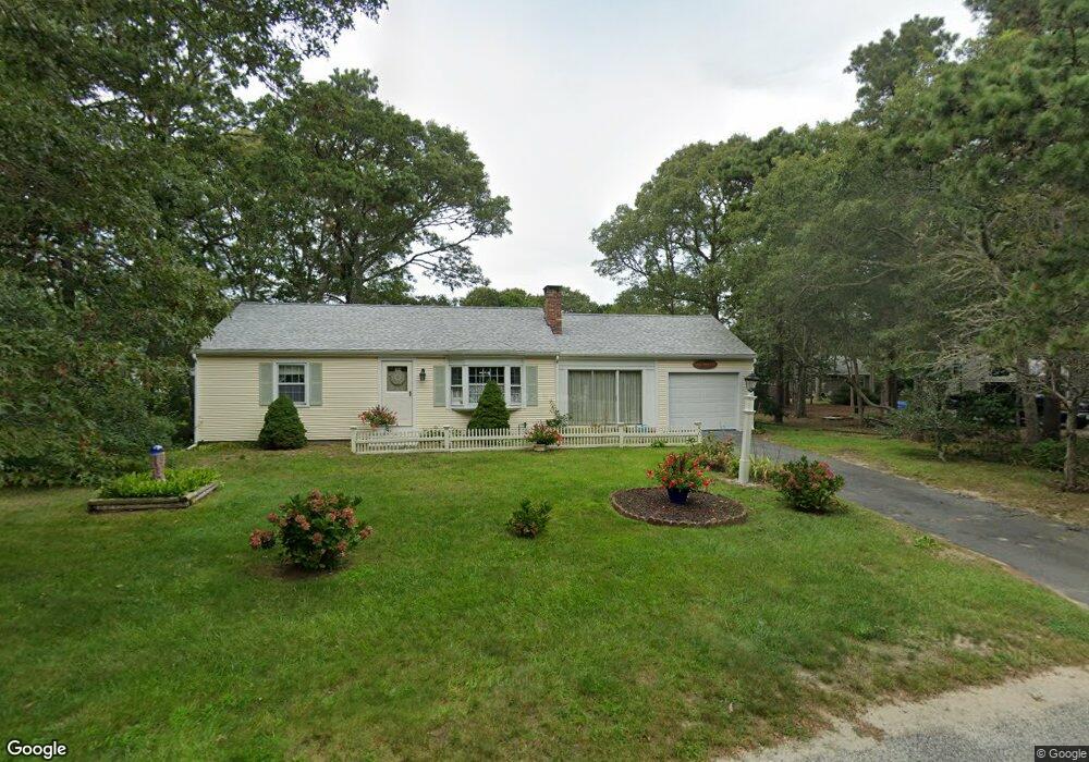
50 Swift Brook Rd South Yarmouth, MA 02664
South Yarmouth NeighborhoodEstimated Value: $534,000 - $577,000
2
Beds
1
Bath
1,128
Sq Ft
$487/Sq Ft
Est. Value
About This Home
This home is located at 50 Swift Brook Rd, South Yarmouth, MA 02664 and is currently estimated at $548,983, approximately $486 per square foot. 50 Swift Brook Rd is a home located in Barnstable County with nearby schools including Dennis-Yarmouth Regional High School, Sturgis Charter Public School, and St. Pius X. School.
Ownership History
Date
Name
Owned For
Owner Type
Purchase Details
Closed on
Mar 3, 2008
Sold by
Moriarty Frederick J and Moriarty Philomena
Bought by
Moriarty Frederick J and Kilduff Joanne M
Current Estimated Value
Purchase Details
Closed on
Mar 30, 1995
Sold by
Moran Anne T
Bought by
Moriarty Frederick T and Moriarty Philomena
Create a Home Valuation Report for This Property
The Home Valuation Report is an in-depth analysis detailing your home's value as well as a comparison with similar homes in the area
Home Values in the Area
Average Home Value in this Area
Purchase History
| Date | Buyer | Sale Price | Title Company |
|---|---|---|---|
| Moriarty Frederick J | -- | -- | |
| Moriarty Frederick T | $90,000 | -- |
Source: Public Records
Tax History Compared to Growth
Tax History
| Year | Tax Paid | Tax Assessment Tax Assessment Total Assessment is a certain percentage of the fair market value that is determined by local assessors to be the total taxable value of land and additions on the property. | Land | Improvement |
|---|---|---|---|---|
| 2025 | $3,325 | $469,600 | $180,700 | $288,900 |
| 2024 | $3,085 | $418,000 | $152,800 | $265,200 |
| 2023 | $3,249 | $400,600 | $132,300 | $268,300 |
| 2022 | $3,059 | $333,200 | $120,200 | $213,000 |
| 2021 | $2,871 | $300,300 | $120,200 | $180,100 |
| 2020 | $2,804 | $280,400 | $120,100 | $160,300 |
| 2019 | $2,593 | $256,700 | $120,100 | $136,600 |
| 2018 | $2,458 | $238,900 | $102,300 | $136,600 |
| 2017 | $2,350 | $234,500 | $97,900 | $136,600 |
| 2016 | $2,251 | $225,600 | $89,000 | $136,600 |
| 2015 | $2,128 | $212,000 | $89,000 | $123,000 |
Source: Public Records
Map
Nearby Homes
- 48 Captain Dore Rd
- 18 Captain Stanley Rd
- 35 Captain Percival Rd
- 49 Captain Besse Rd
- 24 Fast Brook Rd
- 147 Captain Bacon Rd
- 11 Bob-O-link Ln
- 3 Saturn Ln
- 72 Quartermaster Row
- 68 Bob-O-link Ln
- 299 Winslow Gray Rd
- 299-301 Winslow Gray Rd
- 33 Lake Rd
- 21 Hazelmoor Rd
- 23 Circuit Rd N
- 33 Sparrow Way
- 22 Powhatan Rd
- 17 Trowbridge Path
- 17 South St
- 0 Forsyth Ave
- 138 Captain Noyes Rd
- 56 Swift Brook Rd
- 132 Captain Noyes Rd
- 51 Swift Brook Rd
- 45 Swift Brook Rd
- 142 Captain Noyes Rd
- 128 Captain Noyes Rd
- 40 Swift Brook Rd
- 57 Swift Brook Rd
- 62 Swift Brook Rd
- 54 Winding Brook Rd
- 58 Winding Brook Rd
- 122 Captain Noyes Rd
- 39 Swift Brook Rd
- 148 Captain Noyes Rd
- 59 Captain Dore Rd
- 137 Captain Noyes Rd
- 63 Swift Brook Rd
- 66 Swift Brook Rd
- 32 Swift Brook Rd