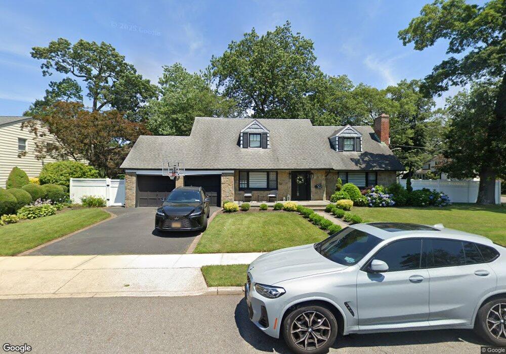
50 Virginia Ave Freeport, NY 11520
Estimated Value: $728,000 - $823,402
4
Beds
4
Baths
10,500
Sq Ft
$74/Sq Ft
Est. Value
About This Home
This home is located at 50 Virginia Ave, Freeport, NY 11520 and is currently estimated at $775,701, approximately $73 per square foot. 50 Virginia Ave is a home located in Nassau County with nearby schools including Caroline G. Atkinson Intermediate School, Columbus Avenue School, and John W Dodd Middle School.
Ownership History
Date
Name
Owned For
Owner Type
Purchase Details
Closed on
Nov 4, 2021
Sold by
Bastien Ricky A
Bought by
Bastien Ricky A and Guerrier Taina
Current Estimated Value
Purchase Details
Closed on
Oct 21, 2011
Sold by
Rodriguez Felix A and Rodriguez Doris J
Bought by
Bastien Alberto
Home Financials for this Owner
Home Financials are based on the most recent Mortgage that was taken out on this home.
Original Mortgage
$337,095
Outstanding Balance
$229,690
Interest Rate
4.08%
Mortgage Type
VA
Estimated Equity
$546,011
Create a Home Valuation Report for This Property
The Home Valuation Report is an in-depth analysis detailing your home's value as well as a comparison with similar homes in the area
Home Values in the Area
Average Home Value in this Area
Purchase History
| Date | Buyer | Sale Price | Title Company |
|---|---|---|---|
| Bastien Ricky A | -- | None Available | |
| Bastien Alberto | $330,000 | -- |
Source: Public Records
Mortgage History
| Date | Status | Borrower | Loan Amount |
|---|---|---|---|
| Open | Bastien Alberto | $337,095 |
Source: Public Records
Tax History Compared to Growth
Tax History
| Year | Tax Paid | Tax Assessment Tax Assessment Total Assessment is a certain percentage of the fair market value that is determined by local assessors to be the total taxable value of land and additions on the property. | Land | Improvement |
|---|---|---|---|---|
| 2025 | $10,700 | $529 | $187 | $342 |
| 2024 | $1,021 | $529 | $187 | $342 |
| 2023 | $10,424 | $529 | $187 | $342 |
| 2022 | $10,424 | $529 | $187 | $342 |
| 2021 | $15,168 | $507 | $179 | $328 |
| 2020 | $9,910 | $710 | $336 | $374 |
| 2019 | $1,178 | $710 | $336 | $374 |
| 2018 | $1,219 | $710 | $0 | $0 |
| 2017 | $8,545 | $710 | $336 | $374 |
| 2016 | $9,610 | $710 | $336 | $374 |
| 2015 | $1,026 | $710 | $336 | $374 |
| 2014 | $1,026 | $710 | $336 | $374 |
| 2013 | $969 | $710 | $336 | $374 |
Source: Public Records
Map
Nearby Homes
- 89 Delaware Ave
- 215 N Brookside Ave
- 345 W Seaman Ave
- 254 Lena Ave
- 142 Maryland Ave
- 154 California Ave
- 107 California Ave
- 36 New York Ave
- 1 Willowbrook Ln
- 6 New York Ave
- 86 N Bayview Ave
- 21 Connecticut Ave
- 139 New York Ave
- 174 Delaware Ave
- 858 Seaman Ave E
- 15 Mckenna Ave
- 2100 Ambrose Ct
- 1850 Voshage St
- 101 Wallace St
- 27 W Woodbine Dr
- 60 Virginia Ave
- 160 Maxson Ave
- 63 Beverly Pkwy
- 59 Beverly Pkwy
- 59 Beverly Pkwy
- 51 Virginia Ave
- 161 Maxson Ave
- 171 Maxson Ave
- 171 Maxson Ave
- 65 Beverly Pkwy
- 55 Virginia Ave
- 37 Virginia Ave
- 37 Beverly Pkwy
- 65 Virginia Ave
- 76 Virginia Ave
- 148 Maxson Ave
- 56 Beverly Pkwy
- 42 Oakfield Ave
- 50 Oakfield Ave
- 35 Virginia Ave