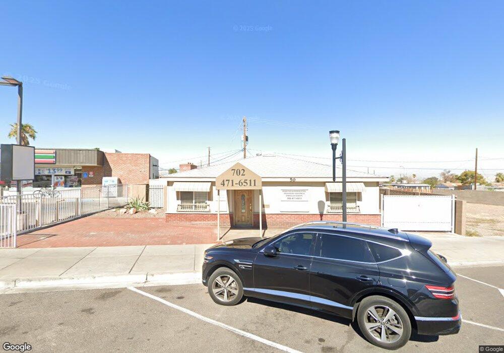
50 W Pacific Ave Henderson, NV 89015
Downtown Henderson NeighborhoodEstimated Value: $365,083 - $468,000
3
Beds
2
Baths
1,548
Sq Ft
$256/Sq Ft
Est. Value
About This Home
This home is located at 50 W Pacific Ave, Henderson, NV 89015 and is currently estimated at $395,521, approximately $255 per square foot. 50 W Pacific Ave is a home located in Clark County with nearby schools including Gordon Mccaw Elementary School, Robert L Taylor Elementary School, and Lyal Burkholder Middle School.
Ownership History
Date
Name
Owned For
Owner Type
Purchase Details
Closed on
Sep 2, 2025
Sold by
Pacific Property Llc
Bought by
Bond 2005 Irrevocable Trust and Glen
Current Estimated Value
Purchase Details
Closed on
Mar 17, 2008
Sold by
Bond Properties Llc
Bought by
Pacific Property Llc
Purchase Details
Closed on
Sep 18, 2007
Sold by
Oghigian Michael M
Bought by
Bond Properties Llc
Purchase Details
Closed on
Feb 4, 2005
Sold by
Perlman Joel S and Perlman Jill H
Bought by
Oghigian Michael M
Home Financials for this Owner
Home Financials are based on the most recent Mortgage that was taken out on this home.
Original Mortgage
$60,000
Interest Rate
5.74%
Mortgage Type
Seller Take Back
Purchase Details
Closed on
Aug 23, 2000
Sold by
Kaycee Club House Assn Inc
Bought by
Perlman Joel S and Perlman Jill H
Create a Home Valuation Report for This Property
The Home Valuation Report is an in-depth analysis detailing your home's value as well as a comparison with similar homes in the area
Home Values in the Area
Average Home Value in this Area
Purchase History
| Date | Buyer | Sale Price | Title Company |
|---|---|---|---|
| Bond 2005 Irrevocable Trust | -- | None Listed On Document | |
| Pacific Property Llc | -- | None Available | |
| Bond Properties Llc | $285,000 | Southwest Title | |
| Oghigian Michael M | $220,000 | Lawyers Title Of Nevada | |
| Perlman Joel S | $89,000 | Old Republic Title Company |
Source: Public Records
Mortgage History
| Date | Status | Borrower | Loan Amount |
|---|---|---|---|
| Previous Owner | Oghigian Michael M | $60,000 |
Source: Public Records
Tax History Compared to Growth
Tax History
| Year | Tax Paid | Tax Assessment Tax Assessment Total Assessment is a certain percentage of the fair market value that is determined by local assessors to be the total taxable value of land and additions on the property. | Land | Improvement |
|---|---|---|---|---|
| 2025 | $1,026 | $43,783 | $20,213 | $23,570 |
| 2024 | $951 | $43,783 | $20,213 | $23,570 |
| 2023 | $951 | $37,983 | $16,844 | $21,138 |
| 2022 | $881 | $32,463 | $13,476 | $18,987 |
| 2021 | $816 | $27,745 | $10,107 | $17,638 |
| 2020 | $755 | $27,261 | $10,107 | $17,154 |
| 2019 | $707 | $26,622 | $10,107 | $16,515 |
| 2018 | $675 | $23,932 | $8,424 | $15,508 |
| 2017 | $691 | $23,846 | $8,424 | $15,422 |
| 2016 | $633 | $21,738 | $6,739 | $14,999 |
| 2015 | $630 | $21,261 | $6,739 | $14,522 |
| 2014 | $615 | $20,608 | $6,739 | $13,869 |
Source: Public Records
Map
Nearby Homes
- 203 W Pacific Ave
- 206 W Atlantic Ave
- 211 W Atlantic Ave
- 27 Magnesium St
- 1 S Water St
- 379 Morgan Crest Dr
- 275 Shasta Crest Ave
- 357 Powell Crest Dr
- 375 Morgan Crest Dr
- 285 Shasta Crest Ave
- 111 E van Wagenen St
- 126 Magnesium St
- 139 E van Wagenen St
- 27 E Pacific Ave
- 0 None Unit 2690079
- 116 W Victory Rd
- 39 E Pacific Ave
- 26 E Atlantic Ave
- 15 Washington Way
- 130 W Fairway Rd
- 38 & 42 Pacific Ave
- 210 W Atlantic Ave
- 53 W Pacific Ave
- 10 Magnesium St
- 12 Magnesium St
- 207 W Atlantic Ave
- 14 Magnesium St
- 218 W Atlantic Ave
- 8 Magnesium St
- 207 W Pacific Ave
- 18 Magnesium St
- 215 W Atlantic Ave
- 149 W Atlantic Ave
- 211 W Pacific Ave
- 211 W Pacific Ave
- 206 Gold St
- 6 Magnesium St
- 22 Magnesium St
- 219 W Atlantic Ave
- 15 Magnesium St