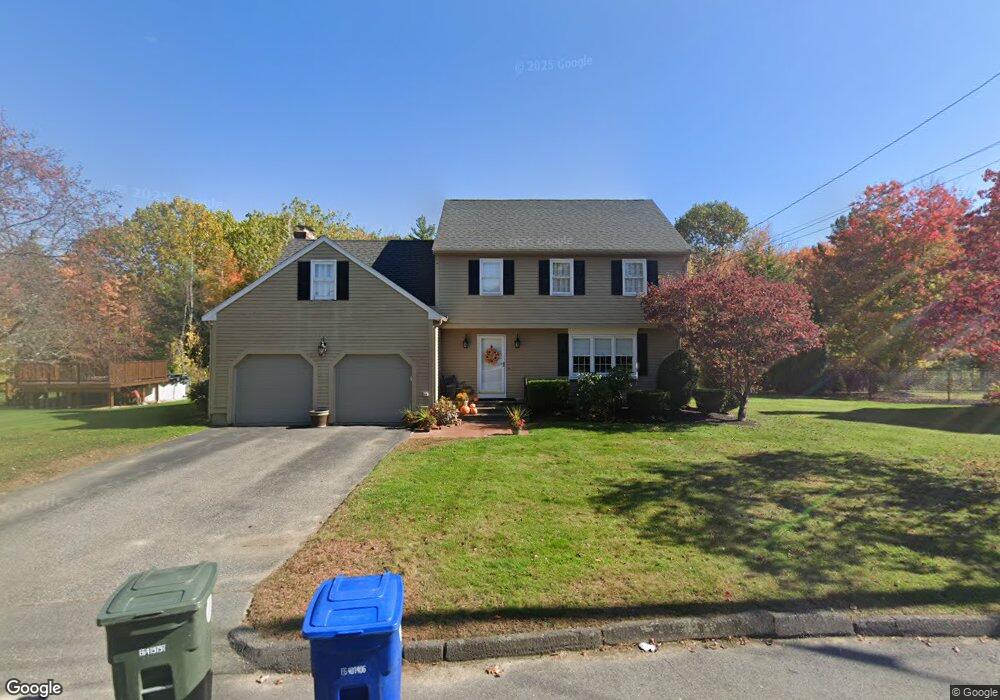
50 Weathervane Dr Leominster, MA 01453
Estimated Value: $626,295 - $698,000
3
Beds
3
Baths
2,168
Sq Ft
$302/Sq Ft
Est. Value
About This Home
This home is located at 50 Weathervane Dr, Leominster, MA 01453 and is currently estimated at $653,824, approximately $301 per square foot. 50 Weathervane Dr is a home located in Worcester County with nearby schools including Leominster High School, St. Anna Catholic School, and St. Leo School.
Ownership History
Date
Name
Owned For
Owner Type
Purchase Details
Closed on
May 9, 1988
Sold by
Donell Corp
Bought by
Donlan Dennis P
Current Estimated Value
Home Financials for this Owner
Home Financials are based on the most recent Mortgage that was taken out on this home.
Original Mortgage
$148,860
Interest Rate
9.94%
Mortgage Type
Purchase Money Mortgage
Create a Home Valuation Report for This Property
The Home Valuation Report is an in-depth analysis detailing your home's value as well as a comparison with similar homes in the area
Home Values in the Area
Average Home Value in this Area
Purchase History
| Date | Buyer | Sale Price | Title Company |
|---|---|---|---|
| Donlan Dennis P | $188,860 | -- |
Source: Public Records
Mortgage History
| Date | Status | Borrower | Loan Amount |
|---|---|---|---|
| Closed | Donlan Dennis P | $144,000 | |
| Closed | Donlan Dennis P | $148,860 |
Source: Public Records
Tax History Compared to Growth
Tax History
| Year | Tax Paid | Tax Assessment Tax Assessment Total Assessment is a certain percentage of the fair market value that is determined by local assessors to be the total taxable value of land and additions on the property. | Land | Improvement |
|---|---|---|---|---|
| 2025 | $7,200 | $513,200 | $148,400 | $364,800 |
| 2024 | $7,104 | $489,600 | $141,400 | $348,200 |
| 2023 | $6,715 | $432,100 | $122,900 | $309,200 |
| 2022 | $6,399 | $386,400 | $106,900 | $279,500 |
| 2021 | $6,210 | $342,500 | $83,300 | $259,200 |
| 2020 | $5,968 | $331,900 | $83,300 | $248,600 |
| 2019 | $5,786 | $312,100 | $79,300 | $232,800 |
| 2018 | $5,733 | $296,600 | $77,000 | $219,600 |
| 2017 | $5,544 | $281,000 | $71,900 | $209,100 |
| 2016 | $5,502 | $281,000 | $71,900 | $209,100 |
| 2015 | $5,043 | $259,400 | $71,900 | $187,500 |
| 2014 | $4,910 | $259,900 | $79,400 | $180,500 |
Source: Public Records
Map
Nearby Homes
- 109 Weathervane Dr
- 1237 Central St Unit 2
- 1237 Central St Unit 15
- 482 Grant St
- 76 Jamestown Rd
- 6 Argentine St
- 26 Belview Dr
- 675 Willard St
- 112 Overlook Dr
- 3 Leo Gagnon Way Unit 3
- 2 Katie Ln
- 597 Willard St
- 151 Berrington Rd
- 740 Central St Unit R24
- 94 Sycamore Dr Unit 94
- 197 Chapman Place Unit 197
- 24 Starling Way
- 102 Chapman Place Unit 102
- 30 Abbey Rd Unit 207
- 10 Abbey Rd Unit 205
- 44 Weathervane Dr
- 56 Weathervane Dr
- 191 Jamestown Rd
- 62 Weathervane Dr
- 63 Weathervane Dr
- 188 Jamestown Rd
- 185 Jamestown Rd
- 35 Weathervane Dr Unit SF
- 35 Weathervane Dr
- 35 Weathervane Dr
- 79 Weathervane Dr
- 415 Willard St
- 423 Willard St
- 182 Jamestown Rd
- 76 Weathervane Dr
- 1205 Central St
- 29 Weathervane Dr
- 179 Jamestown Rd
- 85 Weathervane Dr
- 23 Weathervane Dr