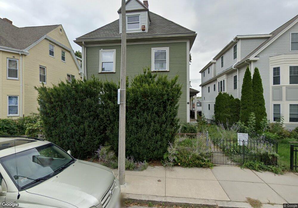
50 Wenham St Unit 52 Jamaica Plain, MA 02130
Jamaica Plain NeighborhoodEstimated Value: $1,116,000 - $1,446,000
4
Beds
3
Baths
3,095
Sq Ft
$434/Sq Ft
Est. Value
About This Home
This home is located at 50 Wenham St Unit 52, Jamaica Plain, MA 02130 and is currently estimated at $1,342,988, approximately $433 per square foot. 50 Wenham St Unit 52 is a home located in Suffolk County with nearby schools including The Croft School - Jamaica Plain.
Ownership History
Date
Name
Owned For
Owner Type
Purchase Details
Closed on
Mar 25, 1997
Sold by
Wenham St Rt 50
Bought by
Roche Edward M and Prettenhofer Marc M
Current Estimated Value
Home Financials for this Owner
Home Financials are based on the most recent Mortgage that was taken out on this home.
Original Mortgage
$156,750
Outstanding Balance
$18,907
Interest Rate
7.68%
Mortgage Type
Purchase Money Mortgage
Estimated Equity
$1,324,081
Create a Home Valuation Report for This Property
The Home Valuation Report is an in-depth analysis detailing your home's value as well as a comparison with similar homes in the area
Home Values in the Area
Average Home Value in this Area
Purchase History
| Date | Buyer | Sale Price | Title Company |
|---|---|---|---|
| Roche Edward M | $166,500 | -- |
Source: Public Records
Mortgage History
| Date | Status | Borrower | Loan Amount |
|---|---|---|---|
| Open | Roche Edward M | $156,750 |
Source: Public Records
Tax History Compared to Growth
Tax History
| Year | Tax Paid | Tax Assessment Tax Assessment Total Assessment is a certain percentage of the fair market value that is determined by local assessors to be the total taxable value of land and additions on the property. | Land | Improvement |
|---|---|---|---|---|
| 2025 | $13,674 | $1,180,800 | $394,800 | $786,000 |
| 2024 | $12,248 | $1,123,700 | $294,500 | $829,200 |
| 2023 | $10,925 | $1,017,200 | $280,500 | $736,700 |
| 2022 | $10,535 | $968,300 | $267,000 | $701,300 |
| 2021 | $10,031 | $940,100 | $259,200 | $680,900 |
| 2020 | $8,059 | $763,200 | $258,500 | $504,700 |
| 2019 | $7,660 | $726,800 | $208,100 | $518,700 |
| 2018 | $6,986 | $666,600 | $208,100 | $458,500 |
| 2017 | $6,918 | $653,300 | $208,100 | $445,200 |
| 2016 | $6,360 | $578,200 | $208,100 | $370,100 |
| 2015 | $6,214 | $513,100 | $186,200 | $326,900 |
| 2014 | $5,705 | $453,500 | $186,200 | $267,300 |
Source: Public Records
Map
Nearby Homes
- 143-171 Hyde Park Ave Unit 169A
- 64 Hyde Park Ave Unit 3
- 11 Weld Hill St Unit 2
- 178 Hyde Park Ave Unit 3
- 58 Weld Hill St Unit 2
- 140 Wachusett St
- 158 Wachusett St Unit 3
- 26 Tower St
- 31 Rodman St Unit 2
- 31 Rodman St Unit 1
- 18-20 Northbourne Rd Unit 18
- 1 Catenaccia Way Unit 47
- 5 Hampstead Ln Unit 1
- 50 Southbourne Rd
- 19 Delford St
- 19 Delford St Unit 1
- 4012 Washington St
- 5 View South Ave Unit 1
- 156A South St Unit 1L
- 4031 Washington St
- 52 Wenham St Unit 1
- 50 Wenham St Unit 1
- 48 Wenham St
- 48 Wenham St
- 48 Wenham St Unit 1
- 56 Wenham St Unit 3
- 56 Wenham St Unit 2
- 56 Wenham St Unit 1
- 44 Wenham St
- 44 Wenham St Unit 2
- 60 Wenham St Unit 2
- 60 Wenham St Unit 1
- 60 Wenham St Unit 3
- 60 Wenham St
- 53 Wenham St
- 53 Wenham St Unit 2
- 53 Wenham St Unit 3
- 53 Wenham St Unit 1
- 55 Wenham St
- 59 Wenham St Unit 1