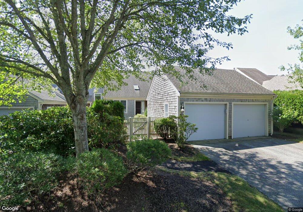
50 Wildflower Ln Unit 'H' Yarmouth Port, MA 02675
Yarmouth Port NeighborhoodEstimated Value: $732,000 - $780,000
2
Beds
4
Baths
1,826
Sq Ft
$418/Sq Ft
Est. Value
About This Home
This home is located at 50 Wildflower Ln Unit 'H', Yarmouth Port, MA 02675 and is currently estimated at $762,729, approximately $417 per square foot. 50 Wildflower Ln Unit 'H' is a home located in Barnstable County with nearby schools including Dennis-Yarmouth Regional High School.
Ownership History
Date
Name
Owned For
Owner Type
Purchase Details
Closed on
Dec 3, 2019
Sold by
Gorman Kathleen M
Bought by
Kathleen M Gorman Irt
Current Estimated Value
Purchase Details
Closed on
May 29, 2009
Sold by
Patricia A Sverid T
Bought by
Gorman James W
Home Financials for this Owner
Home Financials are based on the most recent Mortgage that was taken out on this home.
Original Mortgage
$217,500
Interest Rate
4.87%
Mortgage Type
Purchase Money Mortgage
Create a Home Valuation Report for This Property
The Home Valuation Report is an in-depth analysis detailing your home's value as well as a comparison with similar homes in the area
Home Values in the Area
Average Home Value in this Area
Purchase History
| Date | Buyer | Sale Price | Title Company |
|---|---|---|---|
| Kathleen M Gorman Irt | -- | None Available | |
| Gorman James W | $417,500 | -- |
Source: Public Records
Mortgage History
| Date | Status | Borrower | Loan Amount |
|---|---|---|---|
| Previous Owner | Gorman James W | $217,500 |
Source: Public Records
Tax History Compared to Growth
Tax History
| Year | Tax Paid | Tax Assessment Tax Assessment Total Assessment is a certain percentage of the fair market value that is determined by local assessors to be the total taxable value of land and additions on the property. | Land | Improvement |
|---|---|---|---|---|
| 2025 | $5,014 | $708,200 | $0 | $708,200 |
| 2024 | $4,894 | $663,100 | $0 | $663,100 |
| 2023 | $4,362 | $537,800 | $0 | $537,800 |
| 2022 | $5,150 | $561,000 | $0 | $561,000 |
| 2021 | $4,825 | $504,700 | $0 | $504,700 |
| 2020 | $4,870 | $487,000 | $0 | $487,000 |
| 2019 | $4,568 | $452,300 | $0 | $452,300 |
| 2018 | $4,297 | $417,600 | $0 | $417,600 |
| 2017 | $4,010 | $400,200 | $0 | $400,200 |
| 2016 | $3,821 | $382,900 | $0 | $382,900 |
| 2015 | $3,907 | $389,100 | $0 | $389,100 |
Source: Public Records
Map
Nearby Homes
- 21 Boxwood Cir
- 25 Oak Glen
- 25 Oak Glen Village Unit 25
- 28 Oak Glen
- 2 Pine Grove
- 4208 Heatherwood
- 55 W West Woods Cir
- 800 Route 6a
- 800 Route 6a
- 55 W Woods
- 30 W Woods Cir Unit 30
- 30 W Woods
- 17 Kates Path Unit A
- 158 Kates Path
- 228 Kates Path
- 64 Kates Path
- 24 Minnetuxet Way
- 19 John Hall Cartway Unit E
- 19 John Halls Cartpath Village Unit E
- 42 John Hall Cartway Unit 42
- 50 Wildflower Ln
- 48 Wildflower Ln
- 48 Wildflower Ln Unit I
- 46 Wildflower Ln
- 44 Wildflower Ln
- 42 Wildflower Ln
- 42 Wildflower Ln Unit 42
- 42 Wildflower Ln Unit H
- 27 Wildflower Ln
- 25 Wildflower Ln
- 25 Wildflower Ln Unit H
- 27 Wildflower Ln Unit H
- 40 Wildflower Ln
- 38 Wildflower Ln
- 23 Wildflower Ln
- 21 Wildflower Ln
- 19 Wildflower Ln
- 21 Wildflower Ln Unit 21
- 23 Wildflower Ln Unit H
- 19 Wildflower Ln Unit H