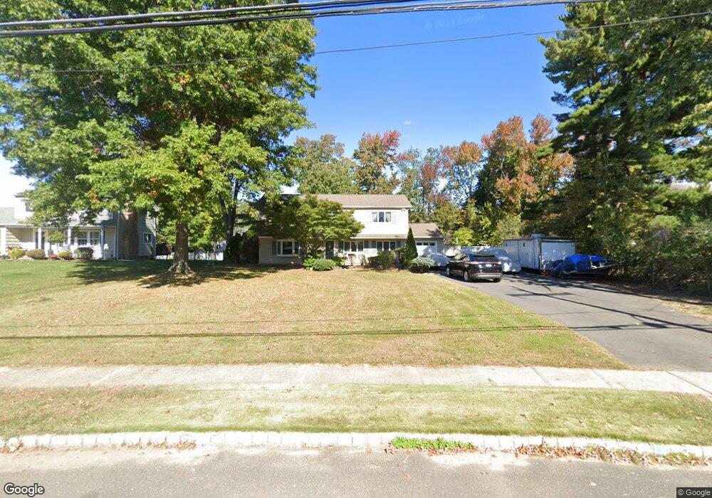
50 Yorktowne Dr Manalapan, NJ 07726
Estimated Value: $770,853 - $825,000
3
Beds
2
Baths
2,292
Sq Ft
$347/Sq Ft
Est. Value
About This Home
This home is located at 50 Yorktowne Dr, Manalapan, NJ 07726 and is currently estimated at $794,463, approximately $346 per square foot. 50 Yorktowne Dr is a home located in Monmouth County with nearby schools including Milford Brook Elementary School, Pine Brook Elementary School, and Manalapan-Englishtown Middle School.
Ownership History
Date
Name
Owned For
Owner Type
Purchase Details
Closed on
Jul 8, 1994
Sold by
Badik Marc
Bought by
Bassista Michael and Bassista Susan
Current Estimated Value
Home Financials for this Owner
Home Financials are based on the most recent Mortgage that was taken out on this home.
Original Mortgage
$146,000
Interest Rate
8.51%
Create a Home Valuation Report for This Property
The Home Valuation Report is an in-depth analysis detailing your home's value as well as a comparison with similar homes in the area
Home Values in the Area
Average Home Value in this Area
Purchase History
| Date | Buyer | Sale Price | Title Company |
|---|---|---|---|
| Bassista Michael | $187,000 | -- |
Source: Public Records
Mortgage History
| Date | Status | Borrower | Loan Amount |
|---|---|---|---|
| Closed | Bassista Michael | $146,000 |
Source: Public Records
Tax History Compared to Growth
Tax History
| Year | Tax Paid | Tax Assessment Tax Assessment Total Assessment is a certain percentage of the fair market value that is determined by local assessors to be the total taxable value of land and additions on the property. | Land | Improvement |
|---|---|---|---|---|
| 2025 | $11,043 | $736,900 | $322,700 | $414,200 |
| 2024 | $10,703 | $654,200 | $305,300 | $348,900 |
| 2023 | $10,703 | $643,200 | $298,100 | $345,100 |
| 2022 | $10,071 | $565,700 | $237,100 | $328,600 |
| 2021 | $10,071 | $485,100 | $196,600 | $288,500 |
| 2020 | $9,824 | $478,500 | $191,600 | $286,900 |
| 2019 | $9,494 | $462,000 | $181,600 | $280,400 |
| 2018 | $8,898 | $430,500 | $163,100 | $267,400 |
| 2017 | $8,495 | $411,200 | $163,100 | $248,100 |
| 2016 | $8,333 | $408,100 | $163,100 | $245,000 |
| 2015 | $7,802 | $378,000 | $139,300 | $238,700 |
| 2014 | $7,948 | $374,900 | $163,800 | $211,100 |
Source: Public Records
Map
Nearby Homes
- 89 Old Queens Blvd
- 56 Tarrytown Rd
- 32 Tarrytown Rd
- 8 Chesapeake Rd
- 17 Yorktowne Dr
- 6 Canterbury Rd
- 11 Oxford Rd
- 210 Pine Brook Rd
- 12 Tori Ln
- 96 Sofia Dr
- 43 Apache Dr
- 104 Gordons Corner Rd
- 30 Shilling Rd
- 18 Cornell Place
- 37 Pease Rd
- 2 Silverleaf Way
- 8 Kensington Dr
- 5 Mallard Ct
- 224 Union Hill Rd
- 23 Country Oaks Dr
- 52 Yorktowne Dr
- 48 Yorktowne Dr
- 54 Yorktowne Dr
- 92 Old Queens Blvd
- 90 Old Queens Blvd
- 46 Yorktowne Dr
- 94 Old Queens Blvd
- 53 Yorktowne Dr
- 88 Old Queens Blvd
- 96 Old Queens Blvd
- 44 Yorktowne Dr
- 56 Yorktowne Dr
- 86 Old Queens Blvd
- 47 Yorktowne Dr
- 98 Old Queens Blvd
- 84 Old Queens Blvd
- 4 Concord Dr
- 45 Yorktowne Dr
- 24 Sheffield Dr
- 26 Sheffield Dr