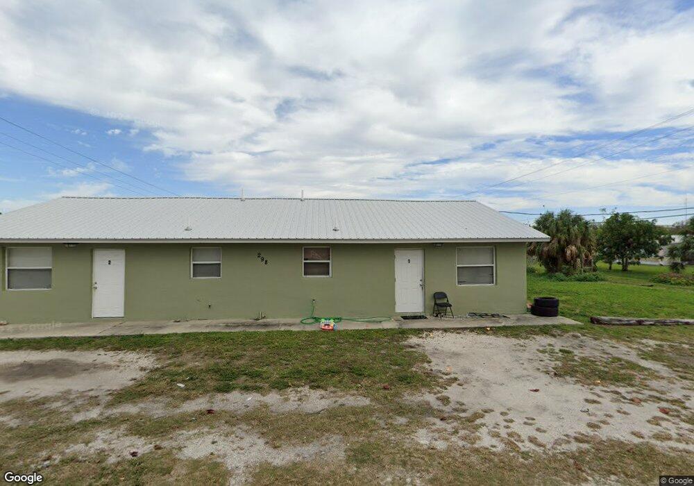
500 7th St SW Moore Haven, FL 33471
Estimated Value: $210,000 - $279,000
3
Beds
2
Baths
1,032
Sq Ft
$237/Sq Ft
Est. Value
About This Home
This home is located at 500 7th St SW, Moore Haven, FL 33471 and is currently estimated at $244,242, approximately $236 per square foot. 500 7th St SW is a home with nearby schools including Moore Haven Junior/Senior High School and Moore Haven Elementary School.
Ownership History
Date
Name
Owned For
Owner Type
Purchase Details
Closed on
Jun 6, 2019
Sold by
Wayne Barfield Thomas and Wayne Elizabeth Alice
Bought by
Ahern-Griner Llc
Current Estimated Value
Purchase Details
Closed on
May 31, 2019
Sold by
Wayne Barfield Thomas and Wayne Elizabeth Alice
Bought by
Ahern-Griner Llc
Purchase Details
Closed on
May 1, 2019
Sold by
Barfield Thomas Wayne and Barfield Alice Elizabeth
Bought by
Ahern Griner Llc
Purchase Details
Closed on
Feb 29, 2008
Sold by
Killebrew Ryan W
Bought by
Barfield Thomas Wayne and Barfield Alice Elizabeth
Create a Home Valuation Report for This Property
The Home Valuation Report is an in-depth analysis detailing your home's value as well as a comparison with similar homes in the area
Home Values in the Area
Average Home Value in this Area
Purchase History
| Date | Buyer | Sale Price | Title Company |
|---|---|---|---|
| Ahern-Griner Llc | $95,000 | None Listed On Document | |
| Ahern-Griner Llc | $95,000 | None Listed On Document | |
| Ahern Griner Llc | $95,000 | Attorney | |
| Barfield Thomas Wayne | $188,000 | Okee Tantie Title Co Inc |
Source: Public Records
Tax History Compared to Growth
Tax History
| Year | Tax Paid | Tax Assessment Tax Assessment Total Assessment is a certain percentage of the fair market value that is determined by local assessors to be the total taxable value of land and additions on the property. | Land | Improvement |
|---|---|---|---|---|
| 2024 | $3,007 | $152,839 | $35,200 | $117,639 |
| 2023 | $3,007 | $152,909 | $35,200 | $117,709 |
| 2022 | $2,725 | $138,641 | $35,200 | $103,441 |
| 2021 | $2,492 | $113,218 | $32,000 | $81,218 |
| 2020 | $2,257 | $98,408 | $0 | $0 |
| 2019 | $2,607 | $115,866 | $32,500 | $83,366 |
| 2018 | $2,391 | $102,229 | $0 | $0 |
| 2017 | $2,188 | $95,519 | $27,500 | $68,019 |
| 2016 | $2,188 | $91,437 | $0 | $0 |
| 2015 | $2,170 | $90,261 | $0 | $0 |
| 2014 | $2,221 | $92,162 | $0 | $0 |
Source: Public Records
Map
Nearby Homes
- 699 Avenue R
- 464 Avenue R
- 599 Avenue R SW
- 1210 Us Highway 27
- 599 N Us Highway 27
- 301 Avenue L
- 571 Avenue H NW
- 270 Avenue H
- 2245 Riverside Dr
- 987 Watson Way
- 315 Avenue J SW
- 940 Meyerchick Dr
- 820 Thatcher Blvd
- 822 Thatcher Blvd
- 914 Thatcher Blvd
- 918 Thatcher Blvd
- 901 Thatcher Blvd
- 428 Avenue F
- 1085 West Ave
- 214 Orchard Ave
- 671 Avenue N SW
- 671 Avenue N SW Unit 11
- 501 7th St SW
- 599 7th St
- 600 Avenue M SW
- 601 Avenue N SW
- 698 Avenue N SW
- 656 Avenue N SW
- 757 Avenue N SW
- 700 North Ave SW
- 601 SW 6th St
- 598 Avenue M SW
- 599 Avenue N SW
- 699 Avenue O SW
- 599 Avenue N SW
- 599 Avenue M SW
- 799 Avenue N SW
- 615 Avenue O SW
- 784 North Ave SW
- 601 Avenue O SW