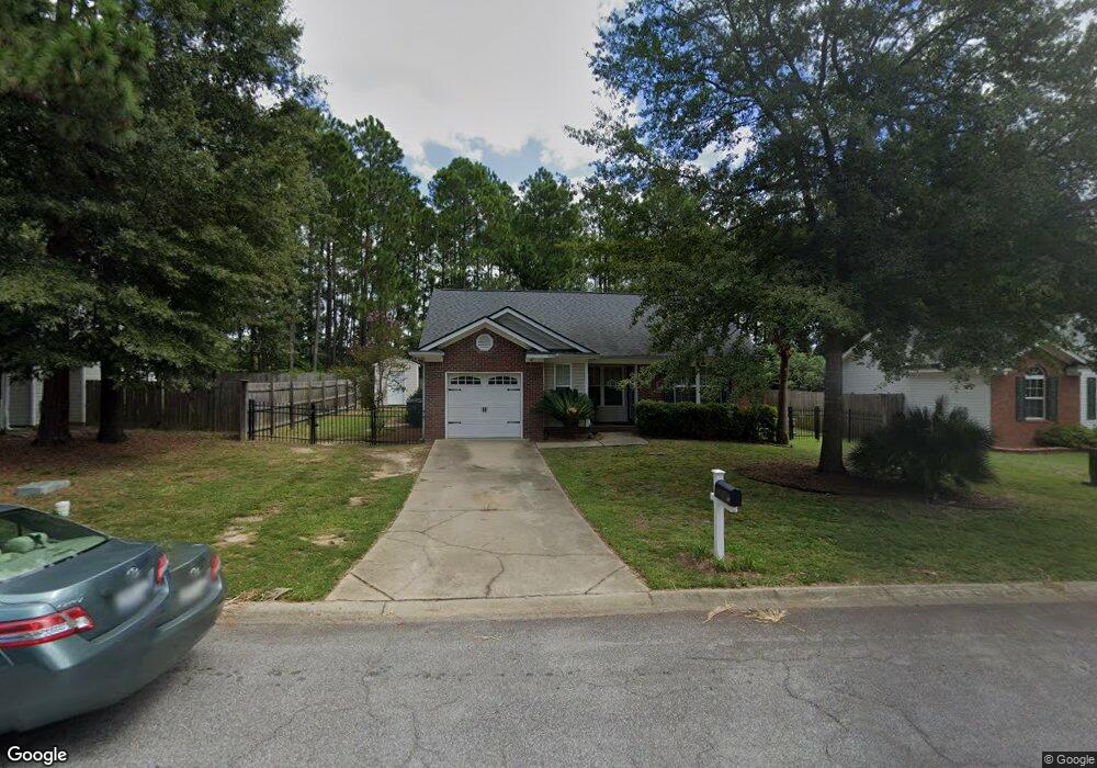
500 Burnside Dr Columbia, SC 29209
The Hamptons NeighborhoodEstimated Value: $238,000 - $250,000
3
Beds
2
Baths
1,350
Sq Ft
$179/Sq Ft
Est. Value
About This Home
This home is located at 500 Burnside Dr, Columbia, SC 29209 and is currently estimated at $241,345, approximately $178 per square foot. 500 Burnside Dr is a home located in Richland County with nearby schools including Meadowfield Elementary School, Hand Middle School, and Dreher High School.
Ownership History
Date
Name
Owned For
Owner Type
Purchase Details
Closed on
May 11, 2023
Sold by
Almond Michael
Bought by
Almond Michael Thomas and Almond Tracy Brown
Current Estimated Value
Purchase Details
Closed on
Sep 1, 2022
Sold by
Mcknight Antoine L
Bought by
Almond Michael
Home Financials for this Owner
Home Financials are based on the most recent Mortgage that was taken out on this home.
Original Mortgage
$180,000
Interest Rate
5.3%
Mortgage Type
New Conventional
Purchase Details
Closed on
Feb 16, 2021
Sold by
Mcknight Kimberly A and Burchell Kimberly A
Bought by
Mcknight Antoine L
Purchase Details
Closed on
Nov 29, 2001
Sold by
Mtm Construction
Bought by
Mcknight Antoine L and Burchell Kimberly A
Home Financials for this Owner
Home Financials are based on the most recent Mortgage that was taken out on this home.
Original Mortgage
$99,500
Interest Rate
7.25%
Create a Home Valuation Report for This Property
The Home Valuation Report is an in-depth analysis detailing your home's value as well as a comparison with similar homes in the area
Home Values in the Area
Average Home Value in this Area
Purchase History
| Date | Buyer | Sale Price | Title Company |
|---|---|---|---|
| Almond Michael Thomas | -- | None Listed On Document | |
| Almond Michael | $225,000 | -- | |
| Mcknight Antoine L | -- | None Available | |
| Mcknight Antoine L | $99,500 | -- |
Source: Public Records
Mortgage History
| Date | Status | Borrower | Loan Amount |
|---|---|---|---|
| Previous Owner | Almond Michael | $180,000 | |
| Previous Owner | Mcknight Antoine L | $99,500 |
Source: Public Records
Tax History
| Year | Tax Paid | Tax Assessment Tax Assessment Total Assessment is a certain percentage of the fair market value that is determined by local assessors to be the total taxable value of land and additions on the property. | Land | Improvement |
|---|---|---|---|---|
| 2024 | $1,244 | $224,100 | $37,500 | $186,600 |
| 2023 | $1,200 | $5,400 | $0 | $0 |
| 2022 | $3,904 | $135,000 | $24,900 | $110,100 |
| 2021 | $1,011 | $5,400 | $0 | $0 |
| 2020 | $1,067 | $5,400 | $0 | $0 |
| 2019 | $1,074 | $5,400 | $0 | $0 |
| 2018 | $957 | $4,700 | $0 | $0 |
| 2017 | $932 | $4,700 | $0 | $0 |
| 2016 | $898 | $4,700 | $0 | $0 |
| 2015 | $898 | $4,700 | $0 | $0 |
| 2014 | $897 | $117,400 | $0 | $0 |
| 2013 | -- | $4,700 | $0 | $0 |
Source: Public Records
Map
Nearby Homes
- 612 Lake Forest Rd
- 404 Hampton Forest Dr
- 759 Burnside Dr
- 411 Hampton Forest Dr
- 833 Forest Park Rd Unit 115
- 231 Forest Green Dr
- 423 Planters Dr
- 600 Rockwood Rd
- 1006 Coatesdale Rd
- 639 Veterans Rd
- 6627 Christie Rd
- 1273 Rockwood Rd
- 6525 Macon Rd
- 1191 Rockwood Rd
- 164 Springway Dr
- 813 Greenlawn Dr
- 6427 Christie Rd
- 6965 Shelley Rd
- 174 Preston Green Dr
- 1005 Greenlawn Dr
- 504 Burnside Dr
- 466 Burnside Dr
- 508 Burnside Dr
- 462 Burnside Dr
- 505 Burnside Dr
- 514 Burnside Dr
- 509 Burnside Dr
- 917 Burnside Dr
- 515 Burnside Dr
- 872 Burnside Dr
- 518 Burnside Dr
- 859 Burnside Dr
- 855 Burnside Dr
- 519 Burnside Dr
- 868 Burnside Dr
- 522 Burnside Dr
- 851 Burnside Dr
- 523 Burnside Dr
- 864 Burnside Dr
- 847 Burnside Dr
Your Personal Tour Guide
Ask me questions while you tour the home.