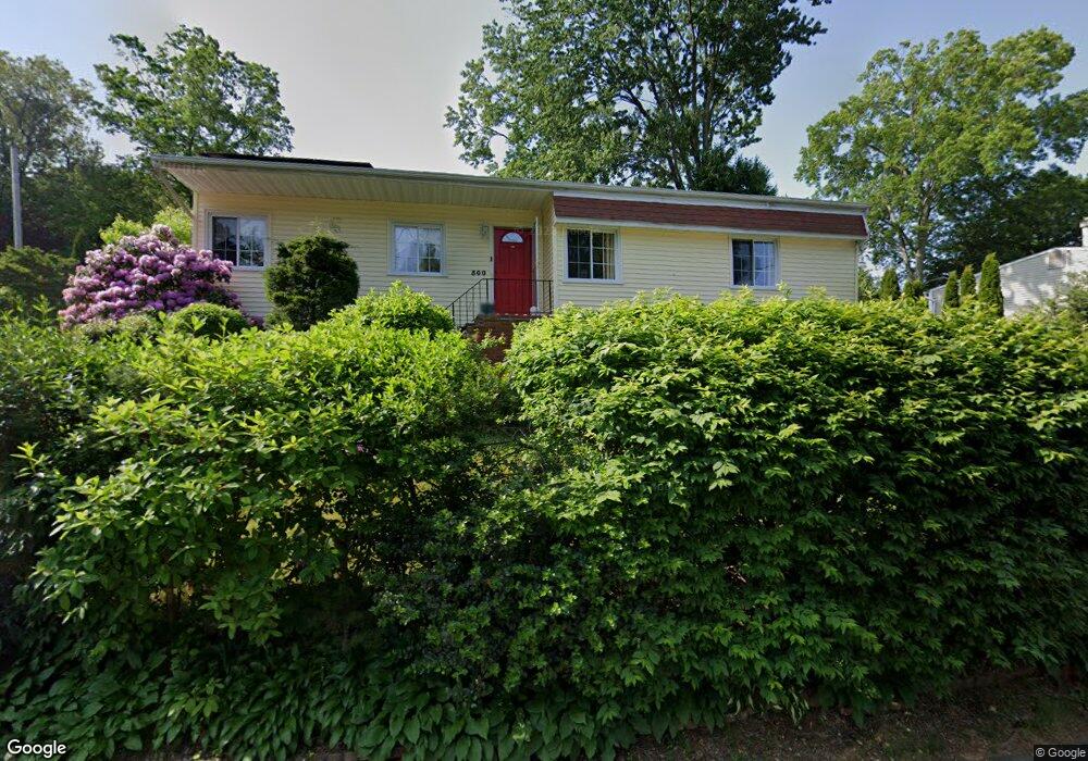
500 Evers St Bridgeport, CT 06610
North Bridgeport NeighborhoodEstimated Value: $342,000 - $378,000
3
Beds
2
Baths
1,200
Sq Ft
$303/Sq Ft
Est. Value
About This Home
This home is located at 500 Evers St, Bridgeport, CT 06610 and is currently estimated at $363,725, approximately $303 per square foot. 500 Evers St is a home located in Fairfield County with nearby schools including Hooker School, Harding High School, and Christian Heritage School.
Ownership History
Date
Name
Owned For
Owner Type
Purchase Details
Closed on
Dec 29, 2014
Sold by
Smith Nessah
Bought by
Emeralds & Diamonds Llc
Current Estimated Value
Purchase Details
Closed on
Jul 13, 2004
Sold by
Green Tree Servicing
Bought by
Smith Nessaah
Purchase Details
Closed on
Sep 2, 1998
Sold by
Lautner David A and Lautner Dlizabeth K
Bought by
Taylor Adele and Daniels Lamond T
Create a Home Valuation Report for This Property
The Home Valuation Report is an in-depth analysis detailing your home's value as well as a comparison with similar homes in the area
Home Values in the Area
Average Home Value in this Area
Purchase History
| Date | Buyer | Sale Price | Title Company |
|---|---|---|---|
| Emeralds & Diamonds Llc | -- | -- | |
| Emeralds & Diamonds Llc | -- | -- | |
| Smith Nessaah | $182,010 | -- | |
| Smith Nessaah | $182,010 | -- | |
| Taylor Adele | $111,500 | -- | |
| Taylor Adele | $111,500 | -- |
Source: Public Records
Mortgage History
| Date | Status | Borrower | Loan Amount |
|---|---|---|---|
| Previous Owner | Taylor Adele | $180,670 | |
| Previous Owner | Taylor Adele | $28,000 |
Source: Public Records
Tax History
| Year | Tax Paid | Tax Assessment Tax Assessment Total Assessment is a certain percentage of the fair market value that is determined by local assessors to be the total taxable value of land and additions on the property. | Land | Improvement |
|---|---|---|---|---|
| 2025 | $6,011 | $138,340 | $53,100 | $85,240 |
| 2024 | $6,011 | $138,340 | $53,100 | $85,240 |
| 2023 | $6,011 | $138,340 | $53,100 | $85,240 |
| 2022 | $6,011 | $138,340 | $53,100 | $85,240 |
| 2021 | $6,011 | $138,340 | $53,100 | $85,240 |
| 2020 | $5,926 | $109,770 | $41,030 | $68,740 |
| 2019 | $5,926 | $109,770 | $41,030 | $68,740 |
| 2018 | $5,968 | $109,770 | $41,030 | $68,740 |
| 2017 | $5,968 | $109,770 | $41,030 | $68,740 |
| 2016 | $5,968 | $109,770 | $41,030 | $68,740 |
| 2015 | $5,607 | $132,860 | $49,650 | $83,210 |
| 2014 | $5,607 | $132,860 | $49,650 | $83,210 |
Source: Public Records
Map
Nearby Homes
- 11 Nob Hill Cir
- 154 Virginia Ave Unit B
- 261 Pennsylvania Ave
- 211 Louisiana Ave Unit D
- 186 Louisiana Ave Unit D
- 132 Virginia Ave Unit 132
- 120 Huntington Turnpike Unit 202
- 119 Jennings Ave
- 33 Louisiana Ave Unit 35
- 123 Beverly Dr
- 3699 Broadbridge Ave Unit 101
- 72 Broadmere Rd
- 563 Pearl Harbor St
- 285 Hillcrest Rd
- 250 Dayton Rd
- 207 Hillcrest Rd
- 2100 E Main St
- 2092 E Main St
- 46 York St
- 282 Horace St
- 480 Evers St
- 520 Evers St
- 507 Evers St
- 460 Evers St
- 191 Dupont Place Unit 193
- 481 Evers St
- 190 Dupont Place Unit 192
- 177 Dupont Place Unit 179
- 33 Regency St
- 465 Evers St
- 180 Dupont Place
- 180 Dupont Place Unit 182
- 545 Evers St
- 182 Dupont Place
- 47 Regency St
- 169 Dupont Place
- 453 Evers St
- 49 Dupont Place Unit 55
- 167 Dupont Place Unit 169
- 24 Regency St
Your Personal Tour Guide
Ask me questions while you tour the home.