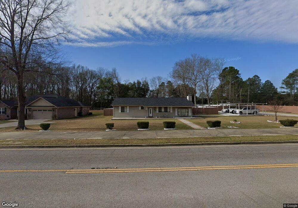
500 Loring Mill Rd Sumter, SC 29150
Estimated Value: $164,230 - $223,000
3
Beds
2
Baths
1,320
Sq Ft
$150/Sq Ft
Est. Value
About This Home
This home is located at 500 Loring Mill Rd, Sumter, SC 29150 and is currently estimated at $197,808, approximately $149 per square foot. 500 Loring Mill Rd is a home located in Sumter County with nearby schools including Millwood Elementary School, Alice Drive Middle School, and Sumter High School.
Ownership History
Date
Name
Owned For
Owner Type
Purchase Details
Closed on
Aug 17, 2015
Sold by
Secretary Of Veterans Affairs
Bought by
Fabrega Gerardo
Current Estimated Value
Purchase Details
Closed on
Jul 1, 2015
Sold by
Trustmark National Bank
Bought by
Secretary Of Veterans Affairs
Purchase Details
Closed on
Jun 10, 2015
Sold by
Letts Michael T
Bought by
Trustmark National Bank
Purchase Details
Closed on
Feb 22, 2008
Sold by
Kelly Aaron
Bought by
Letts Michael T
Home Financials for this Owner
Home Financials are based on the most recent Mortgage that was taken out on this home.
Original Mortgage
$118,391
Interest Rate
5.65%
Mortgage Type
VA
Create a Home Valuation Report for This Property
The Home Valuation Report is an in-depth analysis detailing your home's value as well as a comparison with similar homes in the area
Purchase History
| Date | Buyer | Sale Price | Title Company |
|---|---|---|---|
| Fabrega Gerardo | $20,730 | -- | |
| Secretary Of Veterans Affairs | -- | -- | |
| Trustmark National Bank | $72,292 | -- | |
| Letts Michael T | $115,900 | None Available |
Source: Public Records
Mortgage History
| Date | Status | Borrower | Loan Amount |
|---|---|---|---|
| Previous Owner | Letts Michael T | $118,391 |
Source: Public Records
Tax History Compared to Growth
Tax History
| Year | Tax Paid | Tax Assessment Tax Assessment Total Assessment is a certain percentage of the fair market value that is determined by local assessors to be the total taxable value of land and additions on the property. | Land | Improvement |
|---|---|---|---|---|
| 2025 | $74 | -- | -- | -- |
| 2024 | $74 | -- | -- | -- |
| 2023 | $74 | $4,060 | $660 | $3,400 |
| 2022 | $72 | $4,060 | $660 | $3,400 |
| 2021 | $69 | $4,060 | $660 | $3,400 |
| 2020 | $69 | $3,610 | $660 | $2,950 |
| 2019 | $67 | $3,610 | $660 | $2,950 |
| 2018 | $626 | $3,610 | $660 | $2,950 |
| 2017 | $617 | $3,610 | $660 | $2,950 |
| 2016 | $652 | $3,610 | $660 | $2,950 |
| 2015 | $1,925 | $3,810 | $840 | $2,970 |
| 2014 | $1,925 | $5,720 | $1,260 | $4,460 |
| 2013 | -- | $3,810 | $840 | $2,970 |
Source: Public Records
Map
Nearby Homes
- 545 Loring Mill Rd
- 105 Setter Ct
- 520 Mallard Dr
- 30 Bald Pate Cove
- 350 Chesapeake Dr
- 1130 Curlew Cir Unit Lot 116
- 1110 Curlew Cir
- 1110 Curlew Cir Unit Lot 114
- Nile Plan at Heritage Bay
- Benton II Plan at Heritage Bay
- Bentcreek II Plan at Heritage Bay
- Porter II Plan at Heritage Bay
- Bradley II Plan at Heritage Bay
- Riviera Plan at Heritage Bay
- Montague II Plan at Heritage Bay
- Reedy Plan at Heritage Bay
- Saluda Plan at Heritage Bay
- Julie II Plan at Heritage Bay
- Insha Plan at Heritage Bay
- Harper II Plan at Heritage Bay
- 520 Loring Mill Rd
- 490 Loring Mill Rd
- 2765 Bonnell Dr
- 2755 Bonnell Dr
- 2775 Bonnell Dr
- 495 Loring Mill Rd
- 491 Loring Mill Rd
- 203 Barefoot Ct
- 4 Keels Rd
- 200 Muscovy Trail
- 202 Barefoot Ct
- 50 Gadwall Cir
- 60 Gadwall Cir
- 210 Muscovy Trail
- 460 Loring Mill Rd
- 213 Barefoot Ct
- 201 Muscovy Trail
- 2760 Bonnell Dr
- 2750 Bonnell Dr
- 2770 Bonnell Dr