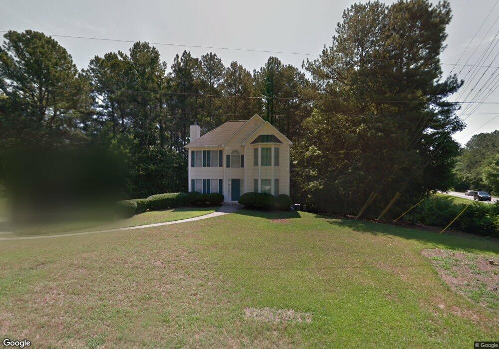
500 Mountain Rd Woodstock, GA 30188
Union Hill NeighborhoodEstimated Value: $319,000 - $441,000
3
Beds
3
Baths
1,666
Sq Ft
$227/Sq Ft
Est. Value
About This Home
This home is located at 500 Mountain Rd, Woodstock, GA 30188 and is currently estimated at $378,332, approximately $227 per square foot. 500 Mountain Rd is a home located in Cherokee County with nearby schools including Mountain Road Elementary School, Rusk Middle School, and Sequoyah High School.
Ownership History
Date
Name
Owned For
Owner Type
Purchase Details
Closed on
May 16, 2019
Sold by
Stone Verna F
Bought by
Stone Verna Fay and Stone Verna Fay Tr
Current Estimated Value
Purchase Details
Closed on
Apr 10, 1998
Sold by
Southern Homestead Builders Inc
Bought by
Stone Verna F
Home Financials for this Owner
Home Financials are based on the most recent Mortgage that was taken out on this home.
Original Mortgage
$121,600
Interest Rate
7.14%
Mortgage Type
New Conventional
Create a Home Valuation Report for This Property
The Home Valuation Report is an in-depth analysis detailing your home's value as well as a comparison with similar homes in the area
Home Values in the Area
Average Home Value in this Area
Purchase History
| Date | Buyer | Sale Price | Title Company |
|---|---|---|---|
| Stone Verna Fay | -- | -- | |
| Stone Verna F | $128,000 | -- |
Source: Public Records
Mortgage History
| Date | Status | Borrower | Loan Amount |
|---|---|---|---|
| Previous Owner | Stone Verna F | $121,600 |
Source: Public Records
Tax History Compared to Growth
Tax History
| Year | Tax Paid | Tax Assessment Tax Assessment Total Assessment is a certain percentage of the fair market value that is determined by local assessors to be the total taxable value of land and additions on the property. | Land | Improvement |
|---|---|---|---|---|
| 2025 | $669 | $147,632 | $42,600 | $105,032 |
| 2024 | $644 | $128,824 | $27,480 | $101,344 |
| 2023 | $510 | $130,296 | $27,480 | $102,816 |
| 2022 | $545 | $88,640 | $27,480 | $61,160 |
| 2021 | $545 | $76,472 | $27,480 | $48,992 |
| 2020 | $532 | $72,496 | $28,840 | $43,656 |
| 2019 | $528 | $71,600 | $27,480 | $44,120 |
| 2018 | $529 | $69,280 | $27,480 | $41,800 |
| 2017 | $536 | $169,100 | $27,480 | $40,160 |
| 2016 | $525 | $151,900 | $23,560 | $37,200 |
| 2015 | $530 | $144,600 | $20,200 | $37,640 |
| 2014 | $512 | $135,000 | $17,360 | $36,640 |
Source: Public Records
Map
Nearby Homes
- 533 Mountain Rd
- 210 River Laurel Way
- 619 Stoney Creek Rd
- 130 Junaluska Dr
- 877 Arnold Mill Rd
- 107 Crown Ln
- 104 Lenore Ct
- 234 Aberdeen Way
- 239 Aberdeen Way
- 1058 Arnold Mill Rd
- 0 Tribal Trail Unit 7650851
- 0 Tribal Trail Unit 10609732
- 102 Gardenia Trail
- 1799 Mountain Farm Rd
- 303 River Laurel Way
- 4706 Waters Rd
- 2100 Mountain Cove Ct
- 205 Stone Creek Ct
- 136 Plantation Trace
- 504 Mountain Rd
- 939 Arnold Mill Rd
- 508 Mountain Rd
- 401 English Ivy Way
- 519 Mountain Rd
- 211 Payton Place
- 400 English Ivy Way Unit GAA017
- 400 English Ivy Way
- 0 English Ivy Way Unit 8933115
- 207 Mount Glen Ct
- 205 Mount Glen Ct Unit 1
- 0 Payton Place Unit 7184584
- 0 Payton Place Unit 8081994
- 512 Mountain Rd
- 203 Mount Glen Ct Unit 1
- 203 Mount Glen Ct
- 937 Arnold Mill Rd
- 525 Mountain Rd
- 221 Payton Place
- 209 Mount Glen Ct